
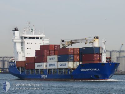
SAMSKIP HOFFELL
General Cargo
Current Trip
| Time Travelled | 2 days |
|---|---|
| Remaining Time | 1 day |
| Distance Travelled | 766.50 nm |
| Remaining Distance | 449.22 nm |
| AVG Speed | 12.7 Knots |
| MAX Speed | 18.2 Knots |
| AVG Wind | 9.7 knots |
| MAX Wind | 21.3 knots |
| MIN Temp | 9.2°C / 48.56°F |
| MAX Temp | 12.9°C / 55.22°F |
| Dybgang | 6.9 m |
| Position Modtaget | 16 h, 55 m siden |
Current Position
| Longitude | -4.57813° |
|---|---|
| Latitude | 58.98045° |
| Status | Under way using engine |
| Fart | 11.7 Knots |
| Kurs | 296.7° |
| Område | North Atlantic Ocean |
| Station | T-AIS |
| Position Modtaget | 16 h, 55 m siden |
Info
Information
The current position of SAMSKIP HOFFELL is in North Atlantic Ocean with coordinates 58.98045° / -4.57813° as reported on 2024-05-09 21:14 by AIS to our vessel tracker app. The vessel's current speed is 11.7 Knots and is heading at the port of REYKJAVIK. The estimated time of arrival as calculated by MyShipTracking vessel tracking app is 2024-05-12 03:49 LT
The vessel SAMSKIP HOFFELL (IMO: 9196943, MMSI: 244860282) is a General Cargo that was built in 2000 ( 24 år gamle ). It's sailing under the flag of [NL] Netherlands.
In this page you can find informations about the vessels current position, last detected port calls, and current voyage information. If the vessels is not in coverage by AIS you will find the latest position.
The current position of SAMSKIP HOFFELL is detected by our AIS receivers and we are not responsible for the reliability of the data. The last position was recorded while the vessel was in Coverage by the Ais receivers of our vessel tracking app.
The current draught of SAMSKIP HOFFELL as reported by AIS is 6.9 meters
Weather
| Temperature | 10.2°C / 50.36°F |
|---|---|
| Wind Speed | 16 knots |
| Direction | 196° SSW |
| Pressure | 1013.5 hPa |
| Humidity | 95.9 % |
| Cloud Coverage | 100 % |
Featured Company
Last Port Calls
| Port | Arrival | Departure | Time In Port |
|---|---|---|---|
| 2024-05-07 13:14 | 2024-05-08 02:31 | 13 h | |
| 2024-05-06 11:02 | 2024-05-06 20:40 | 9 h | |
| 2024-05-01 09:16 | 2024-05-01 16:55 | 7 h | |
| 2024-04-30 19:41 | 2024-05-01 02:50 | 7 h | |
| 2024-04-28 16:10 | 2024-04-29 22:38 | 1 d | |
| 2024-04-24 04:57 | 2024-04-24 19:24 | 14 h | |
| 2024-04-22 20:06 | 2024-04-23 08:04 | 11 h | |
| 2024-04-17 21:25 | 2024-04-18 10:24 | 12 h | |
| 2024-04-17 10:35 | 2024-04-17 15:16 | 4 h | |
| 2024-04-15 07:20 | 2024-04-16 12:53 | 1 d |
Most Visited Ports (Last year)
| Port | Arrivals | |
|---|---|---|
| 25 | ||
| 22 | ||
| 21 | ||
| 19 | ||
| 12 | ||
| 12 |
Last Trips
| Origin | Departure | Destination | Arrival | Distance | |
|---|---|---|---|---|---|
| 2024-05-06 21:40 | 2024-05-07 15:14 | 203.99 nm | |||
| 2024-05-01 16:55 | 2024-05-06 12:02 | 1093.99 nm | |||
| 2024-05-01 02:50 | 2024-05-01 09:16 | 78.65 nm | |||
| 2024-04-29 22:38 | 2024-04-30 19:41 | 289.31 nm | |||
| 2024-04-24 21:24 | 2024-04-28 16:10 | 1210.14 nm | |||
| 2024-04-23 09:04 | 2024-04-24 06:57 | 203.88 nm | |||
| 2024-04-18 10:24 | 2024-04-22 21:06 | 1068.20 nm | |||
| 2024-04-17 15:16 | 2024-04-17 21:25 | 76.49 nm | |||
| 2024-04-16 12:53 | 2024-04-17 10:35 | 287.93 nm | |||
| 2024-04-10 18:24 | 2024-04-15 07:20 | 1220.72 nm |
Events
| Tid | Hændelsen | Detaljer | Position / Dest | Info |
|---|---|---|---|---|
| 2024-05-09 21:18 | Status er ændret | Default Under way using engine |
58.98717 / -4.60404
ISREY
|
Fart: 11.7 kn Kurs: 296.7° |
| 2024-05-09 21:14 | Udenfor Dækning |
58.98045 / -4.57813
North Atlantic Ocean
ISREY
|
Fart: 11.7 kn Kurs: 296.7° |
|
| 2024-05-09 18:01 | Ændre havområde | United Kingdom part of the North Atlantic Ocean United Kingdom part of the North Sea |
58.77079 / -3.41707
North Atlantic Ocean
ISREY
|
Fart: 14.7 kn Kurs: 291.3° |
| 2024-05-09 15:52 | Status er ændret | Under way using engine Default |
58.42568 / -2.66500
ISREY
|
Fart: 13.8 kn Kurs: 329° |
| 2024-05-09 15:38 | Indenfor Dækning |
58.42568 / -2.66500
North Sea
ISREY
|
Fart: 13.9 kn Kurs: 328.5° |
|
| 2024-05-09 13:30 | Status er ændret | Default Under way using engine |
57.98469 / -2.14019
ISREY
|
Fart: 12.3 kn Kurs: 328.6° |
| 2024-05-09 13:25 | Udenfor Dækning |
57.96857 / -2.12153
North Sea
ISREY
|
Fart: 12.3 kn Kurs: 328.6° |
|
| 2024-05-09 13:24 | Status er ændret | Under way using engine Default |
57.96474 / -2.11715
ISREY
|
Fart: 12.4 kn Kurs: 325° |
| 2024-05-09 13:23 | Status er ændret | Default Under way using engine |
57.96179 / -2.11374
ISREY
|
Fart: 12.3 kn Kurs: 324.8° |
| 2024-05-09 07:28 | Status er ændret | Under way using engine Default |
56.83548 / -1.22931
ISREY
|
Fart: 14 kn Kurs: 343° |