
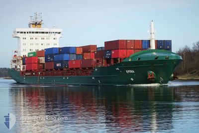
SAMSKIP AMINA
Container Ship
Current Trip
MAAGA
| Time Travelled | 9 h, 54 mins |
|---|---|
| Remaining Time | --- |
| Distance Travelled | 142.38 nm |
| Remaining Distance | --- |
| AVG Speed | 14.7 Knots |
| MAX Speed | 15.7 Knots |
| AVG Wind | 7.9 knots |
| MAX Wind | 18 knots |
| MIN Temp | 17°C / 62.6°F |
| MAX Temp | 18.6°C / 65.48°F |
| Dybgang | 6.9 m |
| Position Modtaget | 1 d siden |
Current Position
| Longitude | --- |
|---|---|
| Latitude | --- |
| Status | At anchor |
| Fart | 0.2 Knots |
| Kurs | 287° |
| Område | North Atlantic Ocean |
| Station | T-AIS |
| Position Modtaget | 1 d siden |
Info
Information
The current position of SAMSKIP AMINA is in North Atlantic Ocean with coordinates 30.45531° / -9.69237° as reported on 2025-12-04 07:11 by AIS to our vessel tracker app. The vessel's current speed is 0.2 Knots
The vessel SAMSKIP AMINA (IMO: 9448683, MMSI: 255806464) is a Container Ship that was built in 2011 ( 14 år gamle ). It's sailing under the flag of [PT] Portugal.
In this page you can find informations about the vessels current position, last detected port calls, and current voyage information. If the vessels is not in coverage by AIS you will find the latest position.
The current position of SAMSKIP AMINA is detected by our AIS receivers and we are not responsible for the reliability of the data. The last position was recorded while the vessel was in Coverage by the Ais receivers of our vessel tracking app.
The current draught of SAMSKIP AMINA as reported by AIS is 6.9 meters
Weather
| Temperature | 17.5°C / 63.5°F |
|---|---|
| Wind Speed | 16 knots |
| Direction | 63° ENE |
| Pressure | 1023.6 hPa |
| Humidity | 67.4 % |
| Cloud Coverage | --- |
Featured Company
Last Port Calls
| Port | Arrival | Departure | Time In Port |
|---|---|---|---|
| 2025-12-04 16:54 | 2025-12-05 04:59 | 12 h | |
| 2025-12-01 14:39 | 2025-12-01 19:43 | 5 h | |
| 2025-11-27 04:03 | 2025-11-27 04:15 | 12 m | |
| 2025-11-26 12:46 | 2025-11-27 04:03 | 15 h | |
| 2025-11-26 11:57 | |||
| 2025-11-25 10:46 | 2025-11-25 23:40 | 12 h | |
| 2025-11-20 10:06 | 2025-11-21 05:38 | 19 h | |
| 2025-11-18 22:38 | 2025-11-19 06:02 | 7 h | |
| 2025-11-12 23:25 | 2025-11-12 23:35 | 10 m | |
| 2025-11-12 13:14 |
Most Visited Ports (Last year)
| Port | Arrivals | |
|---|---|---|
| 29 | ||
| 23 | ||
| 13 | ||
| 6 | ||
| 5 | ||
| 5 |
Last Trips
| Origin | Departure | Destination | Arrival | Distance | |
|---|---|---|---|---|---|
| 2025-12-01 19:43 | 2025-12-04 16:54 | 318.16 nm | |||
| 2025-11-27 04:15 | 2025-12-01 14:39 | 1451.49 nm | |||
| 2025-11-25 23:40 | 2025-11-27 04:03 | 169.77 nm | |||
| 2025-11-25 23:40 | 2025-11-26 12:46 | 169.45 nm | |||
| 2025-11-25 23:40 | 2025-11-26 11:57 | 168.97 nm | |||
| 2025-11-21 05:38 | 2025-11-25 10:46 | 1584.46 nm | |||
| 2025-11-19 06:02 | 2025-11-20 10:06 | 288.30 nm | |||
| 2025-11-12 23:35 | 2025-11-18 22:38 | 1464.46 nm | |||
| 2025-11-11 05:24 | 2025-11-12 23:25 | 166.71 nm | |||
| 2025-11-11 05:24 | 2025-11-12 13:14 | 166.26 nm |
Events
| Tid | Hændelsen | Detaljer | Position / Dest | Info |
|---|---|---|---|---|
| 2025-12-05 03:59 | Afsejlet fra sidste havn |
|
30.40500 / -9.63667
MAAGA
|
Fart: 7 kn Kurs: -1° |
| 2025-12-05 03:54 | START Sejllads |
30.41667 / -9.63833
[MA] AGADIR
|
Fart: 7 kn Kurs: -1° |
|
| 2025-12-04 16:11 | STOP Sejllads |
30.42786 / -9.64338
[MA] AGADIR
|
Fart: 0.1 kn Kurs: 324° |
|
| 2025-12-04 15:54 | Skibe i havn |
|
30.41962 / -9.63977
[MA] AGADIR
|
Fart: 7.1 kn Kurs: 344° |
| 2025-12-04 14:27 | START Sejllads | 4.12 nm, North West of AGADIR |
30.45790 / -9.69820
MAAGA
|
Fart: 7 kn Kurs: 275° |
| 2025-12-04 07:18 | Status er ændret | Default At anchor |
30.45500 / -9.69167
MAAGA
|
Fart: 0.2 kn Kurs: 287° |
| 2025-12-04 07:11 | Status er ændret | At anchor Default |
30.45531 / -9.69237
MAAGA
|
Fart: Kurs: -1° |
| 2025-12-04 07:11 | Indenfor Dækning |
30.45531 / -9.69237
North Atlantic Ocean
|
Fart: 0.2 kn Kurs: 184.3° |
|
| 2025-12-04 07:11 | Udenfor Dækning |
30.45531 / -9.69237
North Atlantic Ocean
|
Fart: 0.2 kn Kurs: 184.3° |
|
| 2025-12-02 19:14 | Udenfor Dækning |
30.45463 / -9.69258
North Atlantic Ocean
|
Fart: 0.2 kn Kurs: 354.4° |