
SAMJOHN LEGACY
Bulk Carrier
Current Trip
SHULANGHU
| Time Travelled | --- |
|---|---|
| Remaining Time | --- |
| Distance Travelled | 7230.32 nm |
| Remaining Distance | --- |
| AVG Speed | 9 Knots |
| MAX Speed | 14.6 Knots |
| AVG Wind | 12.3 knots |
| MAX Wind | 33.9 knots |
| MIN Temp | 3.5°C / 38.3°F |
| MAX Temp | 30.5°C / 86.9°F |
| Dybgang | 17.8 m |
| Position Modtaget | 23 d siden |
Current Position
| Longitude | --- |
|---|---|
| Latitude | --- |
| Status | Under way using engine |
| Fart | 7.1 Knots |
| Kurs | 49.8° |
| Område | South China Sea |
| Station | T-AIS |
| Position Modtaget | 23 d siden |
Info
Information
The current position of SAMJOHN LEGACY is in South China Sea with coordinates 1.31905° / 104.37103° as reported on 2025-02-15 19:04 by AIS to our vessel tracker app. The vessel's current speed is 7.1 Knots
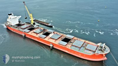
The vessel SAMJOHN LEGACY (IMO: 9434436, MMSI: 538007238) is a Bulk Carrier that was built in 2010 ( 15 år gamle ). It's sailing under the flag of [MH] Marshall Is.
In this page you can find informations about the vessels current position, last detected port calls, and current voyage information. If the vessels is not in coverage by AIS you will find the latest position.
The current position of SAMJOHN LEGACY is detected by our AIS receivers and we are not responsible for the reliability of the data. The last position was recorded while the vessel was in Coverage by the Ais receivers of our vessel tracking app.
The current draught of SAMJOHN LEGACY as reported by AIS is 17.8 meters
Weather
| Temperature | 26.9°C / 80.42°F |
|---|---|
| Wind Speed | 12 knots |
| Direction | 56° NE |
| Pressure | 1009.8 hPa |
| Humidity | 87.2 % |
| Cloud Coverage | 15 % |
Featured Company
Most Visited Ports (Last year)
| Port | Arrivals | |
|---|---|---|
| 1 | ||
| 1 | ||
| 1 | ||
| 1 | ||
| 1 | ||
| 1 |
Events
| Tid | Hændelsen | Detaljer | Position / Dest | Info |
|---|---|---|---|---|
| 2025-03-06 02:12 | START Sejllads | 11.34 nm, South West of GAOGANG |
32.20293 / 119.65481
SHULANGHU
|
Fart: 10.1 kn Kurs: 50° |
| 2025-03-04 02:49 | STOP Sejllads | 11.86 nm, East of ZHENJIANG |
32.19223 / 119.63485
SHULANGHU
|
Fart: 0.2 kn Kurs: 252° |
| 2025-03-03 23:49 | START Sejllads | 1.61 nm, South East of JIANGSU HANTONG |
32.10003 / 119.92054
SHULANGHU
|
Fart: 4.4 kn Kurs: 352° |
| 2025-03-03 17:17 | STOP Sejllads | 1.71 nm, South East of JIANGSU HANTONG |
32.09575 / 119.91698
SHULANGHU
|
Fart: Kurs: 329° |
| 2025-03-02 22:26 | START Sejllads |
31.28574 / 122.67391
SHULANGHU
|
Fart: 6.1 kn Kurs: 231° |