
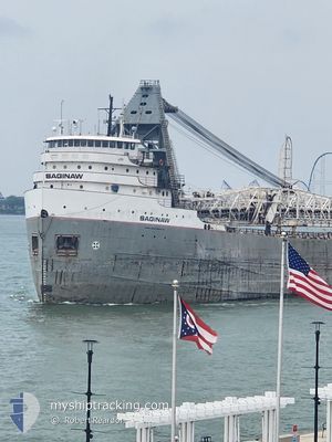
SAGINAW
Self Discharging Bulk Carrier
Current Trip
| Time Travelled | 1 day |
|---|---|
| Remaining Time | --- |
| Distance Travelled | 279.37 nm |
| Remaining Distance | --- |
| AVG Speed | 10.7 Knots |
| MAX Speed | 13.4 Knots |
| AVG Wind | 9.2 knots |
| MAX Wind | 23.8 knots |
| MIN Temp | 2.5°C / 36.5°F |
| MAX Temp | 4.9°C / 40.82°F |
| Dybgang | 5.7 m |
| Position Modtaget | 8 d siden |
Current Position
| Longitude | -83.48908° |
|---|---|
| Latitude | 45.51515° |
| Status | Under way using engine |
| Fart | 12.3 Knots |
| Kurs | 326.5° |
| Område | Gulf of St-Lawrence |
| Station | T-AIS |
| Position Modtaget | 8 d siden |
Info
Information
The current position of SAGINAW is in Gulf of St-Lawrence with coordinates 45.51515° / -83.48908° as reported on 2024-04-24 06:13 by AIS to our vessel tracker app. The vessel's current speed is 12.3 Knots and is heading at the port of THUNDER BAY. The estimated time of arrival as calculated by MyShipTracking vessel tracking app is 2024-04-25 13:00 LT
The vessel SAGINAW (IMO: 5173876, MMSI: 316004950) is a Self Discharging Bulk Carrier that was built in 1953 ( 71 år gamle ). It's sailing under the flag of [CA] Canada.
In this page you can find informations about the vessels current position, last detected port calls, and current voyage information. If the vessels is not in coverage by AIS you will find the latest position.
The current position of SAGINAW is detected by our AIS receivers and we are not responsible for the reliability of the data. The last position was recorded while the vessel was in Coverage by the Ais receivers of our vessel tracking app.
The current draught of SAGINAW as reported by AIS is 5.7 meters
Weather
| Temperature | 5°C / 41°F |
|---|---|
| Wind Speed | 5 knots |
| Direction | 42° NE |
| Pressure | 1018.2 hPa |
| Humidity | 86.5 % |
| Cloud Coverage | 49 % |
Featured Company
Last Port Calls
| Port | Arrival | Departure | Time In Port |
|---|---|---|---|
| 2024-05-01 05:50 | 2024-05-01 08:09 | 2 h | |
| 2024-04-28 10:42 | 2024-04-30 06:36 | 1 d | |
| 2024-04-27 01:27 | 2024-04-27 02:14 | 47 m | |
| 2024-04-25 09:24 | 2024-04-26 02:12 | 16 h | |
| 2024-04-24 13:42 | 2024-04-24 14:30 | 48 m | |
| 2024-04-22 19:42 | 2024-04-23 12:36 | 16 h | |
| 2024-04-20 06:08 | 2024-04-20 10:00 | 3 h | |
| 2024-04-18 15:47 | 2024-04-20 01:46 | 1 d | |
| 2024-04-18 02:56 | 2024-04-18 10:24 | 7 h | |
| 2024-04-16 18:21 | 2024-04-16 23:10 | 4 h |
Most Visited Ports (Last year)
| Port | Arrivals | |
|---|---|---|
| 65 | ||
| 34 | ||
| 17 | ||
| 13 | ||
| 11 | ||
| 9 |
Last Trips
| Origin | Departure | Destination | Arrival | Distance | |
|---|---|---|---|---|---|
| 2024-04-30 01:36 | 2024-05-01 01:50 | 246.73 nm | |||
| 2024-04-26 22:14 | 2024-04-28 05:42 | 251.34 nm | |||
| 2024-04-25 22:12 | 2024-04-26 21:27 | 236.90 nm | |||
| 2024-04-24 10:30 | 2024-04-25 05:24 | 234.51 nm | |||
| 2024-04-23 08:36 | 2024-04-24 09:42 | 285.72 nm | |||
| 2024-04-20 06:00 | 2024-04-22 15:42 | 523.37 nm | |||
| 2024-04-19 21:46 | 2024-04-20 02:08 | 44.71 nm | |||
| 2024-04-18 06:24 | 2024-04-18 11:47 | 45.71 nm | |||
| 2024-04-16 19:10 | 2024-04-17 22:56 | 322.11 nm | |||
| 2024-04-15 20:42 | 2024-04-16 14:21 | 232.17 nm |
Events
| Tid | Hændelsen | Detaljer | Position / Dest | Info |
|---|---|---|---|---|
| 2024-05-01 08:09 | Afsejlet fra sidste havn |
|
46.49667 / -84.40500
THUNDER BAY
|
Fart: 8 kn Kurs: 266° |
| 2024-05-01 07:57 | START Sejllads |
46.50167 / -84.36833
[CA] SAULT STE MARIE
|
Fart: 6 kn Kurs: -1° |
|
| 2024-05-01 05:50 | STOP Sejllads |
46.50180 / -84.34153
[CA] SAULT STE MARIE
|
Fart: 0.1 kn Kurs: 275° |
|
| 2024-05-01 05:50 | Skibe i havn |
|
46.50180 / -84.34153
[CA] SAULT STE MARIE
|
Fart: 0.9 kn Kurs: 275° |
| 2024-04-30 06:50 | START Sejllads | 1.74 nm, East of MANITOWOC |
44.09295 / -87.60904
THUNDER BAY
|
Fart: 11.3 kn Kurs: 86° |
| 2024-04-30 06:36 | Afsejlet fra sidste havn |
|
44.09167 / -87.63666
THUNDER BAY
|
Fart: 3 kn Kurs: -1° |
| 2024-04-28 10:42 | STOP Sejllads |
44.09167 / -87.65500
[US] MANITOWOC
|
Fart: Kurs: -1° |
|
| 2024-04-28 10:42 | Skibe i havn |
|
44.09167 / -87.65500
[US] MANITOWOC
|
Fart: 0.8 kn Kurs: 264° |
| 2024-04-28 02:47 | START Sejllads | 19.38 nm, North East of FRANKFORT |
44.91384 / -86.01990
THUNDER BAY
|
Fart: 9.1 kn Kurs: 317° |
| 2024-04-27 19:12 | STOP Sejllads | 18.9 nm, North West of TRAVERSE CITY |
44.90667 / -86.01166
THUNDER BAY
|
Fart: Kurs: -1° |