
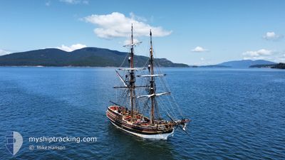
S/V LADY WASHINGTON
Sailing
Current Trip
Unknown
| Time Travelled | 17 h, 25 mins |
|---|---|
| Remaining Time | --- |
| Distance Travelled | 2.63 nm |
| Remaining Distance | --- |
| AVG Speed | 6 Knots |
| MAX Speed | 6.5 Knots |
| AVG Wind | 3 knots |
| MAX Wind | 3 knots |
| MIN Temp | 16.4°C / 61.52°F |
| MAX Temp | 16.6°C / 61.88°F |
| Dybgang | --- |
| Position Modtaget | 16 h, 58 m siden |
Current Position
| Longitude | -122.50114° |
|---|---|
| Latitude | 47.30768° |
| Status | Default |
| Fart | 6.5 Knots |
| Kurs | 294.4° |
| Område | The Coastal Waters of Southeast Alaska and British Columbia |
| Station | T-AIS |
| Position Modtaget | 16 h, 58 m siden |
Info
Information
The current position of S/V LADY WASHINGTON is in The Coastal Waters of Southeast Alaska and British Columbia with coordinates 47.30768° / -122.50114° as reported on 2024-07-01 16:33 by AIS to our vessel tracker app. The vessel's current speed is 6.5 Knots
The vessel S/V LADY WASHINGTON (MMSI: 366945360) is a Sailing It's sailing under the flag of [US] USA.
In this page you can find informations about the vessels current position, last detected port calls, and current voyage information. If the vessels is not in coverage by AIS you will find the latest position.
The current position of S/V LADY WASHINGTON is detected by our AIS receivers and we are not responsible for the reliability of the data. The last position was recorded while the vessel was in Coverage by the Ais receivers of our vessel tracking app.
Weather
| Temperature | 16.4°C / 61.52°F |
|---|---|
| Wind Speed | 3 knots |
| Direction | 236° SW |
| Pressure | 1020.4 hPa |
| Humidity | 86.8 % |
| Cloud Coverage | 100 % |
Featured Company
Last Port Calls
| Port | Arrival | Departure | Time In Port |
|---|---|---|---|
| 2024-06-30 22:34 | 2024-07-01 16:07 | 17 h | |
| 2024-06-27 21:36 | 2024-06-30 20:34 | 2 d | |
| 2024-06-27 02:42 | 2024-06-27 20:04 | 17 h | |
| 2024-06-24 00:08 | 2024-06-26 20:46 | 2 d | |
| 2024-06-23 21:47 | 2024-06-23 22:58 | 1 h | |
| 2024-06-23 00:05 | 2024-06-23 20:33 | 20 h | |
| 2024-06-22 21:38 | 2024-06-22 23:11 | 1 h | |
| 2024-06-22 20:20 | |||
| 2024-06-15 21:01 | 2024-06-19 21:28 | 4 d | |
| 2024-06-13 23:49 | 2024-06-15 20:37 | 1 d |
Last Trips
| Origin | Departure | Destination | Arrival | Distance | |
|---|---|---|---|---|---|
| 2024-06-30 13:34 | 2024-06-30 15:34 | 2.48 nm | |||
| 2024-06-27 13:04 | 2024-06-27 14:36 | 1.84 nm | |||
| 2024-06-26 13:46 | 2024-06-26 19:42 | 5.23 nm | |||
| 2024-06-23 15:58 | 2024-06-23 17:08 | 3.07 nm | |||
| 2024-06-23 13:33 | 2024-06-23 14:47 | 4.38 nm | |||
| 2024-06-22 16:11 | 2024-06-22 17:05 | 2.65 nm | |||
| 2024-06-22 13:20 | 2024-06-22 14:38 | 2.64 nm | |||
| 2024-06-15 13:37 | 2024-06-15 14:01 | 0.37 nm | |||
| 2024-06-13 16:16 | 2024-06-13 16:49 | 0.54 nm | |||
| 2024-06-09 16:13 | 2024-06-09 16:45 | 0.89 nm |
Events
| Tid | Hændelsen | Detaljer | Position / Dest | Info |
|---|---|---|---|---|
| 2024-07-01 16:33 | Udenfor Dækning |
47.30768 / -122.50114
The Coastal Waters of Southeast Alaska and British Columbia
|
Fart: 6.5 kn Kurs: 294.4° |
|
| 2024-07-01 16:07 | Afsejlet fra sidste havn |
|
47.27756 / -122.45483
|
Fart: 6.3 kn Kurs: 315.4° |
| 2024-07-01 15:57 | Indenfor Dækning |
47.26398 / -122.43899
The Coastal Waters of Southeast Alaska and British Columbia
[US] TACOMA
|
Fart: 6.1 kn Kurs: 336.3° |
|
| 2024-07-01 09:29 | Udenfor Dækning |
47.25882 / -122.43684
The Coastal Waters of Southeast Alaska and British Columbia
[US] TACOMA
|
Fart: Kurs: 276.5° |
|
| 2024-07-01 09:29 | Indenfor Dækning |
47.25882 / -122.43684
The Coastal Waters of Southeast Alaska and British Columbia
[US] TACOMA
|
Fart: Kurs: 276.5° |
|
| 2024-06-30 22:37 | Udenfor Dækning |
47.26829 / -122.44278
The Coastal Waters of Southeast Alaska and British Columbia
[US] TACOMA
|
Fart: 6 kn Kurs: 343.3° |
|
| 2024-06-30 22:34 | Indenfor Dækning |
47.26382 / -122.43943
The Coastal Waters of Southeast Alaska and British Columbia
[US] TACOMA
|
Fart: 6.1 kn Kurs: 329.4° |
|
| 2024-06-30 22:34 | Skibe i havn |
|
47.26382 / -122.43943
[US] TACOMA
|
Fart: 1.6 kn Kurs: 511° |
| 2024-06-30 20:48 | Udenfor Dækning |
47.29642 / -122.44877
The Coastal Waters of Southeast Alaska and British Columbia
|
Fart: 1.6 kn Kurs: 323° |
|
| 2024-06-30 20:34 | Afsejlet fra sidste havn |
|
47.28848 / -122.44684
|
Fart: 2.9 kn Kurs: 511° |