
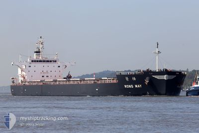
RONG MAY
Cargo
Current Trip
GIGIB>USG
| Time Travelled | 9 days |
|---|---|
| Remaining Time | --- |
| Distance Travelled | 2353.13 nm |
| Remaining Distance | --- |
| AVG Speed | 11.1 Knots |
| MAX Speed | 15.2 Knots |
| AVG Wind | 10.5 knots |
| MAX Wind | 32 knots |
| MIN Temp | 10°C / 50°F |
| MAX Temp | 20°C / 68°F |
| Dybgang | 8.8 m |
| Position Modtaget | Nu |
Current Position
| Longitude | -13.13912° |
|---|---|
| Latitude | 36.79703° |
| Status | Under way using engine |
| Fart | 11.5 Knots |
| Kurs | 277.3° |
| Område | North Atlantic Ocean |
| Station | T-AIS |
| Position Modtaget | Nu |
Info
Information
The current position of RONG MAY is in North Atlantic Ocean with coordinates 36.79703° / -13.13912° as reported on 2024-05-11 19:45 by AIS to our vessel tracker app. The vessel's current speed is 11.5 Knots
The vessel RONG MAY (IMO: 9774484, MMSI: 636017370) is a Cargo It's sailing under the flag of [LR] Liberia.
In this page you can find informations about the vessels current position, last detected port calls, and current voyage information. If the vessels is not in coverage by AIS you will find the latest position.
The current position of RONG MAY is detected by our AIS receivers and we are not responsible for the reliability of the data. The last position was recorded while the vessel was in Coverage by the Ais receivers of our vessel tracking app.
The current draught of RONG MAY as reported by AIS is 8.8 meters
Weather
| Temperature | 17.4°C / 63.32°F |
|---|---|
| Wind Speed | 17 knots |
| Direction | 3° N |
| Pressure | 1021.5 hPa |
| Humidity | 80.9 % |
| Cloud Coverage | 14 % |
Featured Company
Last Port Calls
| Port | Arrival | Departure | Time In Port |
|---|---|---|---|
| 2024-04-27 16:16 | 2024-05-02 14:59 | 4 d | |
| 2024-03-22 05:03 | 2024-03-26 18:51 | 4 d | |
| 2024-03-11 01:53 | 2024-03-19 09:11 | 8 d |
Most Visited Ports (Last year)
| Port | Arrivals | |
|---|---|---|
| 2 | ||
| 1 | ||
| 1 | ||
| 1 | ||
| 1 | ||
| 1 |
Last Trips
| Origin | Departure | Destination | Arrival | Distance | |
|---|---|---|---|---|---|
| 2024-03-26 13:51 | 2024-04-27 19:16 | 6722.65 nm | |||
| 2024-03-19 04:11 | 2024-03-22 00:03 | 299.65 nm | |||
| 2024-01-29 22:33 | 2024-03-10 20:53 | 9039.44 nm |
Events
| Tid | Hændelsen | Detaljer | Position / Dest | Info |
|---|---|---|---|---|
| 2024-05-11 12:07 | Status er ændret | Under way using engine Default |
36.58951 / -11.33557
GIGIB>USG
|
Fart: 11.3 kn Kurs: 277° |
| 2024-05-11 12:00 | Status er ændret | Default Under way using engine |
36.58658 / -11.30884
GIGIB>USG
|
Fart: 11.4 kn Kurs: 277.2° |
| 2024-05-11 11:42 | Status er ændret | Under way using engine Default |
36.57975 / -11.23876
GIGIB>USG
|
Fart: 11.7 kn Kurs: 277° |
| 2024-05-11 11:30 | Status er ændret | Default Under way using engine |
36.57441 / -11.19272
GIGIB>USG
|
Fart: 11.4 kn Kurs: 278.8° |
| 2024-05-10 20:22 | Status er ændret | Under way using engine Default |
36.07994 / -7.72429
GIGIB>USG
|
Fart: 11.6 kn Kurs: 278° |
| 2024-05-10 20:09 | Status er ændret | Default Under way using engine |
36.07522 / -7.68642
GIGIB>USG
|
Fart: 11.5 kn Kurs: 279.2° |
| 2024-05-10 19:45 | Fundet i havområde | Portuguese part of the North Atlantic Ocean |
36.06126 / -7.58488
North Atlantic Ocean
GIGIB>USG
|
Fart: 12 kn Kurs: 279.2° |
| 2024-05-10 19:45 | Status er ændret | Under way using engine Default |
36.06126 / -7.58488
GIGIB>USG
|
Fart: 12.1 kn Kurs: 280° |
| 2024-05-10 19:34 | Status er ændret | Default Under way using engine |
36.05564 / -7.54664
GIGIB>USG
|
Fart: 12.2 kn Kurs: 279.1° |
| 2024-05-10 18:53 | Status er ændret | Under way using engine Default |
36.02903 / -7.37324
GIGIB>USG
|
Fart: 12.1 kn Kurs: 282° |