
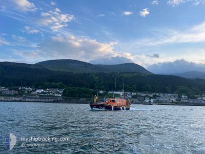
RNLI LIFEBOAT 12-20
Search and Rescue vessel
Current Trip
SAR OPS
| Time Travelled | 14 days |
|---|---|
| Remaining Time | --- |
| Distance Travelled | 30.84 nm |
| Remaining Distance | --- |
| AVG Speed | 10.8 Knots |
| MAX Speed | 15.9 Knots |
| AVG Wind | 12.8 knots |
| MAX Wind | 18.4 knots |
| MIN Temp | 11°C / 51.8°F |
| MAX Temp | 14.6°C / 58.28°F |
| Dybgang | 1.1 m |
| Position Modtaget | 5 h, 39 m siden |
Current Position
| Longitude | -5.88513° |
|---|---|
| Latitude | 54.19885° |
| Status | Under way using engine |
| Fart | 2.7 Knots |
| Kurs | --- |
| Område | Irish Sea and St. George's Channel |
| Station | T-AIS |
| Position Modtaget | 5 h, 39 m siden |
Info
Information
The current position of RNLI LIFEBOAT 12-20 is in Irish Sea and St. George's Channel with coordinates 54.19885° / -5.88513° as reported on 2024-06-27 21:36 by AIS to our vessel tracker app. The vessel's current speed is 2.7 Knots
The vessel RNLI LIFEBOAT 12-20 (MMSI: 232002280) is a Search and Rescue vessel It's sailing under the flag of [GB] United Kingdom.
In this page you can find informations about the vessels current position, last detected port calls, and current voyage information. If the vessels is not in coverage by AIS you will find the latest position.
The current position of RNLI LIFEBOAT 12-20 is detected by our AIS receivers and we are not responsible for the reliability of the data. The last position was recorded while the vessel was in Coverage by the Ais receivers of our vessel tracking app.
The current draught of RNLI LIFEBOAT 12-20 as reported by AIS is 1.1 meters
Weather
| Temperature | 11.1°C / 51.98°F |
|---|---|
| Wind Speed | 18 knots |
| Direction | 262° W |
| Pressure | 1003.6 hPa |
| Humidity | 93.8 % |
| Cloud Coverage | 100 % |
Featured Company
Last Port Calls
| Port | Arrival | Departure | Time In Port |
|---|---|---|---|
| 2024-06-08 11:01 | 2024-06-13 18:01 | 5 d | |
| 2024-06-06 21:33 | 2024-06-08 07:08 | 1 d | |
| 2024-06-02 12:50 | 2024-06-06 18:19 | 4 d | |
| 2024-05-30 20:21 | 2024-06-02 11:46 | 2 d | |
| 2024-05-26 12:09 | 2024-05-30 18:40 | 4 d | |
| 2024-05-18 11:16 | 2024-05-18 14:46 | 3 h |
Most Visited Ports (Last year)
| Port | Arrivals | |
|---|---|---|
| 7 | ||
| 1 |
Last Trips
| Origin | Departure | Destination | Arrival | Distance | |
|---|---|---|---|---|---|
| 2024-06-08 08:08 | 2024-06-08 12:01 | 15.88 nm | |||
| 2024-06-06 19:19 | 2024-06-06 22:33 | 30.20 nm | |||
| 2024-06-02 12:46 | 2024-06-02 13:50 | 14.17 nm | |||
| 2024-05-30 19:40 | 2024-05-30 21:21 | 18.63 nm | |||
| 2024-05-18 15:46 | 2024-05-26 13:09 | 24.30 nm |
Events
| Tid | Hændelsen | Detaljer | Position / Dest | Info |
|---|---|---|---|---|
| 2024-06-27 21:36 | Udenfor Dækning |
54.19885 / -5.88513
Irish Sea and St. George's Channel
|
Fart: 2.7 kn Kurs: 311.4° |
|
| 2024-06-27 21:36 | START Sejllads | 9.19 nm, North East of KILKEEL |
54.19855 / -5.88571
SAR OPS
|
Fart: 3.3 kn Kurs: 85.5° |
| 2024-06-27 21:09 | STOP Sejllads | 9.37 nm, North East of KILKEEL |
54.20051 / -5.88032
SAR OPS
|
Fart: 0.3 kn Kurs: 511° |
| 2024-06-27 20:41 | Indenfor Dækning |
54.14850 / -5.73264
Irish Sea and St. George's Channel
|
Fart: 15.3 kn Kurs: 302.6° |
|
| 2024-06-27 19:14 | Udenfor Dækning |
54.15387 / -5.70741
Irish Sea and St. George's Channel
|
Fart: 11.9 kn Kurs: 201.2° |
|
| 2024-06-27 18:45 | START Sejllads | 9.25 nm, North East of KILKEEL |
54.19925 / -5.88427
SAR OPS
|
Fart: 13.1 kn Kurs: 64.3° |
| 2024-06-27 18:29 | Indenfor Dækning |
54.19823 / -5.88686
Irish Sea and St. George's Channel
|
Fart: Kurs: 0° |
|
| 2024-06-20 20:07 | Udenfor Dækning |
54.19842 / -5.88643
Irish Sea and St. George's Channel
|
Fart: 0.3 kn Kurs: 250.6° |
|
| 2024-06-20 20:06 | STOP Sejllads | 9.18 nm, North East of KILKEEL |
54.19847 / -5.88627
SAR OPS
|
Fart: 0.3 kn Kurs: 511° |
| 2024-06-20 19:29 | START Sejllads | 9.71 nm, West of ARDGLASS |
54.20675 / -5.86281
SAR OPS
|
Fart: 8 kn Kurs: 216.8° |