
RIZIK BEY
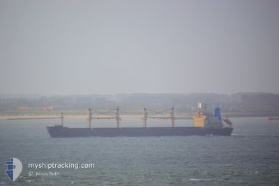
Bulk Carrier
Current Trip
| Time Travelled | 9 days |
|---|---|
| Remaining Time | 6 days |
| Distance Travelled | 2199.14 nm |
| Remaining Distance | 1896.72 nm |
| AVG Speed | 10 Knots |
| MAX Speed | 13.2 Knots |
| AVG Wind | 13.7 knots |
| MAX Wind | 28.6 knots |
| MIN Temp | 1.6°C / 34.88°F |
| MAX Temp | 13.3°C / 55.94°F |
| Dybgang | 10.8 m |
| Position Modtaget | 1 d siden |
Current Position
| Longitude | -5.90864° |
|---|---|
| Latitude | 48.75474° |
| Status | Under way using engine |
| Fart | 11.2 Knots |
| Kurs | 205° |
| Område | Celtic Sea |
| Station | T-AIS |
| Position Modtaget | 1 d siden |
Info
Information
The current position of RIZIK BEY is in Celtic Sea with coordinates 48.75474° / -5.90864° as reported on 2024-05-02 03:03 by AIS to our vessel tracker app. The vessel's current speed is 11.2 Knots and is heading at the port of VALLETTA. The estimated time of arrival as calculated by MyShipTracking vessel tracking app is 2024-05-10 01:42 LT
The vessel RIZIK BEY (IMO: 9285419, MMSI: 620862000) is a Bulk Carrier that was built in 2004 ( 20 år gamle ). It's sailing under the flag of [KM] Comoros.
In this page you can find informations about the vessels current position, last detected port calls, and current voyage information. If the vessels is not in coverage by AIS you will find the latest position.
The current position of RIZIK BEY is detected by our AIS receivers and we are not responsible for the reliability of the data. The last position was recorded while the vessel was in Coverage by the Ais receivers of our vessel tracking app.
The current draught of RIZIK BEY as reported by AIS is 10.8 meters
Weather
| Temperature | 14.2°C / 57.56°F |
|---|---|
| Wind Speed | 32 knots |
| Direction | 206° SSW |
| Pressure | 1010.2 hPa |
| Humidity | 91.6 % |
| Cloud Coverage | 100 % |
Featured Company
Last Port Calls
| Port | Arrival | Departure | Time In Port |
|---|---|---|---|
| 2024-04-21 04:16 | 2024-04-24 10:28 | 3 d |
Most Visited Ports (Last year)
| Port | Arrivals | |
|---|---|---|
| 4 | ||
| 2 | ||
| 2 | ||
| 2 | ||
| 2 | ||
| 1 |
Last Trips
| Origin | Departure | Destination | Arrival | Distance | |
|---|---|---|---|---|---|
| 2024-02-29 04:07 | 2024-04-21 07:16 | 6123.27 nm |
Events
| Tid | Hændelsen | Detaljer | Position / Dest | Info |
|---|---|---|---|---|
| 2024-05-02 03:19 | Status er ændret | Default Under way using engine |
48.71310 / -5.94398
MT MLA
|
Fart: 11.2 kn Kurs: 205° |
| 2024-05-02 03:03 | Udenfor Dækning |
48.75474 / -5.90864
Celtic Sea
MT MLA
|
Fart: 11.2 kn Kurs: 205° |
|
| 2024-05-02 02:46 | Status er ændret | Under way using engine Default |
48.80067 / -5.87014
MT MLA
|
Fart: 10.8 kn Kurs: 220° |
| 2024-05-02 02:34 | Status er ændret | Default Under way using engine |
48.83398 / -5.84179
MT MLA
|
Fart: 10.7 kn Kurs: 212.5° |
| 2024-05-02 02:30 | Status er ændret | Under way using engine Default |
48.84225 / -5.83343
MT MLA
|
Fart: 10.1 kn Kurs: 233° |
| 2024-05-02 02:18 | Indenfor Dækning |
48.84225 / -5.83343
Celtic Sea
MT MLA
|
Fart: 10.6 kn Kurs: 208.8° |
|
| 2024-05-01 23:11 | Status er ændret | Default Under way using engine |
49.15358 / -5.12268
MT MLA
|
Fart: 9.8 kn Kurs: 240.9° |
| 2024-05-01 23:08 | Udenfor Dækning |
49.15848 / -5.11109
Celtic Sea
MT MLA
|
Fart: 9.8 kn Kurs: 240.9° |
|
| 2024-05-01 23:07 | Status er ændret | Under way using engine Default |
49.15946 / -5.10869
MT MLA
|
Fart: 10.1 kn Kurs: 240° |
| 2024-05-01 22:57 | Status er ændret | Default Under way using engine |
49.17428 / -5.07284
MT MLA
|
Fart: 9.8 kn Kurs: 239.5° |