
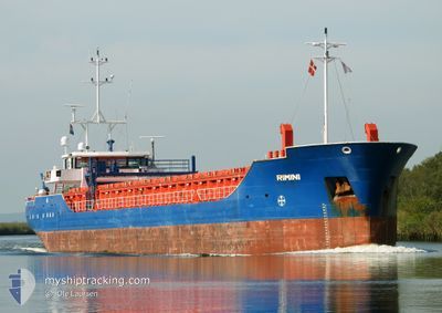
RIMINI
General Cargo
Current Trip
| Time Travelled | 1 day |
|---|---|
| Remaining Time | 34 mins |
| Distance Travelled | 348.67 nm |
| Remaining Distance | 8.80 nm |
| AVG Speed | 8.6 Knots |
| MAX Speed | 15 Knots |
| AVG Wind | 11.6 knots |
| MAX Wind | 18 knots |
| MIN Temp | 2.1°C / 35.78°F |
| MAX Temp | 9.5°C / 49.1°F |
| Dybgang | 3.4 m |
| Position Modtaget | 1 m siden |
Current Position
| Longitude | --- |
|---|---|
| Latitude | --- |
| Status | Under way using engine |
| Fart | 9.2 Knots |
| Kurs | 237.7° |
| Område | Inner Seas off the West Coast of Scotland |
| Station | T-AIS |
| Position Modtaget | 1 m siden |
Info
Information
The current position of RIMINI is in Inner Seas off the West Coast of Scotland with coordinates 54.70816° / -5.72786° as reported on 2025-03-02 11:47 by AIS to our vessel tracker app. The vessel's current speed is 9.2 Knots and is heading at the port of BELFAST. The estimated time of arrival as calculated by MyShipTracking vessel tracking app is 2025-03-02 12:22 LT
The vessel RIMINI (IMO: 9421635, MMSI: 244218000) is a General Cargo that was built in 2008 ( 17 år gamle ). It's sailing under the flag of [NL] Netherlands.
In this page you can find informations about the vessels current position, last detected port calls, and current voyage information. If the vessels is not in coverage by AIS you will find the latest position.
The current position of RIMINI is detected by our AIS receivers and we are not responsible for the reliability of the data. The last position was recorded while the vessel was in Coverage by the Ais receivers of our vessel tracking app.
The current draught of RIMINI as reported by AIS is 3.4 meters
Weather
| Temperature | 8.3°C / 46.94°F |
|---|---|
| Wind Speed | 10 knots |
| Direction | 226° SW |
| Pressure | 1030.6 hPa |
| Humidity | 81.6 % |
| Cloud Coverage | 61 % |
Featured Company
Last Port Calls
| Port | Arrival | Departure | Time In Port |
|---|---|---|---|
| 2025-02-28 18:40 | |||
| 2025-02-19 18:20 | 2025-02-21 15:36 | 1 d | |
| 2025-02-17 05:51 | 2025-02-18 08:33 | 1 d | |
| 2025-02-14 06:25 | 2025-02-14 19:45 | 13 h | |
| 2025-02-07 10:04 | 2025-02-07 23:01 | 12 h | |
| 2025-02-03 08:29 | 2025-02-04 18:58 | 1 d | |
| 2025-01-27 22:48 | 2025-01-30 10:29 | 2 d | |
| 2025-01-22 09:08 | 2025-01-22 13:15 | 4 h | |
| 2025-01-12 19:10 | 2025-01-15 00:06 | 2 d | |
| 2025-01-10 05:03 | 2025-01-10 07:57 | 2 h |
Most Visited Ports (Last year)
| Port | Arrivals | |
|---|---|---|
| 10 | ||
| 6 | ||
| 4 | ||
| 4 | ||
| 3 | ||
| 3 |
Last Trips
| Origin | Departure | Destination | Arrival | Distance | |
|---|---|---|---|---|---|
| 2025-02-18 09:33 | 2025-02-19 19:20 | 323.86 nm | |||
| 2025-02-14 19:45 | 2025-02-17 06:51 | 439.20 nm | |||
| 2025-02-07 23:01 | 2025-02-14 06:25 | 1227.71 nm | |||
| 2025-02-04 19:58 | 2025-02-07 10:04 | 294.53 nm | |||
| 2025-01-30 11:29 | 2025-02-03 09:29 | 800.07 nm | |||
| 2025-01-22 14:15 | 2025-01-27 23:48 | 852.00 nm | |||
| 2025-01-15 01:06 | 2025-01-22 10:08 | 1242.90 nm | |||
| 2025-01-10 08:57 | 2025-01-12 20:10 | 592.83 nm | |||
| 2025-01-07 20:31 | 2025-01-10 06:03 | 461.32 nm | |||
| 2025-01-05 16:19 | 2025-01-05 17:40 | 9.70 nm |
Events
| Tid | Hændelsen | Detaljer | Position / Dest | Info |
|---|---|---|---|---|
| 2025-03-02 09:41 | Status er ændret | Under way using engine Default |
55.04998 / -5.87273
BELFAST
|
Fart: 12.4 kn Kurs: 161° |
| 2025-03-02 09:20 | Status er ændret | Default Under way using engine |
55.12104 / -5.91338
BELFAST
|
Fart: 13.7 kn Kurs: 163.8° |
| 2025-03-02 06:27 | Dybgangen er ændret | 3.4 4.3 |
55.40320 / -6.63881
BELFAST
|
Fart: 8.7 kn Kurs: 104.7° |
| 2025-03-02 06:04 | Fundet i havområde | United Kingdom part of the Inner Seas off the West Coast of Scotland |
55.41502 / -6.72780
Inner Seas off the West Coast of Scotland
BELFAST
|
Fart: 7.3 kn Kurs: 103.3° |
| 2025-03-02 05:57 | ETA er ændret | 2025/03/02 15:00 2026/02/26 18:00 |
55.41867 / -6.75534
BELFAST
|
Fart: 6.8 kn Kurs: 99.7° |
| 2025-03-02 05:29 | Status er ændret | Under way using engine Default |
55.43171 / -6.85041
BELFAST
|
Fart: 7.2 kn Kurs: 104° |
| 2025-03-02 05:27 | Status er ændret | Default Under way using engine |
55.43262 / -6.85700
BELFAST
|
Fart: 6.8 kn Kurs: 107.4° |
| 2025-03-02 05:19 | Status er ændret | Under way using engine Default |
55.43615 / -6.88216
BELFAST
|
Fart: 6.2 kn Kurs: 104° |
| 2025-03-02 05:19 | Indenfor Dækning |
55.43552 / -6.87701
Inner Seas off the West Coast of Scotland
|
Fart: 5.9 kn Kurs: 108.3° |
|
| 2025-03-02 03:34 | Udenfor Dækning |
55.47393 / -7.20350
Inner Seas off the West Coast of Scotland
|
Fart: 5.7 kn Kurs: 96.2° |