
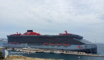
RESILIENT LADY
Passenger
Current Trip
| Time Travelled | 1 day |
|---|---|
| Remaining Time | 2 h, 41 mins |
| Distance Travelled | 553.26 nm |
| Remaining Distance | 29.42 nm |
| AVG Speed | 12.9 Knots |
| MAX Speed | 17.3 Knots |
| AVG Wind | 21.6 knots |
| MAX Wind | 32 knots |
| MIN Temp | 13.5°C / 56.3°F |
| MAX Temp | 17.7°C / 63.86°F |
| Dybgang | 8 m |
| Position Modtaget | Nu |
Current Position
| Longitude | --- |
|---|---|
| Latitude | --- |
| Status | Under way using engine |
| Fart | 10.1 Knots |
| Kurs | 195.7° |
| Område | North Atlantic Ocean |
| Station | T-AIS |
| Position Modtaget | Nu |
Info
Information
The current position of RESILIENT LADY is in North Atlantic Ocean with coordinates 43.79399° / -8.38853° as reported on 2024-10-02 01:53 by AIS to our vessel tracker app. The vessel's current speed is 10.1 Knots and is heading at the port of CORUNA. The estimated time of arrival as calculated by MyShipTracking vessel tracking app is 2024-10-02 04:35 LT
The vessel RESILIENT LADY (IMO: 9805348, MMSI: 311001056) is a Passenger It's sailing under the flag of [BS] Bahamas.
In this page you can find informations about the vessels current position, last detected port calls, and current voyage information. If the vessels is not in coverage by AIS you will find the latest position.
The current position of RESILIENT LADY is detected by our AIS receivers and we are not responsible for the reliability of the data. The last position was recorded while the vessel was in Coverage by the Ais receivers of our vessel tracking app.
The current draught of RESILIENT LADY as reported by AIS is 8 meters
Weather
| Temperature | 17.5°C / 63.5°F |
|---|---|
| Wind Speed | 13 knots |
| Direction | 227° SW |
| Pressure | 1013.4 hPa |
| Humidity | 99 % |
| Cloud Coverage | 100 % |
Featured Company
Last Port Calls
| Port | Arrival | Departure | Time In Port |
|---|---|---|---|
| 2024-09-29 04:44 | 2024-09-30 07:37 | 1 d | |
| 2024-09-26 05:10 | 2024-09-27 17:03 | 1 d | |
| 2024-09-23 03:35 | 2024-09-23 17:02 | 13 h | |
| 2024-09-20 13:32 | 2024-09-21 16:39 | 1 d | |
| 2024-09-19 04:59 | 2024-09-19 17:41 | 12 h | |
| 2024-09-18 05:19 | 2024-09-18 16:11 | 10 h | |
| 2024-09-17 20:24 | 2024-09-17 20:54 | 30 m | |
| 2024-09-16 04:16 | 2024-09-17 17:15 | 1 d | |
| 2024-09-16 01:39 | 2024-09-16 02:57 | 1 h | |
| 2024-09-14 04:42 | 2024-09-14 17:52 | 13 h |
Last Trips
| Origin | Departure | Destination | Arrival | Distance | |
|---|---|---|---|---|---|
| 2024-09-27 19:03 | 2024-09-29 05:44 | 578.67 nm | |||
| 2024-09-23 18:02 | 2024-09-26 07:10 | 712.03 nm | |||
| 2024-09-21 18:39 | 2024-09-23 04:35 | 281.30 nm | |||
| 2024-09-19 18:41 | 2024-09-20 15:32 | 293.88 nm | |||
| 2024-09-18 18:11 | 2024-09-19 05:59 | 199.58 nm | |||
| 2024-09-17 22:54 | 2024-09-18 07:19 | 136.92 nm | |||
| 2024-09-17 19:15 | 2024-09-17 22:24 | 10.30 nm | |||
| 2024-09-16 04:57 | 2024-09-16 06:16 | 8.61 nm | |||
| 2024-09-14 18:52 | 2024-09-16 03:39 | 282.01 nm | |||
| 2024-09-11 18:30 | 2024-09-14 05:42 | 699.01 nm |
Events
| Tid | Hændelsen | Detaljer | Position / Dest | Info |
|---|---|---|---|---|
| 2024-10-02 01:05 | Ændre havområde | Spanish part of the North Atlantic Ocean French part of the Celtic Sea |
43.92126 / -8.31534
North Atlantic Ocean
ESLCG
|
Fart: 10.3 kn Kurs: 209.1° |
| 2024-10-02 01:05 | Status er ændret | Under way using engine Default |
43.92126 / -8.31534
ESLCG
|
Fart: 10.2 kn Kurs: 208° |
| 2024-10-02 01:05 | Indenfor Dækning |
43.92126 / -8.31534
North Atlantic Ocean
ESLCG
|
Fart: 10.3 kn Kurs: 209.1° |
|
| 2024-09-30 22:27 | Status er ændret | Default Under way using engine |
49.18372 / -5.10785
ESLCG
|
Fart: 15.6 kn Kurs: 235.8° |
| 2024-09-30 22:21 | Ændre havområde | French part of the Celtic Sea French part of the English Channel |
49.19727 / -5.07724
Celtic Sea
ESLCG
|
Fart: 15.6 kn Kurs: 235.8° |
| 2024-09-30 22:21 | Udenfor Dækning |
49.19727 / -5.07724
Celtic Sea
ESLCG
|
Fart: 15.6 kn Kurs: 235.8° |
|
| 2024-09-30 22:21 | Status er ændret | Under way using engine Default |
49.19899 / -5.07345
ESLCG
|
Fart: 15.9 kn Kurs: 236° |
| 2024-09-30 22:19 | Status er ændret | Default Under way using engine |
49.20293 / -5.06477
ESLCG
|
Fart: 16 kn Kurs: 235° |
| 2024-09-30 22:12 | Ændre havområde | French part of the English Channel United Kingdom part of the English Channel |
49.22120 / -5.02428
English Channel
ESLCG
|
Fart: 16 kn Kurs: 235° |
| 2024-09-30 22:12 | Status er ændret | Under way using engine Default |
49.22120 / -5.02428
ESLCG
|
Fart: 16 kn Kurs: 234° |