
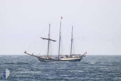
REGINA MARIS
Yacht
Current Trip
WEATHER DEPENDING
| Time Travelled | 18 h, 59 mins |
|---|---|
| Remaining Time | --- |
| Distance Travelled | 20.68 nm |
| Remaining Distance | --- |
| AVG Speed | 5.2 Knots |
| MAX Speed | 7.7 Knots |
| AVG Wind | 9.1 knots |
| MAX Wind | 11 knots |
| MIN Temp | 16.1°C / 60.98°F |
| MAX Temp | 19°C / 66.2°F |
| Dybgang | 2.8 m |
| Position Modtaget | 1 m siden |
Current Position
| Longitude | 10.15925° |
|---|---|
| Latitude | 55.05227° |
| Status | Under way sailing |
| Fart | |
| Kurs | --- |
| Område | Kattegat |
| Station | T-AIS |
| Position Modtaget | 1 m siden |
Info
Information
The current position of REGINA MARIS is in Kattegat with coordinates 55.05227° / 10.15925° as reported on 2024-09-19 03:00 by AIS to our vessel tracker app. The vessel's current speed is 0 Knots
The vessel REGINA MARIS (IMO: 7025126, MMSI: 244528000) is a Yacht that was built in 1970 ( 54 år gamle ). It's sailing under the flag of [NL] Netherlands.
In this page you can find informations about the vessels current position, last detected port calls, and current voyage information. If the vessels is not in coverage by AIS you will find the latest position.
The current position of REGINA MARIS is detected by our AIS receivers and we are not responsible for the reliability of the data. The last position was recorded while the vessel was in Coverage by the Ais receivers of our vessel tracking app.
The current draught of REGINA MARIS as reported by AIS is 2.8 meters
Weather
| Temperature | 14.8°C / 58.64°F |
|---|---|
| Wind Speed | 10 knots |
| Direction | 69° ENE |
| Pressure | 1030.9 hPa |
| Humidity | 86.2 % |
| Cloud Coverage | 68 % |
Featured Company
Last Port Calls
| Port | Arrival | Departure | Time In Port |
|---|---|---|---|
| 2024-09-17 15:39 | 2024-09-18 10:03 | 18 h | |
| 2024-09-17 11:06 | 2024-09-17 12:14 | 1 h | |
| 2024-09-13 13:42 | 2024-09-16 12:09 | 2 d | |
| 2024-09-12 13:28 | 2024-09-13 09:51 | 20 h | |
| 2024-09-11 16:09 | 2024-09-12 10:17 | 18 h | |
| 2024-09-10 13:34 | 2024-09-11 10:16 | 20 h | |
| 2024-09-09 17:26 | 2024-09-10 10:20 | 16 h | |
| 2024-09-08 15:06 | 2024-09-09 12:33 | 21 h | |
| 2024-09-08 10:42 | 2024-09-08 10:44 | 2 m | |
| 2024-09-07 16:31 | 2024-09-08 09:56 | 17 h |
Last Trips
| Origin | Departure | Destination | Arrival | Distance | |
|---|---|---|---|---|---|
| 2024-09-17 12:14 | 2024-09-17 15:39 | 15.35 nm | |||
| 2024-09-16 12:09 | 2024-09-17 11:06 | 38.20 nm | |||
| 2024-09-13 09:51 | 2024-09-13 13:42 | 17.50 nm | |||
| 2024-09-12 10:17 | 2024-09-12 13:28 | 18.91 nm | |||
| 2024-09-11 10:16 | 2024-09-11 16:09 | 40.27 nm | |||
| 2024-09-10 10:20 | 2024-09-10 13:34 | 17.25 nm | |||
| 2024-09-09 12:33 | 2024-09-09 17:26 | 32.81 nm | |||
| 2024-09-08 10:44 | 2024-09-08 15:06 | 22.27 nm | |||
| 2024-09-08 09:56 | 2024-09-08 10:42 | 4.30 nm | |||
| 2024-09-07 10:28 | 2024-09-07 16:31 | 24.54 nm |
Events
| Tid | Hændelsen | Detaljer | Position / Dest | Info |
|---|---|---|---|---|
| 2024-09-18 14:00 | STOP Sejllads | 3.6 nm, South West of FAABORG |
55.05229 / 10.15925
WEATHER DEPENDING
|
Fart: 0.1 kn Kurs: 511° |
| 2024-09-18 08:03 | Afsejlet fra sidste havn |
|
54.85952 / 10.52200
WEATHER DEPENDING
|
Fart: 7.5 kn Kurs: 356.5° |
| 2024-09-18 08:03 | START Sejllads |
54.85885 / 10.52207
[DK] MARSTAL
|
Fart: 7.5 kn Kurs: 356.1° |
|
| 2024-09-17 13:39 | Skibe i havn |
|
54.85673 / 10.52243
[DK] MARSTAL
|
Fart: 1.3 kn Kurs: 511° |
| 2024-09-17 13:37 | STOP Sejllads | 0.03 nm, North East of MARSTAL |
54.85703 / 10.52312
WEATHER DEPENDING
|
Fart: 0.3 kn Kurs: 511° |
| 2024-09-17 10:14 | START Sejllads | 0.14 nm, East of MARSTAL |
54.85618 / 10.52650
WEATHER DEPENDING
|
Fart: 6.2 kn Kurs: 110.8° |
| 2024-09-17 10:14 | Afsejlet fra sidste havn |
|
54.85618 / 10.52650
WEATHER DEPENDING
|
Fart: 6.1 kn Kurs: 111.4° |
| 2024-09-17 09:06 | Skibe i havn |
|
54.85693 / 10.52253
[DK] MARSTAL
|
Fart: 2.7 kn Kurs: 511° |
| 2024-09-17 09:04 | STOP Sejllads | 0.02 nm, East of MARSTAL |
54.85683 / 10.52313
WEATHER DEPENDING
|
Fart: 0.3 kn Kurs: 511° |
| 2024-09-17 07:55 | START Sejllads | 8.01 nm, South East of MARSTAL |
54.75402 / 10.66962
WEATHER DEPENDING
|
Fart: 7.4 kn Kurs: 327° |