
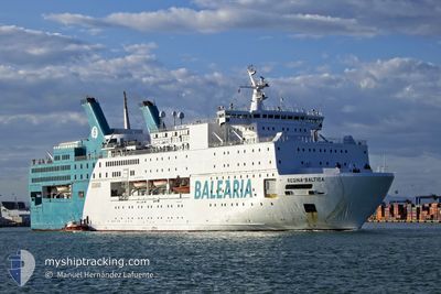
REGINA BALTICA
Cable Layer
Current Trip
| Trip Time | 8 h, 35 mins |
|---|---|
| Trip Distance | 94.13 nm |
| AVG Speed | 10.9 Knots |
| MAX Speed | 11.7 Knots |
| Dybgang | 5.3 m |
| AVG Wind | 21.7 knots |
| MAX Wind | 28 knots |
| MIN Temp | 15.4°C / 59.72°F |
| MAX Temp | 17.3°C / 63.14°F |
| Position Modtaget | 2 h, 37 m siden |
Current Position
| Longitude | -2.80118° |
|---|---|
| Latitude | 35.66924° |
| Status | Under way using engine |
| Fart | 10.9 Knots |
| Kurs | 194.2° |
| Område | Alboran Sea |
| Station | T-AIS |
| Position Modtaget | 2 h, 37 m siden |
Info
Information
The current position of REGINA BALTICA is in Alboran Sea with coordinates 35.66924° / -2.80118° as reported on 2024-04-27 16:28 by AIS to our vessel tracker app. The vessel's current speed is 10.9 Knots and is currently inside the port of NADOR.
The vessel REGINA BALTICA (IMO: 7827225, MMSI: 210976000) is a Cable Layer that was built in 1980 ( 44 år gamle ). It's sailing under the flag of [CY] Cyprus.
In this page you can find informations about the vessels current position, last detected port calls, and current voyage information. If the vessels is not in coverage by AIS you will find the latest position.
The current position of REGINA BALTICA is detected by our AIS receivers and we are not responsible for the reliability of the data. The last position was recorded while the vessel was in Coverage by the Ais receivers of our vessel tracking app.
The current draught of REGINA BALTICA as reported by AIS is 5.3 meters
Weather
| Temperature | 15.2°C / 59.36°F |
|---|---|
| Wind Speed | 12 knots |
| Direction | 288° WNW |
| Pressure | 1009.2 hPa |
| Humidity | 75.1 % |
| Cloud Coverage | 100 % |
Featured Company
Last Port Calls
| Port | Arrival | Departure | Time In Port |
|---|---|---|---|
| 2024-04-27 18:48 | |||
| 2024-04-27 07:16 | 2024-04-27 10:13 | 2 h | |
| 2024-04-26 18:50 | 2024-04-26 23:41 | 4 h | |
| 2024-04-26 06:50 | 2024-04-26 09:48 | 2 h | |
| 2024-04-25 18:32 | 2024-04-25 23:10 | 4 h | |
| 2024-04-25 07:13 | 2024-04-25 10:06 | 2 h | |
| 2024-04-24 18:54 | 2024-04-24 23:14 | 4 h | |
| 2024-04-24 06:58 | 2024-04-24 09:58 | 3 h | |
| 2024-04-23 19:29 | 2024-04-23 22:44 | 3 h | |
| 2024-04-23 06:50 | 2024-04-23 10:06 | 3 h |
Last Trips
| Origin | Departure | Destination | Arrival | Distance | |
|---|---|---|---|---|---|
| 2024-04-27 12:13 | 2024-04-27 19:48 | 94.13 nm | |||
| 2024-04-27 00:41 | 2024-04-27 09:16 | 95.41 nm | |||
| 2024-04-26 11:48 | 2024-04-26 19:50 | 94.47 nm | |||
| 2024-04-26 00:10 | 2024-04-26 08:50 | 92.98 nm | |||
| 2024-04-25 12:06 | 2024-04-25 19:32 | 95.81 nm | |||
| 2024-04-25 00:14 | 2024-04-25 09:13 | 96.47 nm | |||
| 2024-04-24 11:58 | 2024-04-24 19:54 | 96.83 nm | |||
| 2024-04-23 23:44 | 2024-04-24 08:58 | 96.34 nm | |||
| 2024-04-23 12:06 | 2024-04-23 20:29 | 94.55 nm | |||
| 2024-04-22 23:42 | 2024-04-23 08:50 | 92.55 nm |
Events
| Tid | Hændelsen | Detaljer | Position / Dest | Info |
|---|---|---|---|---|
| 2024-04-27 18:48 | Skibe i havn |
|
35.27925 / -2.92254
[MA] NADOR
|
Fart: 7.1 kn Kurs: 201° |
| 2024-04-27 17:06 | Status er ændret | Default Under way using engine |
35.54108 / -2.83874
NADOR
|
Fart: 10.9 kn Kurs: 194.2° |
| 2024-04-27 16:28 | Udenfor Dækning |
35.66924 / -2.80118
Alboran Sea
NADOR
|
Fart: 10.9 kn Kurs: 194.2° |
|
| 2024-04-27 16:09 | Ændre havområde | Moroccan part of the Alboran Sea Spanish part of the Alboran Sea |
35.70692 / -2.78983
Alboran Sea
NADOR
|
Fart: 11 kn Kurs: 194.4° |
| 2024-04-27 15:15 | Status er ændret | Under way using engine Default |
35.88252 / -2.73756
NADOR
|
Fart: 11.6 kn Kurs: 193° |
| 2024-04-27 14:44 | Status er ændret | Default Under way using engine |
35.96954 / -2.71165
NADOR
|
Fart: 11.4 kn Kurs: 191.7° |
| 2024-04-27 12:40 | Status er ændret | Under way using engine Default |
36.35885 / -2.59732
NADOR
|
Fart: 11.5 kn Kurs: 195° |
| 2024-04-27 12:25 | Status er ændret | Default Under way using engine |
36.40624 / -2.58022
NADOR
|
Fart: 11.5 kn Kurs: 194.5° |
| 2024-04-27 12:20 | Status er ændret | Under way using engine Default |
36.42224 / -2.57475
NADOR
|
Fart: 11.5 kn Kurs: 194° |
| 2024-04-27 12:13 | Status er ændret | Default Under way using engine |
36.44404 / -2.56778
NADOR
|
Fart: 11.3 kn Kurs: 193.3° |