
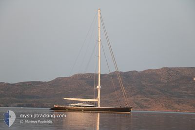
RED DRAGON
Sailing
Current Trip
ANBAI
| Time Travelled | 5 days |
|---|---|
| Remaining Time | --- |
| Distance Travelled | 156.09 nm |
| Remaining Distance | --- |
| AVG Speed | 9.6 Knots |
| MAX Speed | 14 Knots |
| AVG Wind | 8.4 knots |
| MAX Wind | 13 knots |
| MIN Temp | 24.8°C / 76.64°F |
| MAX Temp | 26.5°C / 79.7°F |
| Dybgang | 5 m |
| Position Modtaget | 3 m siden |
Current Position
| Longitude | --- |
|---|---|
| Latitude | --- |
| Status | At anchor |
| Fart | |
| Kurs | 77° |
| Område | Caribbean Sea |
| Station | T-AIS |
| Position Modtaget | 3 m siden |
Info
Information
The current position of RED DRAGON is in Caribbean Sea with coordinates 17.25115° / -62.66296° as reported on 2026-01-03 10:09 by AIS to our vessel tracker app. The vessel's current speed is 0 Knots
The vessel RED DRAGON (IMO: 1009651, MMSI: 256005000) is a Sailing It's sailing under the flag of [MT] Malta.
In this page you can find informations about the vessels current position, last detected port calls, and current voyage information. If the vessels is not in coverage by AIS you will find the latest position.
The current position of RED DRAGON is detected by our AIS receivers and we are not responsible for the reliability of the data. The last position was recorded while the vessel was in Coverage by the Ais receivers of our vessel tracking app.
The current draught of RED DRAGON as reported by AIS is 5 meters
Weather
| Temperature | 26°C / 78.8°F |
|---|---|
| Wind Speed | 9 knots |
| Direction | 107° ESE |
| Pressure | 1013.5 hPa |
| Humidity | 72.9 % |
| Cloud Coverage | 7 % |
Featured Company
Last Port Calls
| Port | Arrival | Departure | Time In Port |
|---|---|---|---|
| 2025-12-23 09:40 | 2025-12-28 10:43 | 5 d | |
| 2025-12-12 05:22 | 2025-12-14 08:14 | 2 d | |
| 2025-12-09 07:37 | 2025-12-09 11:00 | 3 h | |
| 2025-12-06 10:16 | 2025-12-07 15:58 | 1 d | |
| 2025-12-06 08:28 |
Most Visited Ports (Last year)
| Port | Arrivals | |
|---|---|---|
| 7 | ||
| 6 | ||
| 2 | ||
| 1 | ||
| 1 | ||
| 1 |
Last Trips
| Origin | Departure | Destination | Arrival | Distance | |
|---|---|---|---|---|---|
| 2025-12-14 08:14 | 2025-12-23 09:40 | 2679.56 nm | |||
| 2025-12-09 11:00 | 2025-12-12 05:22 | 726.72 nm | |||
| 2025-12-07 15:58 | 2025-12-09 07:37 | 450.63 nm | |||
| 2025-12-06 08:28 | 2025-12-06 10:16 | 3.38 nm |
Events
| Tid | Hændelsen | Detaljer | Position / Dest | Info |
|---|---|---|---|---|
| 2026-01-03 00:45 | Status er ændret | At anchor Under way using engine |
17.25075 / -62.66257
ANBAI
|
Fart: 0.7 kn Kurs: 18° |
| 2026-01-03 00:41 | STOP Sejllads | 1.75 nm, North West of MAJORS BAY |
17.25111 / -62.66237
ANBAI
|
Fart: 0.2 kn Kurs: 60° |
| 2026-01-02 23:24 | Fundet i havområde | Saint Kitts and Nevis part of the Caribbean Sea |
17.35742 / -62.86983
Caribbean Sea
|
Fart: 12.5 kn Kurs: 137.3° |
| 2026-01-02 23:24 | Indenfor Dækning |
17.35742 / -62.86983
Caribbean Sea
|
Fart: 12.5 kn Kurs: 137.3° |
|
| 2026-01-02 21:02 | Udenfor Dækning |
17.61989 / -63.26187
Caribbean Sea
|
Fart: 8.7 kn Kurs: 170.7° |
|
| 2026-01-02 20:56 | Status er ændret | Under way using engine At anchor |
17.63219 / -63.26114
ANBAI
|
Fart: 6 kn Kurs: 248.1° |
| 2026-01-02 20:56 | START Sejllads | 16.79 nm, North West of ST EUSTATIUS |
17.63219 / -63.26114
ANBAI
|
Fart: 6.2 kn Kurs: 246.1° |
| 2026-01-02 20:28 | STOP Sejllads | 16.73 nm, North West of ST EUSTATIUS |
17.63328 / -63.25926
ANBAI
|
Fart: 0.2 kn Kurs: 47° |
| 2026-01-02 19:46 | Indenfor Dækning |
17.63330 / -63.25916
Caribbean Sea
|
Fart: 0.8 kn Kurs: 131° |
|
| 2026-01-02 18:31 | Udenfor Dækning |
17.63354 / -63.25885
Caribbean Sea
|
Fart: 1.1 kn Kurs: 156° |