

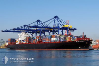
RDO CONCORD
Container Ship

Current Trip
| Time Travelled | 12 days |
|---|---|
| Remaining Time | --- |
| Distance Travelled | 3697.26 nm |
| Remaining Distance | --- |
| AVG Speed | 11.9 Knots |
| MAX Speed | 19.7 Knots |
| AVG Wind | 13.8 knots |
| MAX Wind | 30 knots |
| MIN Temp | 11.7°C / 53.06°F |
| MAX Temp | 20.3°C / 68.54°F |
| Dybgang | 13.1 m |
| Position Modtaget | 4 d siden |
Current Position
| Longitude | --- |
|---|---|
| Latitude | --- |
| Status | Under way using engine |
| Fart | 16.4 Knots |
| Kurs | 268.6° |
| Område | North Atlantic Ocean |
| Station | T-AIS |
| Position Modtaget | 4 d siden |
Information
The current position of RDO CONCORD is in North Atlantic Ocean with coordinates 36.54492° / -31.01011° as reported on 2025-03-24 17:56 by AIS to our vessel tracker app. The vessel's current speed is 16.4 Knots and is heading at the port of VERACRUZ. The estimated time of arrival as calculated by MyShipTracking vessel tracking app is 2025-04-03 13:30 LT
The vessel RDO CONCORD (IMO: 9401283, MMSI: 636092919) is a Container Ship that was built in 2009 ( 16 år gamle ). It's sailing under the flag of [LR] Liberia.
In this page you can find informations about the vessels current position, last detected port calls, and current voyage information. If the vessels is not in coverage by AIS you will find the latest position.
The current position of RDO CONCORD is detected by our AIS receivers and we are not responsible for the reliability of the data. The last position was recorded while the vessel was in Coverage by the Ais receivers of our vessel tracking app.
The current draught of RDO CONCORD as reported by AIS is 13.1 meters
Weather
| Temperature | 19.2°C / 66.56°F |
|---|---|
| Wind Speed | 14 knots |
| Direction | 95° E |
| Pressure | 1028 hPa |
| Humidity | 64.2 % |
| Cloud Coverage | 7 % |


Featured Company
Last Port Calls
| Port | Arrival | Departure | Time In Port |
|---|---|---|---|
| 2025-03-16 01:15 | 2025-03-16 21:13 | 19 h | |
| 2025-03-14 19:42 | 2025-03-15 12:00 | 16 h | |
| 2025-03-11 07:03 | 2025-03-12 13:22 | 1 d | |
| 2025-03-03 04:37 | 2025-03-06 22:14 | 3 d | |
| 2025-02-22 06:27 | 2025-02-23 15:29 | 1 d | |
| 2025-02-16 06:20 | 2025-02-16 17:30 | 11 h | |
| 2025-02-12 09:15 | 2025-02-14 11:39 | 2 d | |
| 2025-02-01 09:02 | 2025-02-03 18:47 | 2 d | |
| 2025-01-28 02:06 | 2025-01-30 07:12 | 2 d | |
| 2025-01-23 22:40 | 2025-01-25 21:21 | 1 d |
Most Visited Ports (Last year)
| Port | Arrivals | |
|---|---|---|
| 8 | ||
| 8 | ||
| 8 | ||
| 7 | ||
| 7 | ||
| 7 |
Last Trips
| Origin | Departure | Destination | Arrival | Distance | |
|---|---|---|---|---|---|
| 2025-03-15 12:00 | 2025-03-16 01:15 | 176.04 nm | |||
| 2025-03-12 13:22 | 2025-03-14 19:42 | 463.25 nm | |||
| 2025-03-06 22:14 | 2025-03-11 07:03 | 2120.68 nm | |||
| 2025-02-23 15:29 | 2025-03-03 04:37 | 3534.04 nm | |||
| 2025-02-16 17:30 | 2025-02-22 06:27 | 294.51 nm | |||
| 2025-02-14 11:39 | 2025-02-16 06:20 | 249.66 nm | |||
| 2025-02-03 18:47 | 2025-02-12 09:15 | 3928.73 nm | |||
| 2025-01-30 07:12 | 2025-02-01 09:02 | 313.86 nm | |||
| 2025-01-25 21:21 | 2025-01-28 02:06 | 273.25 nm | |||
| 2025-01-23 11:06 | 2025-01-23 22:40 | 123.74 nm |
Events
| Tid | Hændelsen | Detaljer | Position / Dest | Info |
|---|---|---|---|---|
| 2025-03-24 18:18 | Status er ændret | Default Under way using engine |
36.54137 / -31.13623
MAPTM>MXVER
|
Fart: 16.4 kn Kurs: 268.6° |
| 2025-03-24 17:56 | Udenfor Dækning |
36.54492 / -31.01011
North Atlantic Ocean
MAPTM>MXVER
|
Fart: 16.4 kn Kurs: 268.6° |
|
| 2025-03-24 17:55 | Status er ændret | Under way using engine Default |
36.54496 / -31.00852
MAPTM>MXVER
|
Fart: 16.3 kn Kurs: 268° |
| 2025-03-24 17:51 | Status er ændret | Default Under way using engine |
36.54560 / -30.98312
MAPTM>MXVER
|
Fart: 16.2 kn Kurs: 268.2° |
| 2025-03-24 17:38 | Status er ændret | Under way using engine Default |
36.54756 / -30.91287
MAPTM>MXVER
|
Fart: 16.3 kn Kurs: 268° |
| 2025-03-24 17:38 | Indenfor Dækning |
36.54756 / -30.91287
North Atlantic Ocean
MAPTM>MXVER
|
Fart: 16.2 kn Kurs: 268.2° |
|
| 2025-03-24 15:57 | Status er ændret | Default Under way using engine |
36.55918 / -30.33127
MAPTM>MXVER
|
Fart: 16.9 kn Kurs: 268.5° |
| 2025-03-24 15:48 | Status er ændret | Under way using engine Default |
36.56009 / -30.28041
MAPTM>MXVER
|
Fart: 17.1 kn Kurs: 268° |
| 2025-03-24 15:48 | Udenfor Dækning |
36.56009 / -30.28041
North Atlantic Ocean
MAPTM>MXVER
|
Fart: 16.9 kn Kurs: 268.5° |
|
| 2025-03-24 15:41 | Status er ændret | Default Under way using engine |
36.56103 / -30.23814
MAPTM>MXVER
|
Fart: 17.2 kn Kurs: 266.6° |