
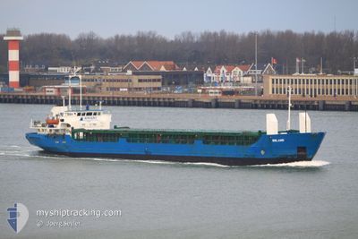
RANIA QUEEN
General Cargo
Current Trip
| Trip Time | 7 days |
|---|---|
| Trip Distance | 1170.85 nm |
| AVG Speed | 7.3 Knots |
| MAX Speed | 10.7 Knots |
| Dybgang | 4 m |
| AVG Wind | 11 knots |
| MAX Wind | 30 knots |
| MIN Temp | 11.7°C / 53.06°F |
| MAX Temp | 30°C / 86°F |
| Position Modtaget | 21 h, 15 m siden |
Current Position
| Longitude | 30.68270° |
|---|---|
| Latitude | 46.31828° |
| Status | Under way using engine |
| Fart | 5.4 Knots |
| Kurs | 285° |
| Område | Black Sea |
| Station | T-AIS |
| Position Modtaget | 21 h, 15 m siden |
Info
Information
The current position of RANIA QUEEN is in Black Sea with coordinates 46.31828° / 30.68270° as reported on 2024-05-02 17:52 by AIS to our vessel tracker app. The vessel's current speed is 5.4 Knots and is currently inside the port of CHORNOMORSK.
The vessel RANIA QUEEN (IMO: 8406779, MMSI: 667001589) is a General Cargo that was built in 1985 ( 39 år gamle ). It's sailing under the flag of [SL] Sierra Leone.
In this page you can find informations about the vessels current position, last detected port calls, and current voyage information. If the vessels is not in coverage by AIS you will find the latest position.
The current position of RANIA QUEEN is detected by our AIS receivers and we are not responsible for the reliability of the data. The last position was recorded while the vessel was in Coverage by the Ais receivers of our vessel tracking app.
The current draught of RANIA QUEEN as reported by AIS is 4 meters
Weather
| Temperature | 16.2°C / 61.16°F |
|---|---|
| Wind Speed | 3 knots |
| Direction | 198° SSW |
| Pressure | 1007 hPa |
| Humidity | 69.1 % |
| Cloud Coverage | 74 % |
Featured Company
Last Port Calls
| Port | Arrival | Departure | Time In Port |
|---|---|---|---|
| 2024-05-02 18:12 | |||
| 2024-04-22 21:36 | 2024-04-25 06:20 | 2 d | |
| 2024-04-15 14:20 | 2024-04-16 22:59 | 1 d | |
| 2024-04-02 16:38 | 2024-04-10 13:35 | 7 d | |
| 2024-03-29 14:47 | 2024-04-02 10:58 | 3 d | |
| 2024-03-20 08:44 | 2024-03-22 20:08 | 2 d | |
| 2024-03-12 08:57 | 2024-03-18 15:25 | 6 d |
Last Trips
| Origin | Departure | Destination | Arrival | Distance | |
|---|---|---|---|---|---|
| 2024-04-25 09:20 | 2024-05-02 21:12 | 1170.85 nm | |||
| 2024-04-17 01:59 | 2024-04-23 00:36 | 390.61 nm | |||
| 2024-04-10 15:35 | 2024-04-15 17:20 | 1095.05 nm | |||
| 2024-04-02 12:58 | 2024-04-02 18:38 | 49.47 nm | |||
| 2024-03-22 23:08 | 2024-03-29 15:47 | 1035.04 nm | |||
| 2024-03-18 17:25 | 2024-03-20 11:44 | 189.90 nm |
Events
| Tid | Hændelsen | Detaljer | Position / Dest | Info |
|---|---|---|---|---|
| 2024-05-03 04:04 | START Sejllads |
46.33739 / 30.67437
[UA] CHORNOMORSK
|
Fart: 33.9 kn Kurs: 324° |
|
| 2024-05-02 18:12 | STOP Sejllads |
46.32505 / 30.66580
[UA] CHORNOMORSK
|
Fart: Kurs: 322° |
|
| 2024-05-02 18:12 | Skibe i havn |
|
46.32505 / 30.66580
[UA] CHORNOMORSK
|
Fart: 1.4 kn Kurs: 333° |
| 2024-05-02 18:04 | Status er ændret | Default Under way using engine |
46.32142 / 30.66555
RU SUL
|
Fart: 5.4 kn Kurs: 285° |
| 2024-05-02 17:52 | Udenfor Dækning |
46.31828 / 30.68270
Black Sea
[UA] CHORNOMORSK
|
Fart: 5.4 kn Kurs: 285° |
|
| 2024-05-02 17:49 | Status er ændret | Under way using engine Default |
46.31653 / 30.69137
RU SUL
|
Fart: 8.8 kn Kurs: 208° |
| 2024-05-02 17:16 | Status er ændret | Default Under way using engine |
46.36102 / 30.77769
RU SUL
|
Fart: 8.5 kn Kurs: 222.6° |
| 2024-05-02 16:24 | START Sejllads | 4.82 nm, East of MALYI FONTAN |
46.44918 / 30.87983
RU SUL
|
Fart: 5 kn Kurs: 184.7° |
| 2024-05-02 16:12 | Status er ændret | Under way using engine Default |
46.45040 / 30.88704
RU SUL
|
Fart: 0.3 kn Kurs: 276° |
| 2024-05-02 16:04 | Status er ændret | Default Under way using engine |
46.44933 / 30.88700
RU SUL
|
Fart: 0.3 kn Kurs: 221° |