
RALEIGH FISHER
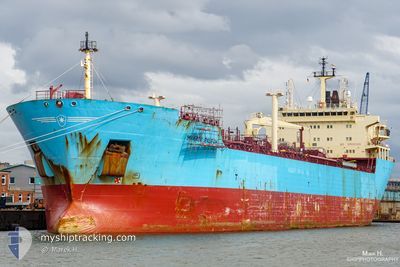
Oil Products Tanker
Current Trip
| Time Travelled | 4 days |
|---|---|
| Remaining Time | 15 days |
| Distance Travelled | 1122.69 nm |
| Remaining Distance | 4694.86 nm |
| AVG Speed | 11.2 Knots |
| MAX Speed | 14 Knots |
| AVG Wind | 13.1 knots |
| MAX Wind | 24 knots |
| MIN Temp | 18°C / 64.4°F |
| MAX Temp | 24.6°C / 76.28°F |
| Dybgang | 7.2 m |
| Position Modtaget | 4 d siden |
Current Position
| Longitude | --- |
|---|---|
| Latitude | --- |
| Status | Under way using engine |
| Fart | 11 Knots |
| Kurs | 180° |
| Område | South Atlantic Ocean |
| Station | T-AIS |
| Position Modtaget | 4 d siden |
Info
Information
The current position of RALEIGH FISHER is in South Atlantic Ocean with coordinates -34.27533° / 18.10017° as reported on 2024-11-21 19:01 by AIS to our vessel tracker app. The vessel's current speed is 11 Knots and is heading at the port of SINGAPORE. The estimated time of arrival as calculated by MyShipTracking vessel tracking app is 2024-12-11 11:17 LT
The vessel RALEIGH FISHER (IMO: 9306940, MMSI: 232008765) is a Oil Products Tanker that was built in 2005 ( 19 år gamle ). It's sailing under the flag of [GB] United Kingdom.
In this page you can find informations about the vessels current position, last detected port calls, and current voyage information. If the vessels is not in coverage by AIS you will find the latest position.
The current position of RALEIGH FISHER is detected by our AIS receivers and we are not responsible for the reliability of the data. The last position was recorded while the vessel was in Coverage by the Ais receivers of our vessel tracking app.
The current draught of RALEIGH FISHER as reported by AIS is 7.2 meters
Weather
| Temperature | 23.7°C / 74.66°F |
|---|---|
| Wind Speed | 19 knots |
| Direction | 73° ENE |
| Pressure | 1015.8 hPa |
| Humidity | 79 % |
| Cloud Coverage | 1 % |
Featured Company
Last Port Calls
| Port | Arrival | Departure | Time In Port |
|---|---|---|---|
| 2024-11-19 10:58 | 2024-11-21 17:45 | 2 d | |
| 2024-09-24 05:06 | 2024-09-25 14:56 | 1 d |
Last Trips
| Origin | Departure | Destination | Arrival | Distance | |
|---|---|---|---|---|---|
| 2024-09-25 14:56 | 2024-11-19 10:58 | 10494.36 nm | |||
| 2024-07-19 11:31 | 2024-09-24 05:06 | 10771.66 nm |
Events
| Tid | Hændelsen | Detaljer | Position / Dest | Info |
|---|---|---|---|---|
| 2024-11-21 19:05 | Status er ændret | Default Under way using engine |
-34.28867 / 18.10050
SINGAPORE
|
Fart: 11 kn Kurs: 180° |
| 2024-11-21 19:01 | Udenfor Dækning |
-34.27533 / 18.10017
South Atlantic Ocean
SINGAPORE
|
Fart: 11 kn Kurs: 180° |
|
| 2024-11-21 19:00 | Status er ændret | Under way using engine Default |
-34.27433 / 18.10017
SINGAPORE
|
Fart: 10.9 kn Kurs: 179° |
| 2024-11-21 18:41 | Status er ændret | Default Under way using engine |
-34.21567 / 18.09967
SINGAPORE
|
Fart: 11.5 kn Kurs: 179° |
| 2024-11-21 18:35 | Status er ændret | Under way using engine Default |
-34.19367 / 18.09917
SINGAPORE
|
Fart: 11.3 kn Kurs: 178° |
| 2024-11-21 18:02 | Status er ændret | Default Under way using engine |
-34.10133 / 18.13483
SINGAPORE
|
Fart: 11 kn Kurs: 219° |
| 2024-11-21 17:41 | Status er ændret | Under way using engine Default |
-34.04733 / 18.17933
SINGAPORE
|
Fart: 10.8 kn Kurs: 212° |
| 2024-11-21 17:27 | Indenfor Dækning |
-34.04733 / 18.17933
South Atlantic Ocean
SINGAPORE
|
Fart: 10.7 kn Kurs: 211° |
|
| 2024-11-21 16:39 | Status er ændret | Default Under way using engine |
-33.88850 / 18.29783
SINGAPORE
|
Fart: 11 kn Kurs: 238° |
| 2024-11-21 16:33 | Udenfor Dækning |
-33.87233 / 18.31083
South Atlantic Ocean
SINGAPORE
|
Fart: 11 kn Kurs: 238° |