
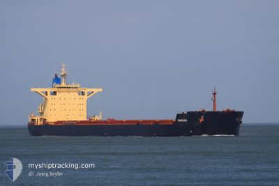
RAIATEA
Bulk Carrier
Current Trip
| Time Travelled | 1 day |
|---|---|
| Remaining Time | 1 day |
| Distance Travelled | 531.10 nm |
| Remaining Distance | 625.15 nm |
| AVG Speed | 11.7 Knots |
| MAX Speed | 14.5 Knots |
| AVG Wind | 18 knots |
| MAX Wind | 29.3 knots |
| MIN Temp | -0.1°C / 31.82°F |
| MAX Temp | 6.3°C / 43.34°F |
| Dybgang | 11.8 m |
| Position Modtaget | 2 m siden |
Current Position
| Longitude | --- |
|---|---|
| Latitude | --- |
| Status | Under way using engine |
| Fart | 13.3 Knots |
| Kurs | 2° |
| Område | North Sea |
| Station | T-AIS |
| Position Modtaget | 2 m siden |
Info
Information
The current position of RAIATEA is in North Sea with coordinates 60.37466° / 4.19060° as reported on 2026-01-08 15:26 by AIS to our vessel tracker app. The vessel's current speed is 13.3 Knots and is heading at the port of NARVIK. The estimated time of arrival as calculated by MyShipTracking vessel tracking app is 2026-01-10 15:54 LT
The vessel RAIATEA (IMO: 9580376, MMSI: 636022207) is a Bulk Carrier that was built in 2011 ( 15 år gamle ). It's sailing under the flag of [LR] Liberia.
In this page you can find informations about the vessels current position, last detected port calls, and current voyage information. If the vessels is not in coverage by AIS you will find the latest position.
The current position of RAIATEA is detected by our AIS receivers and we are not responsible for the reliability of the data. The last position was recorded while the vessel was in Coverage by the Ais receivers of our vessel tracking app.
The current draught of RAIATEA as reported by AIS is 11.8 meters
Weather
| Temperature | --- |
|---|---|
| Wind Speed | 13 knots |
| Direction | 122° ESE |
| Pressure | 1006.2 hPa |
| Humidity | 57.9 % |
| Cloud Coverage | 100 % |
Featured Company
Last Port Calls
Last Trips
| Origin | Departure | Destination | Arrival | Distance | |
|---|---|---|---|---|---|
| 2025-12-17 16:15 | 2026-01-01 13:22 | 2950.77 nm | |||
| 2025-11-25 19:59 | 2025-12-15 02:03 | 3848.12 nm | |||
| 2025-11-20 22:29 | 2025-11-23 13:16 | 294.44 nm | |||
| 2025-10-21 07:46 | 2025-11-16 19:53 | 4949.19 nm | |||
| 2025-10-21 07:46 | 2025-11-05 09:40 | 3432.50 nm |
Events
| Tid | Hændelsen | Detaljer | Position / Dest | Info |
|---|---|---|---|---|
| 2026-01-08 12:09 | ETA er ændret | 2026/01/10 14:00 2026/01/10 12:30 |
59.65887 / 4.19943
NO NVK
|
Fart: 13.3 kn Kurs: 359.4° |
| 2026-01-08 03:04 | Status er ændret | Under way using engine Default |
57.65430 / 4.02139
NO NVK
|
Fart: 12.8 kn Kurs: 5° |
| 2026-01-08 02:55 | Status er ændret | Default Under way using engine |
57.62228 / 4.01560
NO NVK
|
Fart: 12.6 kn Kurs: 4.9° |
| 2026-01-08 02:50 | Status er ændret | Under way using engine Default |
57.60438 / 4.01257
NO NVK
|
Fart: 12.5 kn Kurs: 5° |
| 2026-01-08 02:07 | Status er ændret | Default Under way using engine |
57.45969 / 3.99042
NO NVK
|
Fart: 12.4 kn Kurs: 1.9° |
| 2026-01-08 01:53 | Status er ændret | Under way using engine Default |
57.41119 / 3.98510
NO NVK
|
Fart: 12.1 kn Kurs: 4° |
| 2026-01-08 01:34 | Status er ændret | Default Under way using engine |
57.34529 / 3.97734
NO NVK
|
Fart: 12.5 kn Kurs: 3.8° |
| 2026-01-08 01:28 | Status er ændret | Under way using engine Default |
57.32552 / 3.97566
NO NVK
|
Fart: 12.3 kn Kurs: 2° |
| 2026-01-08 01:28 | Indenfor Dækning |
57.32552 / 3.97566
North Sea
NO NVK
|
Fart: 12.5 kn Kurs: 3.8° |
|
| 2026-01-07 22:56 | Udenfor Dækning |
56.83527 / 3.89999
North Sea
NO NVK
|
Fart: 11.5 kn Kurs: 3.2° |