
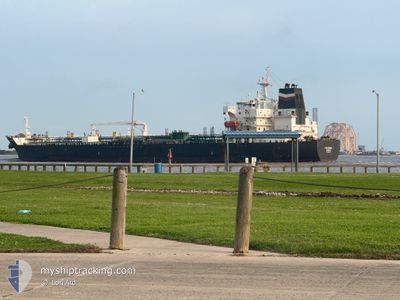
PS ROMA
Oil/Chemical Tanker
Current Trip
| Time Travelled | 16 days |
|---|---|
| Remaining Time | --- |
| Distance Travelled | 2276.76 nm |
| Remaining Distance | --- |
| AVG Speed | 10.8 Knots |
| MAX Speed | 14.1 Knots |
| AVG Wind | 11.5 knots |
| MAX Wind | 20.8 knots |
| MIN Temp | 13.6°C / 56.48°F |
| MAX Temp | 32.6°C / 90.68°F |
| Dybgang | 10.8 m |
| Position Modtaget | 5 d siden |
Current Position
| Longitude | --- |
|---|---|
| Latitude | --- |
| Status | Under way using engine |
| Fart | 13 Knots |
| Kurs | 184.8° |
| Område | North Pacific Ocean |
| Station | T-AIS |
| Position Modtaget | 5 d siden |
Info
Information
The current position of PS ROMA is in North Pacific Ocean with coordinates 6.93497° / -79.53460° as reported on 2025-02-13 16:36 by AIS to our vessel tracker app. The vessel's current speed is 13 Knots
The vessel PS ROMA (IMO: 9510462, MMSI: 247437400) is a Oil/Chemical Tanker that was built in 2011 ( 14 år gamle ). It's sailing under the flag of [IT] Italy.
In this page you can find informations about the vessels current position, last detected port calls, and current voyage information. If the vessels is not in coverage by AIS you will find the latest position.
The current position of PS ROMA is detected by our AIS receivers and we are not responsible for the reliability of the data. The last position was recorded while the vessel was in Coverage by the Ais receivers of our vessel tracking app.
The current draught of PS ROMA as reported by AIS is 10.8 meters
Weather
| Temperature | 25.6°C / 78.08°F |
|---|---|
| Wind Speed | 3 knots |
| Direction | 157° SSE |
| Pressure | 1008.7 hPa |
| Humidity | 78.4 % |
| Cloud Coverage | 72 % |
Featured Company
Last Port Calls
| Port | Arrival | Departure | Time In Port |
|---|---|---|---|
| 2025-01-28 23:11 | 2025-02-02 10:49 | 4 d | |
| 2025-01-05 10:03 | 2025-01-05 13:58 | 3 h | |
| 2025-01-02 23:41 | 2025-01-05 09:55 | 2 d | |
| 2025-01-01 23:40 | 2025-01-02 23:07 | 23 h | |
| 2024-12-22 12:28 | |||
| 2024-12-19 06:25 | 2024-12-20 07:56 | 1 d | |
| 2024-12-03 11:30 |
Last Trips
| Origin | Departure | Destination | Arrival | Distance | |
|---|---|---|---|---|---|
| 2025-01-05 07:58 | 2025-01-28 17:11 | 3092.09 nm | |||
| 2025-01-05 03:55 | 2025-01-05 04:03 | 1.42 nm | |||
| 2025-01-02 17:07 | 2025-01-02 17:41 | 2.84 nm | |||
| 2024-12-22 06:28 | 2025-01-01 17:40 | 2460.44 nm | |||
| 2024-12-03 05:30 | 2024-12-19 00:25 | 2731.08 nm |
Events
| Tid | Hændelsen | Detaljer | Position / Dest | Info |
|---|---|---|---|---|
| 2025-02-15 17:14 | STOP Sejllads | 3.24 nm, North of LA LUCIA |
-2.16374 / -80.91116
PABLB
|
Fart: 0.1 kn Kurs: 74° |
| 2025-02-15 16:37 | START Sejllads | 3.86 nm, North of LA LUCIA |
-2.15491 / -80.93684
PABLB
|
Fart: 3.4 kn Kurs: 82° |
| 2025-02-15 16:27 | STOP Sejllads | 3.92 nm, North of LA LUCIA |
-2.15614 / -80.94370
PABLB
|
Fart: 0.2 kn Kurs: 78° |
| 2025-02-13 16:41 | Status er ændret | Default Under way using engine |
6.91450 / -79.53638
PABLB
|
Fart: 13 kn Kurs: 184.8° |
| 2025-02-13 16:36 | Status er ændret | Under way using engine Default |
6.93497 / -79.53460
PABLB
|
Fart: 12.9 kn Kurs: 185° |
| 2025-02-13 16:36 | Udenfor Dækning |
6.93497 / -79.53460
North Pacific Ocean
|
Fart: 13 kn Kurs: 184.8° |
|
| 2025-02-13 15:47 | Status er ændret | Default Under way using engine |
7.10867 / -79.51698
PABLB
|
Fart: 12.3 kn Kurs: 185.1° |
| 2025-02-13 15:41 | Status er ændret | Under way using engine Default |
7.12703 / -79.51492
PABLB
|
Fart: 12.3 kn Kurs: 186° |
| 2025-02-13 15:19 | Status er ændret | Default Under way using engine |
7.20430 / -79.50658
PABLB
|
Fart: 12.2 kn Kurs: 186.3° |
| 2025-02-13 14:55 | Status er ændret | Under way using engine Default |
7.28238 / -79.49791
PABLB
|
Fart: 12.1 kn Kurs: 186° |