

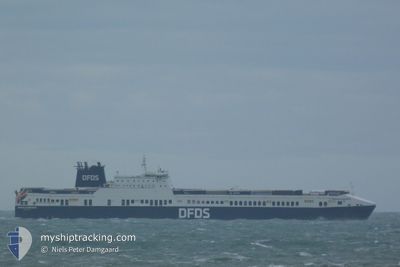
PRIMULA SEAWAYS
Ro-Ro Cargo

Current Trip
| Time Travelled | 20 h, 19 mins |
|---|---|
| Remaining Time | --- |
| Distance Travelled | 388.57 nm |
| Remaining Distance | --- |
| AVG Speed | 19.4 Knots |
| MAX Speed | 20 Knots |
| AVG Wind | 16.2 knots |
| MAX Wind | 20.3 knots |
| MIN Temp | -2.2°C / 28.04°F |
| MAX Temp | 3.3°C / 37.94°F |
| Dybgang | 7 m |
| Position Modtaget | 13 m siden |
Current Position
| Longitude | --- |
|---|---|
| Latitude | --- |
| Status | Under way using engine |
| Fart | 19.8 Knots |
| Kurs | 200.2° |
| Område | North Sea |
| Station | T-AIS |
| Position Modtaget | 13 m siden |
Information
The current position of PRIMULA SEAWAYS is in North Sea with coordinates 53.47448° / 4.56608° as reported on 2025-02-14 00:46 by AIS to our vessel tracker app. The vessel's current speed is 19.8 Knots
The vessel PRIMULA SEAWAYS (IMO: 9259513, MMSI: 220253000) is a Ro-Ro Cargo that was built in 2004 ( 21 år gamle ). It's sailing under the flag of [DK] Denmark.
In this page you can find informations about the vessels current position, last detected port calls, and current voyage information. If the vessels is not in coverage by AIS you will find the latest position.
The current position of PRIMULA SEAWAYS is detected by our AIS receivers and we are not responsible for the reliability of the data. The last position was recorded while the vessel was in Coverage by the Ais receivers of our vessel tracking app.
The current draught of PRIMULA SEAWAYS as reported by AIS is 7 meters
Weather
| Temperature | 3.3°C / 37.94°F |
|---|---|
| Wind Speed | 9 knots |
| Direction | 54° NE |
| Pressure | 1026.1 hPa |
| Humidity | 69.9 % |
| Cloud Coverage | 100 % |


Featured Company
Last Port Calls
| Port | Arrival | Departure | Time In Port |
|---|---|---|---|
| 2025-02-12 20:12 | 2025-02-13 04:40 | 8 h | |
| 2025-02-11 14:52 | 2025-02-11 15:35 | 43 m | |
| 2025-02-11 03:19 | 2025-02-11 13:17 | 9 h | |
| 2025-02-09 14:18 | 2025-02-09 22:48 | 8 h | |
| 2025-02-09 04:41 | 2025-02-09 08:39 | 3 h | |
| 2025-02-07 12:26 | 2025-02-07 21:57 | 9 h | |
| 2025-02-05 20:16 | 2025-02-06 04:35 | 8 h | |
| 2025-02-04 15:25 | 2025-02-04 16:33 | 1 h | |
| 2025-02-04 04:23 | 2025-02-04 13:50 | 9 h | |
| 2025-02-02 14:43 | 2025-02-02 23:23 | 8 h |
Last Trips
| Origin | Departure | Destination | Arrival | Distance | |
|---|---|---|---|---|---|
| 2025-02-11 16:35 | 2025-02-12 21:12 | 532.95 nm | |||
| 2025-02-11 14:17 | 2025-02-11 15:52 | 8.95 nm | |||
| 2025-02-09 23:48 | 2025-02-11 04:19 | 554.23 nm | |||
| 2025-02-09 09:39 | 2025-02-09 15:18 | 114.93 nm | |||
| 2025-02-07 22:57 | 2025-02-09 05:41 | 544.66 nm | |||
| 2025-02-06 05:35 | 2025-02-07 13:26 | 551.41 nm | |||
| 2025-02-04 17:33 | 2025-02-05 21:16 | 533.15 nm | |||
| 2025-02-04 14:50 | 2025-02-04 16:25 | 8.61 nm | |||
| 2025-02-03 00:23 | 2025-02-04 05:23 | 553.26 nm | |||
| 2025-02-02 09:38 | 2025-02-02 15:43 | 115.39 nm |
Events
| Tid | Hændelsen | Detaljer | Position / Dest | Info |
|---|---|---|---|---|
| 2025-02-14 00:52 | Status er ændret | Default Under way using engine |
53.44353 / 4.54773
BE GNE
|
Fart: 19.8 kn Kurs: 200.2° |
| 2025-02-14 00:46 | Fundet i havområde | Dutch part of the North Sea |
53.47448 / 4.56608
North Sea
BE GNE
|
Fart: 19.8 kn Kurs: 200.2° |
| 2025-02-14 00:46 | Status er ændret | Under way using engine Default |
53.47448 / 4.56608
BE GNE
|
Fart: 19.4 kn Kurs: 207° |
| 2025-02-14 00:46 | Indenfor Dækning |
53.47448 / 4.56608
North Sea
BE GNE
|
Fart: 19.8 kn Kurs: 200.2° |
|
| 2025-02-13 17:00 | Status er ændret | Default Under way using engine |
55.64893 / 6.60560
BE GNE
|
Fart: 19.6 kn Kurs: 211.3° |
| 2025-02-13 16:56 | Udenfor Dækning |
55.66799 / 6.62611
North Sea
BE GNE
|
Fart: 19.6 kn Kurs: 211.3° |
|
| 2025-02-13 16:53 | Status er ændret | Under way using engine Default |
55.68241 / 6.64161
BE GNE
|
Fart: 19.5 kn Kurs: 210° |
| 2025-02-13 16:30 | Status er ændret | Default Under way using engine |
55.78926 / 6.75585
BE GNE
|
Fart: 19.6 kn Kurs: 211.6° |
| 2025-02-13 11:13 | Ændre havområde | Danish part of the North Sea Danish part of the Skaggerak |
57.22765 / 8.39138
North Sea
BE GNE
|
Fart: 19.4 kn Kurs: 232.2° |
| 2025-02-13 06:22 | Ændre havområde | Danish part of the Skaggerak Danish part of the Kattegat |
57.80168 / 10.95039
Skaggerak
BE GNE
|
Fart: 19.5 kn Kurs: 285.9° |