

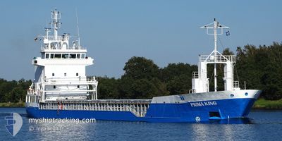
PRIMA KING
General Cargo

Current Trip
| Time Travelled | 1 day |
|---|---|
| Remaining Time | 1 day |
| Distance Travelled | 238.50 nm |
| Remaining Distance | 486.28 nm |
| AVG Speed | 9.9 Knots |
| MAX Speed | 11.4 Knots |
| AVG Wind | 9.5 knots |
| MAX Wind | 19 knots |
| MIN Temp | -9.6°C / 14.72°F |
| MAX Temp | -0.2°C / 31.64°F |
| Dybgang | 6.2 m |
| Position Modtaget | 8 m siden |
Current Position
| Longitude | --- |
|---|---|
| Latitude | --- |
| Status | Under way using engine |
| Fart | 11.3 Knots |
| Kurs | 243.3° |
| Område | Gulf of Finland |
| Station | T-AIS |
| Position Modtaget | 8 m siden |
Information
The current position of PRIMA KING is in Gulf of Finland with coordinates 59.37268° / 23.33235° as reported on 2025-02-20 08:41 by AIS to our vessel tracker app. The vessel's current speed is 11.3 Knots and is heading at the port of SZCZECIN. The estimated time of arrival as calculated by MyShipTracking vessel tracking app is 2025-02-22 07:13 LT
The vessel PRIMA KING (IMO: 9195822, MMSI: 230695000) is a General Cargo that was built in 2000 ( 25 år gamle ). It's sailing under the flag of [FI] Finland.
In this page you can find informations about the vessels current position, last detected port calls, and current voyage information. If the vessels is not in coverage by AIS you will find the latest position.
The current position of PRIMA KING is detected by our AIS receivers and we are not responsible for the reliability of the data. The last position was recorded while the vessel was in Coverage by the Ais receivers of our vessel tracking app.
The current draught of PRIMA KING as reported by AIS is 6.2 meters
Weather
| Temperature | -0.4°C / 31.28°F |
|---|---|
| Wind Speed | 9 knots |
| Direction | 208° SSW |
| Pressure | 1030.8 hPa |
| Humidity | 79.3 % |
| Cloud Coverage | 58 % |


Featured Company
Last Port Calls
| Port | Arrival | Departure | Time In Port |
|---|---|---|---|
| 2025-02-16 08:53 | 2025-02-18 20:17 | 2 d | |
| 2025-02-14 00:20 | 2025-02-14 20:28 | 20 h | |
| 2025-02-07 18:20 | 2025-02-12 12:06 | 4 d | |
| 2025-01-25 16:05 | 2025-01-29 08:57 | 3 d | |
| 2025-01-21 18:02 | 2025-01-22 23:26 | 1 d | |
| 2025-01-14 16:21 | 2025-01-16 02:45 | 1 d | |
| 2025-01-10 22:13 | 2025-01-13 23:22 | 3 d | |
| 2025-01-08 13:16 | 2025-01-08 13:21 | 4 m | |
| 2025-01-02 03:44 | 2025-01-08 01:19 | 5 d | |
| 2025-01-01 15:34 | 2025-01-01 16:27 | 52 m |
Last Trips
| Origin | Departure | Destination | Arrival | Distance | |
|---|---|---|---|---|---|
| 2025-02-14 20:28 | 2025-02-16 08:53 | 304.87 nm | |||
| 2025-02-12 12:06 | 2025-02-14 00:20 | 386.71 nm | |||
| 2025-01-29 08:57 | 2025-02-07 18:20 | 1301.78 nm | |||
| 2025-01-22 23:26 | 2025-01-25 16:05 | 622.28 nm | |||
| 2025-01-16 02:45 | 2025-01-21 18:02 | 827.82 nm | |||
| 2025-01-13 23:22 | 2025-01-14 16:21 | 117.72 nm | |||
| 2025-01-08 13:21 | 2025-01-10 22:13 | 588.73 nm | |||
| 2025-01-08 01:19 | 2025-01-08 13:16 | 85.82 nm | |||
| 2025-01-01 16:27 | 2025-01-02 03:44 | 88.36 nm | |||
| 2024-12-19 19:25 | 2025-01-01 15:34 | 953.43 nm |
Events
| Tid | Hændelsen | Detaljer | Position / Dest | Info |
|---|---|---|---|---|
| 2025-02-20 03:17 | Status er ændret | Under way using engine Default |
59.84161 / 25.02491
PLSZZ
|
Fart: 11.3 kn Kurs: 244° |
| 2025-02-20 03:13 | Status er ændret | Default Under way using engine |
59.84582 / 25.04282
PLSZZ
|
Fart: 11.3 kn Kurs: 247.8° |
| 2025-02-20 02:38 | Ændre havområde | Estonian part of the Gulf of Finland Finnish part of the Gulf of Finland |
59.88266 / 25.25293
Gulf of Finland
PLSZZ
|
Fart: 11.4 kn Kurs: 254.8° |
| 2025-02-20 00:11 | Status er ændret | Under way using engine Default |
60.04468 / 26.10992
PLSZZ
|
Fart: 11.4 kn Kurs: 242° |
| 2025-02-20 00:01 | Status er ændret | Default Under way using engine |
60.05867 / 26.16643
PLSZZ
|
Fart: 11.3 kn Kurs: 242° |
| 2025-02-19 22:23 | Dybgangen er ændret | 6.2 3.8 |
60.20709 / 26.70434
PLSZZ
|
Fart: 11 kn Kurs: 231.8° |
| 2025-02-19 22:23 | Destination er ændret | PLSZZ FIMSS |
60.20709 / 26.70434
PLSZZ
|
Fart: 11 kn Kurs: 231.8° |
| 2025-02-19 22:23 | ETA er ændret | 2025/02/22 08:00 2025/02/19 08:00 |
60.20709 / 26.70434
PLSZZ
|
Fart: 11 kn Kurs: 231.8° |
| 2025-02-19 20:52 | START Sejllads | 3.84 nm, South of KOTKA |
60.41836 / 26.91659
FIMSS
|
Fart: 5.2 kn Kurs: 176.5° |
| 2025-02-19 20:28 | Status er ændret | Under way using engine Moored |
60.42175 / 26.91501
FIMSS
|
Fart: Kurs: 131° |