
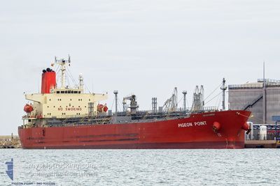
PIGEON POINT
Chemical Tanker
Current Trip
| Time Travelled | 13 days |
|---|---|
| Remaining Time | --- |
| Distance Travelled | 3559.52 nm |
| Remaining Distance | --- |
| AVG Speed | 11.9 Knots |
| MAX Speed | 16 Knots |
| AVG Wind | 12.2 knots |
| MAX Wind | 26 knots |
| MIN Temp | 19.9°C / 67.82°F |
| MAX Temp | 29.6°C / 85.28°F |
| Dybgang | 11.7 m |
| Position Modtaget | 1 h, 46 m siden |
Current Position
| Longitude | -48.02647° |
|---|---|
| Latitude | -25.68468° |
| Status | At anchor |
| Fart | 0.1 Knots |
| Kurs | 161° |
| Område | South Atlantic Ocean |
| Station | T-AIS |
| Position Modtaget | 1 h, 46 m siden |
Info
Information
The current position of PIGEON POINT is in South Atlantic Ocean with coordinates -25.68468° / -48.02647° as reported on 2024-09-12 21:33 by AIS to our vessel tracker app. The vessel's current speed is 0.1 Knots
The vessel PIGEON POINT (IMO: 9322396, MMSI: 235077605) is a Chemical Tanker that was built in 2005 ( 19 år gamle ). It's sailing under the flag of [GB] United Kingdom.
In this page you can find informations about the vessels current position, last detected port calls, and current voyage information. If the vessels is not in coverage by AIS you will find the latest position.
The current position of PIGEON POINT is detected by our AIS receivers and we are not responsible for the reliability of the data. The last position was recorded while the vessel was in Coverage by the Ais receivers of our vessel tracking app.
The current draught of PIGEON POINT as reported by AIS is 11.7 meters
Weather
| Temperature | 19.7°C / 67.46°F |
|---|---|
| Wind Speed | 14 knots |
| Direction | 184° S |
| Pressure | 1013.6 hPa |
| Humidity | 94.5 % |
| Cloud Coverage | 28 % |
Featured Company
Last Port Calls
| Port | Arrival | Departure | Time In Port |
|---|---|---|---|
| 2024-08-28 23:22 | 2024-08-30 07:19 | 1 d | |
| 2024-08-15 06:51 | 2024-08-17 21:35 | 2 d | |
| 2024-08-08 20:37 | 2024-08-11 04:09 | 2 d | |
| 2024-07-26 11:29 | 2024-07-28 01:36 | 1 d | |
| 2024-07-13 20:59 | 2024-07-15 16:26 | 1 d | |
| 2024-07-01 22:55 | 2024-07-06 04:57 | 4 d |
Last Trips
| Origin | Departure | Destination | Arrival | Distance | |
|---|---|---|---|---|---|
| 2024-08-17 18:35 | 2024-08-28 19:22 | 2543.41 nm | |||
| 2024-08-11 01:09 | 2024-08-15 03:51 | 1112.62 nm | |||
| 2024-07-27 21:36 | 2024-08-08 17:37 | 3604.42 nm | |||
| 2024-07-15 13:26 | 2024-07-26 07:29 | 2548.70 nm | |||
| 2024-07-06 01:57 | 2024-07-13 17:59 | 1124.55 nm | |||
| 2024-06-09 16:57 | 2024-07-01 19:55 | 5752.39 nm |
Events
| Tid | Hændelsen | Detaljer | Position / Dest | Info |
|---|---|---|---|---|
| 2024-09-12 21:36 | Status er ændret | Default At anchor |
-25.68467 / -48.02643
BR PNG
|
Fart: 0.1 kn Kurs: 161° |
| 2024-09-12 21:33 | Udenfor Dækning |
-25.68468 / -48.02647
South Atlantic Ocean
|
Fart: 0.1 kn Kurs: 266° |
|
| 2024-09-12 21:15 | Status er ændret | At anchor Default |
-25.68475 / -48.02637
BR PNG
|
Fart: 0.1 kn Kurs: 159° |
| 2024-09-12 20:59 | Status er ændret | Default At anchor |
-25.68475 / -48.02635
BR PNG
|
Fart: Kurs: 161° |
| 2024-09-12 20:48 | Status er ændret | At anchor Default |
-25.68475 / -48.02637
BR PNG
|
Fart: 0.1 kn Kurs: 161° |
| 2024-09-12 20:03 | Status er ændret | Default At anchor |
-25.68478 / -48.02620
BR PNG
|
Fart: Kurs: 166° |
| 2024-09-12 19:54 | Status er ændret | At anchor Default |
-25.68480 / -48.02623
BR PNG
|
Fart: Kurs: 169° |
| 2024-09-12 19:36 | Status er ændret | Default At anchor |
-25.68482 / -48.02610
BR PNG
|
Fart: Kurs: 171° |
| 2024-09-12 19:30 | Status er ændret | At anchor Default |
-25.68487 / -48.02612
BR PNG
|
Fart: Kurs: 172° |
| 2024-09-12 18:30 | Udenfor Dækning |
-25.68488 / -48.02643
South Atlantic Ocean
|
Fart: Kurs: 78° |