
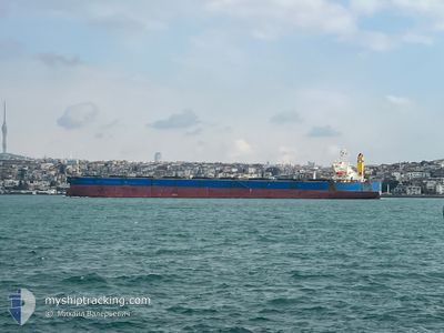
PHOENIX 8
Bulk Carrier
Current Trip
| Trip Time | 2 days |
|---|---|
| Trip Distance | 341.08 nm |
| AVG Speed | 10.1 Knots |
| MAX Speed | 12.5 Knots |
| Dybgang | 9.8 m |
| AVG Wind | 8.4 knots |
| MAX Wind | 14 knots |
| MIN Temp | 24.6°C / 76.28°F |
| MAX Temp | 27.9°C / 82.22°F |
| Position Modtaget | 24 d siden |
Current Position
| Longitude | --- |
|---|---|
| Latitude | --- |
| Status | Under way using engine |
| Fart | 12.9 Knots |
| Kurs | 339° |
| Område | South Atlantic Ocean |
| Station | T-AIS |
| Position Modtaget | 24 d siden |
Info
Information
The current position of PHOENIX 8 is in South Atlantic Ocean with coordinates -34.06943° / 17.94575° as reported on 2025-11-16 10:14 by AIS to our vessel tracker app. The vessel's current speed is 12.9 Knots and is currently inside the port of TAKORADI.
The vessel PHOENIX 8 (IMO: 9303845, MMSI: 477372200) is a Bulk Carrier that was built in 2004 ( 21 år gamle ). It's sailing under the flag of [HK] Hong Kong.
In this page you can find informations about the vessels current position, last detected port calls, and current voyage information. If the vessels is not in coverage by AIS you will find the latest position.
The current position of PHOENIX 8 is detected by our AIS receivers and we are not responsible for the reliability of the data. The last position was recorded while the vessel was in Coverage by the Ais receivers of our vessel tracking app.
The current draught of PHOENIX 8 as reported by AIS is 9.8 meters
Weather
| Temperature | 30.1°C / 86.18°F |
|---|---|
| Wind Speed | 8 knots |
| Direction | 169° S |
| Pressure | 1009.9 hPa |
| Humidity | 62.1 % |
| Cloud Coverage | 95 % |
Featured Company
Last Port Calls
| Port | Arrival | Departure | Time In Port |
|---|---|---|---|
| 2025-12-08 08:49 | |||
| 2025-11-26 07:17 | 2025-12-05 21:01 | 9 d | |
| 2025-10-14 10:36 | 2025-10-20 13:40 | 6 d | |
| 2025-10-06 14:37 | 2025-10-10 10:08 | 3 d |
Most Visited Ports (Last year)
| Port | Arrivals | |
|---|---|---|
| 5 | ||
| 2 | ||
| 1 | ||
| 1 | ||
| 1 | ||
| 1 |
Last Trips
| Origin | Departure | Destination | Arrival | Distance | |
|---|---|---|---|---|---|
| 2025-12-05 21:01 | 2025-12-08 08:49 | 341.08 nm | |||
| 2025-10-20 13:40 | 2025-11-26 07:17 | 10759.35 nm | |||
| 2025-10-10 10:08 | 2025-10-14 10:36 | 617.56 nm | |||
| 2025-08-25 08:07 | 2025-10-06 14:37 | 7623.21 nm |
Events
| Tid | Hændelsen | Detaljer | Position / Dest | Info |
|---|---|---|---|---|
| 2025-12-08 08:55 | STOP Sejllads |
4.89500 / -1.73500
[GH] TAKORADI
|
Fart: Kurs: -1° |
|
| 2025-12-08 08:49 | Skibe i havn |
|
4.89667 / -1.73333
[GH] TAKORADI
|
Fart: 4 kn Kurs: -1° |
| 2025-12-08 08:20 | START Sejllads | 1.86 nm, North East of TAKORADI |
4.90110 / -1.70632
NG LOS
|
Fart: 3.2 kn Kurs: 268° |
| 2025-12-08 06:36 | STOP Sejllads | 2 nm, East of TAKORADI |
4.89167 / -1.70167
NG LOS
|
Fart: Kurs: -1° |
| 2025-12-08 06:12 | START Sejllads | 2.76 nm, South East of TAKORADI |
4.86333 / -1.69667
NG LOS
|
Fart: 6 kn Kurs: 21° |
| 2025-12-07 02:59 | STOP Sejllads | 2.45 nm, South East of TAKORADI |
4.86060 / -1.70537
NG LOS
|
Fart: 0.1 kn Kurs: 307° |
| 2025-12-05 20:01 | Afsejlet fra sidste havn |
|
6.38433 / 3.40398
NG LOS
|
Fart: 7.9 kn Kurs: 163° |
| 2025-12-05 18:37 | START Sejllads |
6.42862 / 3.34450
[NG] LAGOS
|
Fart: 4.5 kn Kurs: 266° |