
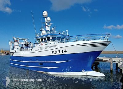
PD344 MIKKEL LOUISE
Fishing
Current Trip
FISHING
| Time Travelled | 1 day |
|---|---|
| Remaining Time | --- |
| Distance Travelled | 109.69 nm |
| Remaining Distance | --- |
| AVG Speed | 8.7 Knots |
| MAX Speed | 10.8 Knots |
| AVG Wind | 14.8 knots |
| MAX Wind | 20 knots |
| MIN Temp | 5.5°C / 41.9°F |
| MAX Temp | 8°C / 46.4°F |
| Dybgang | 4.5 m |
| Position Modtaget | 10 h, 38 m siden |
Current Position
| Longitude | --- |
|---|---|
| Latitude | --- |
| Status | Moored |
| Fart | 11.4 Knots |
| Kurs | 228.1° |
| Område | English Channel |
| Station | T-AIS |
| Position Modtaget | 10 h, 38 m siden |
Info
Information
The current position of PD344 MIKKEL LOUISE is in English Channel with coordinates 51.02598° / 1.50405° as reported on 2025-03-17 19:16 by AIS to our vessel tracker app. The vessel's current speed is 11.4 Knots
The vessel PD344 MIKKEL LOUISE (IMO: 9841574, MMSI: 232037112) is a Fishing It's sailing under the flag of [GB] United Kingdom.
In this page you can find informations about the vessels current position, last detected port calls, and current voyage information. If the vessels is not in coverage by AIS you will find the latest position.
The current position of PD344 MIKKEL LOUISE is detected by our AIS receivers and we are not responsible for the reliability of the data. The last position was recorded while the vessel was in Coverage by the Ais receivers of our vessel tracking app.
The current draught of PD344 MIKKEL LOUISE as reported by AIS is 4.5 meters
Weather
| Temperature | 8°C / 46.4°F |
|---|---|
| Wind Speed | 14 knots |
| Direction | 80° E |
| Pressure | 1026.9 hPa |
| Humidity | 69.5 % |
| Cloud Coverage | 1 % |
Featured Company
Last Port Calls
| Port | Arrival | Departure | Time In Port |
|---|---|---|---|
| 2025-03-14 01:54 | 2025-03-17 02:36 | 3 d | |
| 2025-03-07 02:33 | 2025-03-10 03:21 | 3 d | |
| 2025-02-28 01:45 | 2025-03-03 02:38 | 3 d | |
| 2025-02-25 01:15 | 2025-02-25 03:37 | 2 h | |
| 2025-02-21 21:30 | 2025-02-24 02:43 | 2 d | |
| 2025-02-15 03:07 | 2025-02-17 02:49 | 1 d | |
| 2025-02-11 22:42 | 2025-02-13 01:25 | 1 d | |
| 2025-02-08 04:44 | 2025-02-10 02:49 | 1 d | |
| 2025-01-31 02:17 | 2025-02-03 02:41 | 3 d | |
| 2025-01-23 22:57 | 2025-01-27 02:37 | 3 d |
Most Visited Ports (Last year)
| Port | Arrivals | |
|---|---|---|
| 25 | ||
| 12 | ||
| 9 | ||
| 4 | ||
| 1 | ||
| 1 |
Last Trips
| Origin | Departure | Destination | Arrival | Distance | |
|---|---|---|---|---|---|
| 2025-03-10 03:21 | 2025-03-14 01:54 | 364.78 nm | |||
| 2025-03-03 02:38 | 2025-03-07 02:33 | 395.27 nm | |||
| 2025-02-25 03:37 | 2025-02-28 01:45 | 198.07 nm | |||
| 2025-02-24 02:43 | 2025-02-25 01:15 | 69.08 nm | |||
| 2025-02-17 02:49 | 2025-02-21 21:30 | 238.98 nm | |||
| 2025-02-13 01:25 | 2025-02-15 03:07 | 179.26 nm | |||
| 2025-02-10 02:49 | 2025-02-11 22:42 | 233.43 nm | |||
| 2025-02-03 02:41 | 2025-02-08 04:44 | 450.98 nm | |||
| 2025-01-27 02:37 | 2025-01-31 02:17 | 393.62 nm | |||
| 2025-01-20 03:06 | 2025-01-23 22:57 | 419.47 nm |
Events
| Tid | Hændelsen | Detaljer | Position / Dest | Info |
|---|---|---|---|---|
| 2025-03-17 19:16 | Udenfor Dækning |
51.02598 / 1.50405
English Channel
|
Fart: 11.4 kn Kurs: 228.1° |
|
| 2025-03-17 19:10 | Ændre havområde | United Kingdom part of the English Channel United Kingdom part of the North Sea |
51.03914 / 1.52560
English Channel
|
Fart: 10.5 kn Kurs: 226.5° |
| 2025-03-17 17:01 | Indenfor Dækning |
51.31869 / 1.83590
North Sea
|
Fart: 8.5 kn Kurs: 217.8° |
|
| 2025-03-17 15:05 | Udenfor Dækning |
51.34291 / 1.91374
North Sea
|
Fart: 5.3 kn Kurs: 40.3° |
|
| 2025-03-17 14:43 | Indenfor Dækning |
51.31192 / 1.88792
North Sea
|
Fart: 5.1 kn Kurs: 340.4° |
|
| 2025-03-17 12:10 | Udenfor Dækning |
51.18632 / 1.78273
North Sea
|
Fart: 10.8 kn Kurs: 68.1° |
|
| 2025-03-17 12:08 | Indenfor Dækning |
51.18632 / 1.78273
North Sea
|
Fart: 10.8 kn Kurs: 68.1° |
|
| 2025-03-17 10:47 | Udenfor Dækning |
51.22922 / 1.87803
North Sea
|
Fart: 5.3 kn Kurs: 209.6° |
|
| 2025-03-17 10:13 | Fundet i havområde | United Kingdom part of the North Sea |
51.27657 / 1.89830
North Sea
|
Fart: 5.4 kn Kurs: 206.7° |
| 2025-03-17 10:13 | Indenfor Dækning |
51.27657 / 1.89830
North Sea
|
Fart: 5.4 kn Kurs: 206.7° |