
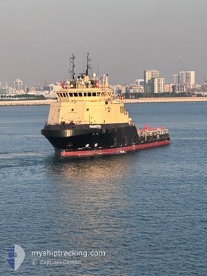
PANNOTIA
Other Type
Current Trip
KHAFJI FIELD
| Time Travelled | 1 day |
|---|---|
| Remaining Time | --- |
| Distance Travelled | 33.23 nm |
| Remaining Distance | --- |
| AVG Speed | 5.3 Knots |
| MAX Speed | 7.7 Knots |
| AVG Wind | 5.1 knots |
| MAX Wind | 11.3 knots |
| MIN Temp | 16°C / 60.8°F |
| MAX Temp | 20.2°C / 68.36°F |
| Dybgang | 4.2 m |
| Position Modtaget | 3 m siden |
Current Position
| Longitude | --- |
|---|---|
| Latitude | --- |
| Status | At anchor |
| Fart | 0.2 Knots |
| Kurs | 32° |
| Område | Persian Gulf |
| Station | T-AIS |
| Position Modtaget | 3 m siden |
Info
Information
The current position of PANNOTIA is in Persian Gulf with coordinates 28.49463° / 48.90529° as reported on 2026-01-03 01:56 by AIS to our vessel tracker app. The vessel's current speed is 0.2 Knots
The vessel PANNOTIA (IMO: 9553452, MMSI: 377145000) is a Other Type It's sailing under the flag of [VC] St Vincent Grenadines.
In this page you can find informations about the vessels current position, last detected port calls, and current voyage information. If the vessels is not in coverage by AIS you will find the latest position.
The current position of PANNOTIA is detected by our AIS receivers and we are not responsible for the reliability of the data. The last position was recorded while the vessel was in Coverage by the Ais receivers of our vessel tracking app.
The current draught of PANNOTIA as reported by AIS is 4.2 meters
Weather
| Temperature | 19.9°C / 67.82°F |
|---|---|
| Wind Speed | 5 knots |
| Direction | 19° NNE |
| Pressure | 1019.3 hPa |
| Humidity | 71.2 % |
| Cloud Coverage | 4 % |
Featured Company
Last Port Calls
| Port | Arrival | Departure | Time In Port |
|---|---|---|---|
| 2026-01-01 06:56 | |||
| 2025-12-08 15:33 | 2025-12-09 16:29 | 1 d | |
| 2025-12-04 03:28 | 2025-12-07 20:48 | 3 d | |
| 2025-11-27 17:56 | 2025-11-30 18:15 | 3 d | |
| 2025-11-23 18:18 | |||
| 2025-11-14 13:41 | 2025-11-16 15:34 | 2 d | |
| 2025-11-10 20:41 | 2025-11-11 16:27 | 19 h | |
| 2025-11-06 18:05 | 2025-11-09 02:40 | 2 d | |
| 2025-11-04 18:01 |
Most Visited Ports (Last year)
| Port | Arrivals | |
|---|---|---|
| 66 |
Last Trips
| Origin | Departure | Destination | Arrival | Distance | |
|---|---|---|---|---|---|
| 2025-12-07 20:48 | 2025-12-08 15:33 | 49.25 nm | |||
| 2025-11-30 18:15 | 2025-12-04 03:28 | 98.24 nm | |||
| 2025-11-23 18:18 | 2025-11-27 17:56 | 96.70 nm | |||
| 2025-11-11 16:27 | 2025-11-14 13:41 | 101.12 nm | |||
| 2025-11-09 02:40 | 2025-11-10 20:41 | 39.43 nm | |||
| 2025-11-04 18:01 | 2025-11-06 18:05 | 127.19 nm |
Events
| Tid | Hændelsen | Detaljer | Position / Dest | Info |
|---|---|---|---|---|
| 2026-01-02 19:02 | Indenfor Dækning |
28.49470 / 48.90537
Persian Gulf
|
Fart: Kurs: 24° |
|
| 2026-01-02 17:26 | Udenfor Dækning |
28.49468 / 48.90511
Persian Gulf
|
Fart: Kurs: 123° |
|
| 2026-01-02 15:34 | Status er ændret | At anchor Under way using engine |
28.49494 / 48.90515
KHAFJI FIELD
|
Fart: 1.3 kn Kurs: 110° |
| 2026-01-02 15:34 | STOP Sejllads | 20.48 nm, East of KHAFJI |
28.49494 / 48.90515
KHAFJI FIELD
|
Fart: 0.1 kn Kurs: 61° |
| 2026-01-02 15:20 | START Sejllads | 20.64 nm, East of KHAFJI |
28.51751 / 48.90158
KHAFJI FIELD
|
Fart: 5.9 kn Kurs: 100° |
| 2026-01-02 13:37 | Destination er ændret | KHAFJI FIELD KHAFJI PORT |
28.51704 / 48.89881
KHAFJI FIELD
|
Fart: Kurs: 84° |
| 2026-01-02 13:37 | ETA er ændret | 2026/01/01 16:00 2025/12/26 23:00 |
28.51704 / 48.89881
KHAFJI FIELD
|
Fart: Kurs: 84° |
| 2026-01-02 12:26 | Indenfor Dækning |
28.51703 / 48.89878
Persian Gulf
|
Fart: 0.1 kn Kurs: 29° |
|
| 2026-01-02 10:17 | Udenfor Dækning |
28.51680 / 48.90030
Persian Gulf
|
Fart: 4.4 kn Kurs: 300° |
|
| 2026-01-02 10:17 | Indenfor Dækning |
28.51680 / 48.90030
Persian Gulf
|
Fart: 4.4 kn Kurs: 300° |