

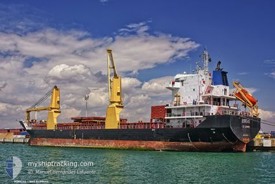
PAN BOREAS
General Cargo

Current Trip
| Trip Time | 2 days |
|---|---|
| Trip Distance | 724.36 nm |
| AVG Speed | 10.5 Knots |
| MAX Speed | 11.3 Knots |
| Dybgang | 5.1 m |
| AVG Wind | 4.9 knots |
| MAX Wind | 12.5 knots |
| MIN Temp | 11.2°C / 52.16°F |
| MAX Temp | 16.4°C / 61.52°F |
| Position Modtaget | 3 d siden |
Current Position
| Longitude | --- |
|---|---|
| Latitude | --- |
| Status | Under way using engine |
| Fart | 10.6 Knots |
| Kurs | 236.7° |
| Område | Mediterranean Sea - Eastern Basin |
| Station | T-AIS |
| Position Modtaget | 3 d siden |
Information
The current position of PAN BOREAS is in Mediterranean Sea - Eastern Basin with coordinates 35.75995° / 14.75269° as reported on 2025-02-18 10:33 by AIS to our vessel tracker app. The vessel's current speed is 10.6 Knots and is currently inside the port of GABES.
The vessel PAN BOREAS (IMO: 9488645, MMSI: 352001098) is a General Cargo that was built in 2008 ( 17 år gamle ). It's sailing under the flag of [PA] Panama.
In this page you can find informations about the vessels current position, last detected port calls, and current voyage information. If the vessels is not in coverage by AIS you will find the latest position.
The current position of PAN BOREAS is detected by our AIS receivers and we are not responsible for the reliability of the data. The last position was recorded while the vessel was in Coverage by the Ais receivers of our vessel tracking app.
The current draught of PAN BOREAS as reported by AIS is 5.1 meters
Weather
| Temperature | 15.4°C / 59.72°F |
|---|---|
| Wind Speed | 12 knots |
| Direction | 70° ENE |
| Pressure | 1026.9 hPa |
| Humidity | 64.9 % |
| Cloud Coverage | 96 % |


Featured Company
Last Port Calls
| Port | Arrival | Departure | Time In Port |
|---|---|---|---|
| 2025-02-19 12:06 | |||
| 2025-02-12 03:40 | 2025-02-16 15:33 | 4 d | |
| 2025-01-29 06:27 | 2025-02-05 16:35 | 7 d | |
| 2025-01-20 13:02 | 2025-01-24 08:16 | 3 d | |
| 2025-01-10 15:28 | 2025-01-16 07:45 | 5 d | |
| 2025-01-04 15:33 | 2025-01-08 19:39 | 4 d | |
| 2024-12-23 09:51 | 2025-01-02 13:11 | 10 d | |
| 2024-12-11 02:03 | 2024-12-17 23:35 | 6 d | |
| 2024-12-03 17:32 |
Most Visited Ports (Last year)
| Port | Arrivals | |
|---|---|---|
| 4 | ||
| 4 | ||
| 2 | ||
| 1 | ||
| 1 | ||
| 1 |
Last Trips
| Origin | Departure | Destination | Arrival | Distance | |
|---|---|---|---|---|---|
| 2025-02-16 15:33 | 2025-02-19 12:06 | 724.36 nm | |||
| 2025-02-05 16:35 | 2025-02-12 03:40 | 1340.74 nm | |||
| 2025-01-24 08:16 | 2025-01-29 06:27 | 1005.81 nm | |||
| 2025-01-16 07:45 | 2025-01-20 13:02 | 1004.45 nm | |||
| 2025-01-08 19:39 | 2025-01-10 15:28 | 39.53 nm | |||
| 2025-01-02 13:11 | 2025-01-04 15:33 | 369.33 nm | |||
| 2024-12-17 23:35 | 2024-12-23 09:51 | 1244.15 nm | |||
| 2024-12-03 17:32 | 2024-12-11 02:03 | 1032.79 nm |
Events
| Tid | Hændelsen | Detaljer | Position / Dest | Info |
|---|---|---|---|---|
| 2025-02-19 11:06 | Skibe i havn |
|
33.92281 / 10.11451
[TN] GABES
|
Fart: 5.1 kn Kurs: 222° |
| 2025-02-18 10:37 | Status er ændret | Default Under way using engine |
35.75262 / 14.73901
TNGAE
|
Fart: 10.6 kn Kurs: 236.7° |
| 2025-02-18 10:33 | Udenfor Dækning |
35.75995 / 14.75269
Mediterranean Sea - Eastern Basin
TNGAE
|
Fart: 10.6 kn Kurs: 236.7° |
|
| 2025-02-18 09:06 | Fundet i havområde | Maltese part of the Mediterranean Sea - Eastern Basin |
35.88134 / 15.02167
Mediterranean Sea - Eastern Basin
TNGAE
|
Fart: 10.4 kn Kurs: 233.2° |
| 2025-02-18 09:06 | Status er ændret | Under way using engine Default |
35.88134 / 15.02167
TNGAE
|
Fart: 10.3 kn Kurs: 233° |
| 2025-02-18 09:05 | Status er ændret | Default Under way using engine |
35.88306 / 15.02448
TNGAE
|
Fart: 10.3 kn Kurs: 233° |
| 2025-02-18 09:05 | Status er ændret | Under way using engine Default |
35.88338 / 15.02500
TNGAE
|
Fart: 10.3 kn Kurs: 232° |
| 2025-02-18 08:57 | Indenfor Dækning |
35.88134 / 15.02167
Mediterranean Sea - Eastern Basin
TNGAE
|
Fart: 10.4 kn Kurs: 233.2° |
|
| 2025-02-17 03:45 | Status er ændret | Default Under way using engine |
40.06636 / 18.65537
TNGAE
|
Fart: 11 kn Kurs: 175.6° |
| 2025-02-17 03:39 | Udenfor Dækning |
40.08605 / 18.65389
Adriatic Sea
TNGAE
|
Fart: 11 kn Kurs: 175.6° |