
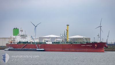
PACIFIC A.DORODCHI
Tanker
Current Trip
| Time Travelled | 12 days |
|---|---|
| Remaining Time | 5 h, 53 mins |
| Distance Travelled | 3235.76 nm |
| Remaining Distance | 81.28 nm |
| AVG Speed | 11 Knots |
| MAX Speed | 15.1 Knots |
| AVG Wind | 12.9 knots |
| MAX Wind | 27 knots |
| MIN Temp | 12.8°C / 55.04°F |
| MAX Temp | 27.1°C / 80.78°F |
| Dybgang | 8.5 m |
| Position Modtaget | 1 m siden |
Current Position
| Longitude | 115.57142° |
|---|---|
| Latitude | -7.81231° |
| Status | Under way using engine |
| Fart | 13.6 Knots |
| Kurs | 319.2° |
| Område | Bali Sea |
| Station | T-AIS |
| Position Modtaget | 1 m siden |
Info
Information
The current position of PACIFIC A.DORODCHI is in Bali Sea with coordinates -7.81231° / 115.57142° as reported on 2024-09-18 03:15 by AIS to our vessel tracker app. The vessel's current speed is 13.6 Knots and is heading at the port of BENOA. The estimated time of arrival as calculated by MyShipTracking vessel tracking app is 2024-09-18 09:10 LT
The vessel PACIFIC A.DORODCHI (IMO: 9732266, MMSI: 538006921) is a Tanker It's sailing under the flag of [MH] Marshall Is.
In this page you can find informations about the vessels current position, last detected port calls, and current voyage information. If the vessels is not in coverage by AIS you will find the latest position.
The current position of PACIFIC A.DORODCHI is detected by our AIS receivers and we are not responsible for the reliability of the data. The last position was recorded while the vessel was in Coverage by the Ais receivers of our vessel tracking app.
The current draught of PACIFIC A.DORODCHI as reported by AIS is 8.5 meters
Weather
| Temperature | 26.8°C / 80.24°F |
|---|---|
| Wind Speed | 7 knots |
| Direction | 167° SSE |
| Pressure | 1009.3 hPa |
| Humidity | 65.5 % |
| Cloud Coverage | 100 % |
Featured Company
Last Port Calls
| Port | Arrival | Departure | Time In Port |
|---|---|---|---|
| 2024-08-30 10:54 | 2024-09-05 05:12 | 5 d | |
| 2024-08-25 23:51 | 2024-08-27 22:12 | 1 d | |
| 2024-08-01 13:21 | 2024-08-02 16:14 | 1 d | |
| 2024-07-03 01:40 |
Most Visited Ports (Last year)
| Port | Arrivals | |
|---|---|---|
| 4 | ||
| 2 | ||
| 1 | ||
| 1 | ||
| 1 | ||
| 1 |
Last Trips
| Origin | Departure | Destination | Arrival | Distance | |
|---|---|---|---|---|---|
| 2024-08-28 07:42 | 2024-08-30 20:54 | 680.41 nm | |||
| 2024-08-02 21:44 | 2024-08-26 09:21 | 5703.40 nm | |||
| 2024-07-03 13:40 | 2024-08-01 18:51 | 7986.78 nm |
Events
| Tid | Hændelsen | Detaljer | Position / Dest | Info |
|---|---|---|---|---|
| 2024-09-18 02:44 | Status er ændret | Under way using engine Default |
-7.90017 / 115.64798
ID BOA
|
Fart: 13.9 kn Kurs: 318° |
| 2024-09-18 02:35 | Status er ændret | Default Under way using engine |
-7.92587 / 115.67119
ID BOA
|
Fart: 14 kn Kurs: 318.4° |
| 2024-09-18 02:27 | Status er ændret | Under way using engine Default |
-7.95195 / 115.69462
ID BOA
|
Fart: 14 kn Kurs: 320° |
| 2024-09-18 02:19 | Status er ændret | Default Under way using engine |
-7.97399 / 115.71376
ID BOA
|
Fart: 13.8 kn Kurs: 320° |
| 2024-09-18 02:01 | Status er ændret | Under way using engine Default |
-8.02964 / 115.75743
ID BOA
|
Fart: 13.9 kn Kurs: 324° |
| 2024-09-18 01:58 | Status er ændret | Default Under way using engine |
-8.03600 / 115.76198
ID BOA
|
Fart: 13.7 kn Kurs: 324.1° |
| 2024-09-18 01:53 | Status er ændret | Under way using engine Default |
-8.05526 / 115.77582
ID BOA
|
Fart: 13.8 kn Kurs: 321° |
| 2024-09-18 01:36 | Status er ændret | Default Under way using engine |
-8.10474 / 115.81477
ID BOA
|
Fart: 13.7 kn Kurs: 321.5° |
| 2024-09-18 01:31 | Status er ændret | Under way using engine Default |
-8.12177 / 115.82827
ID BOA
|
Fart: 13.7 kn Kurs: 321° |
| 2024-09-18 01:28 | Status er ændret | Default Under way using engine |
-8.12975 / 115.83469
ID BOA
|
Fart: 13.6 kn Kurs: 320.8° |