
OV RYVINGEN
Anti-pollution equipment
Current Trip
KRAGERO 90760476
| Time Travelled | 56 days |
|---|---|
| Remaining Time | --- |
| Distance Travelled | 315.70 nm |
| Remaining Distance | --- |
| AVG Speed | 7.8 Knots |
| MAX Speed | 12.2 Knots |
| AVG Wind | 8.3 knots |
| MAX Wind | 26 knots |
| MIN Temp | -9.6°C / 14.72°F |
| MAX Temp | 13°C / 55.4°F |
| Dybgang | 4 m |
| Position Modtaget | 3 m siden |
Current Position
| Longitude | --- |
|---|---|
| Latitude | --- |
| Status | Moored |
| Fart | |
| Kurs | 269° |
| Område | Skaggerak |
| Station | T-AIS |
| Position Modtaget | 3 m siden |
Info
Information
The current position of OV RYVINGEN is in Skaggerak with coordinates 58.87593° / 9.41925° as reported on 2025-03-17 21:08 by AIS to our vessel tracker app. The vessel's current speed is 0 Knots
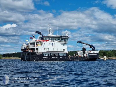
The vessel OV RYVINGEN (IMO: 9824344, MMSI: 257056880) is a Anti-pollution equipment It's sailing under the flag of [NO] Norway.
In this page you can find informations about the vessels current position, last detected port calls, and current voyage information. If the vessels is not in coverage by AIS you will find the latest position.
The current position of OV RYVINGEN is detected by our AIS receivers and we are not responsible for the reliability of the data. The last position was recorded while the vessel was in Coverage by the Ais receivers of our vessel tracking app.
The current draught of OV RYVINGEN as reported by AIS is 4 meters
Weather
| Temperature | 1.2°C / 34.16°F |
|---|---|
| Wind Speed | 4 knots |
| Direction | 315° NW |
| Pressure | 1024.6 hPa |
| Humidity | 75.5 % |
| Cloud Coverage | 74 % |
Featured Company
Most Visited Ports (Last year)
| Port | Arrivals | |
|---|---|---|
| 16 | ||
| 16 | ||
| 14 | ||
| 9 | ||
| 8 | ||
| 8 |
Events
| Tid | Hændelsen | Detaljer | Position / Dest | Info |
|---|---|---|---|---|
| 2025-03-17 17:02 | Status er ændret | Moored Restricted manoeuverability |
58.87592 / 9.41923
KRAGERO 90760476
|
Fart: Kurs: 269° |
| 2025-03-17 16:46 | STOP Sejllads | 0.41 nm, North of KRAGERO |
58.87590 / 9.41937
KRAGERO 90760476
|
Fart: 0.2 kn Kurs: 271° |
| 2025-03-17 15:52 | START Sejllads | 4.86 nm, East of KRAGERO |
58.86032 / 9.57382
KRAGERO 90760476
|
Fart: 9.8 kn Kurs: 230.1° |
| 2025-03-17 14:57 | STOP Sejllads | 5.04 nm, East of KRAGERO |
58.86377 / 9.58003
KRAGERO 90760476
|
Fart: 0.3 kn Kurs: 110° |
| 2025-03-17 14:53 | START Sejllads | 4.97 nm, East of KRAGERO |
58.86213 / 9.57766
KRAGERO 90760476
|
Fart: 4.2 kn Kurs: 37° |
| 2025-03-17 12:24 | Status er ændret | Restricted manoeuverability Under way using engine |
58.86080 / 9.57369
KRAGERO 90760476
|
Fart: Kurs: 350° |
| 2025-03-17 10:24 | STOP Sejllads | 4.85 nm, East of KRAGERO |
58.86071 / 9.57370
KRAGERO 90760476
|
Fart: Kurs: 349° |
| 2025-03-17 10:05 | START Sejllads | 4.08 nm, South East of KRAGERO |
58.83263 / 9.52930
KRAGERO 90760476
|
Fart: 9.8 kn Kurs: 60.7° |
| 2025-03-17 09:30 | STOP Sejllads | 3.8 nm, South East of KRAGERO |
58.83221 / 9.51760
KRAGERO 90760476
|
Fart: Kurs: 235° |
| 2025-03-17 08:45 | START Sejllads | 0.32 nm, North of KRAGERO |
58.87428 / 9.42127
KRAGERO 90760476
|
Fart: 7.2 kn Kurs: 166.2° |