

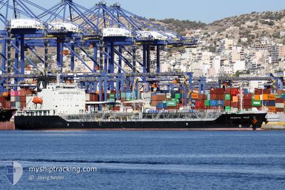
ORIENTAL TULIP
Tanker

Current Trip
| Time Travelled | 8 days |
|---|---|
| Remaining Time | 2 days |
| Distance Travelled | 2377.05 nm |
| Remaining Distance | 631.40 nm |
| AVG Speed | 11.6 Knots |
| MAX Speed | 13.8 Knots |
| AVG Wind | 7.2 knots |
| MAX Wind | 16 knots |
| MIN Temp | 22.4°C / 72.32°F |
| MAX Temp | 28.1°C / 82.58°F |
| Dybgang | 6.2 m |
| Position Modtaget | 7 d siden |
Current Position
| Longitude | --- |
|---|---|
| Latitude | --- |
| Status | Under way using engine |
| Fart | 12 Knots |
| Kurs | 137.4° |
| Område | Gulf of Oman |
| Station | T-AIS |
| Position Modtaget | 7 d siden |
Information
The current position of ORIENTAL TULIP is in Gulf of Oman with coordinates 24.67573° / 56.97850° as reported on 2025-02-13 19:43 by AIS to our vessel tracker app. The vessel's current speed is 12 Knots and is heading at the port of MOMBASA. The estimated time of arrival as calculated by MyShipTracking vessel tracking app is 2025-02-23 08:07 LT
The vessel ORIENTAL TULIP (IMO: 9890549, MMSI: 354731000) is a Tanker It's sailing under the flag of [PA] Panama.
In this page you can find informations about the vessels current position, last detected port calls, and current voyage information. If the vessels is not in coverage by AIS you will find the latest position.
The current position of ORIENTAL TULIP is detected by our AIS receivers and we are not responsible for the reliability of the data. The last position was recorded while the vessel was in Coverage by the Ais receivers of our vessel tracking app.
The current draught of ORIENTAL TULIP as reported by AIS is 6.2 meters
Weather
| Temperature | 26.5°C / 79.7°F |
|---|---|
| Wind Speed | 11 knots |
| Direction | 39° NE |
| Pressure | 1010.2 hPa |
| Humidity | 77.6 % |
| Cloud Coverage | 39 % |


Featured Company
Last Port Calls
| Port | Arrival | Departure | Time In Port |
|---|---|---|---|
| 2025-02-11 09:24 | 2025-02-12 11:54 | 1 d | |
| 2025-02-08 11:12 | 2025-02-09 03:15 | 16 h | |
| 2025-01-20 09:53 | 2025-01-23 15:43 | 3 d | |
| 2024-12-17 21:42 | 2024-12-20 11:56 | 2 d | |
| 2024-12-15 10:16 | 2024-12-17 20:00 | 2 d | |
| 2024-12-14 02:00 | 2024-12-15 09:40 | 1 d | |
| 2024-12-11 21:37 | 2024-12-12 03:29 | 5 h | |
| 2024-12-07 20:50 | 2024-12-11 20:58 | 4 d | |
| 2024-12-06 18:27 | 2024-12-07 20:29 | 1 d |
Most Visited Ports (Last year)
| Port | Arrivals | |
|---|---|---|
| 5 | ||
| 3 | ||
| 3 | ||
| 3 | ||
| 3 | ||
| 2 |
Last Trips
| Origin | Departure | Destination | Arrival | Distance | |
|---|---|---|---|---|---|
| 2025-02-09 03:15 | 2025-02-11 09:24 | 260.85 nm | |||
| 2025-01-23 15:43 | 2025-02-08 11:12 | 4104.10 nm | |||
| 2024-12-20 11:56 | 2025-01-20 09:53 | 7308.59 nm | |||
| 2024-12-17 20:00 | 2024-12-17 21:42 | 16.27 nm | |||
| 2024-12-15 09:40 | 2024-12-15 10:16 | 1.94 nm | |||
| 2024-12-12 03:29 | 2024-12-14 02:00 | 385.73 nm | |||
| 2024-12-11 20:58 | 2024-12-11 21:37 | 1.60 nm | |||
| 2024-12-07 20:29 | 2024-12-07 20:50 | 1.08 nm | |||
| 2024-11-26 20:48 | 2024-12-06 18:27 | 2550.82 nm |
Events
| Tid | Hændelsen | Detaljer | Position / Dest | Info |
|---|---|---|---|---|
| 2025-02-13 19:49 | Status er ændret | Default Under way using engine |
24.65974 / 56.99446
KEMBA
|
Fart: 12 kn Kurs: 137.4° |
| 2025-02-13 19:43 | Udenfor Dækning |
24.67573 / 56.97850
Gulf of Oman
KEMBA
|
Fart: 12 kn Kurs: 137.4° |
|
| 2025-02-13 17:29 | Ændre havområde | Omani part of the Gulf of Oman United Arab Emirates part of the Gulf of Oman |
25.02997 / 56.68463
Gulf of Oman
KEMBA
|
Fart: 12.3 kn Kurs: 159.8° |
| 2025-02-13 15:34 | START Sejllads | 8.02 nm, North East of FUJAIRAH |
25.20507 / 56.49803
KEMBA
|
Fart: 3.1 kn Kurs: 63° |
| 2025-02-13 15:29 | Status er ændret | Under way using engine At anchor |
25.20349 / 56.49600
KEMBA
|
Fart: 0.3 kn Kurs: 24° |
| 2025-02-13 15:01 | ETA er ændret | 2025/02/24 06:00 2025/02/13 04:00 |
25.20274 / 56.49571
KEMBA
|
Fart: Kurs: 10° |
| 2025-02-13 14:43 | Dybgangen er ændret | 6.2 6 |
25.20279 / 56.49577
KEMBA
|
Fart: Kurs: 8° |
| 2025-02-13 14:37 | Destination er ændret | KEMBA AEFUJ |
25.20274 / 56.49583
KEMBA
|
Fart: Kurs: 1° |
| 2025-02-13 12:35 | Status er ændret | At anchor Default |
25.20290 / 56.49562
AEFUJ
|
Fart: Kurs: 16° |
| 2025-02-13 12:23 | Status er ændret | Default At anchor |
25.20293 / 56.49550
AEFUJ
|
Fart: Kurs: 16° |