
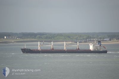
ORIENT PACE
Bulk Carrier
Current Trip
ABIDJAN
| Time Travelled | 7 days |
|---|---|
| Remaining Time | --- |
| Distance Travelled | 1647.91 nm |
| Remaining Distance | --- |
| AVG Speed | 11.7 Knots |
| MAX Speed | 12.9 Knots |
| AVG Wind | 9.6 knots |
| MAX Wind | 15.8 knots |
| MIN Temp | 17.6°C / 63.68°F |
| MAX Temp | 28.6°C / 83.48°F |
| Dybgang | 10.3 m |
| Position Modtaget | 2 d siden |
Current Position
| Longitude | --- |
|---|---|
| Latitude | --- |
| Status | Under way using engine |
| Fart | 11.6 Knots |
| Kurs | 342° |
| Område | North Atlantic Ocean |
| Station | T-AIS |
| Position Modtaget | 2 d siden |
Info
Information
The current position of ORIENT PACE is in North Atlantic Ocean with coordinates 11.17261° / -17.21831° as reported on 2025-02-14 00:08 by AIS to our vessel tracker app. The vessel's current speed is 11.6 Knots
The vessel ORIENT PACE (IMO: 9450753, MMSI: 636014797) is a Bulk Carrier that was built in 2011 ( 14 år gamle ). It's sailing under the flag of [LR] Liberia.
In this page you can find informations about the vessels current position, last detected port calls, and current voyage information. If the vessels is not in coverage by AIS you will find the latest position.
The current position of ORIENT PACE is detected by our AIS receivers and we are not responsible for the reliability of the data. The last position was recorded while the vessel was in Coverage by the Ais receivers of our vessel tracking app.
The current draught of ORIENT PACE as reported by AIS is 10.3 meters
Weather
| Temperature | 22.2°C / 71.96°F |
|---|---|
| Wind Speed | 15 knots |
| Direction | 8° N |
| Pressure | 1013.3 hPa |
| Humidity | 59 % |
| Cloud Coverage | 88 % |
Featured Company
Last Trips
| Origin | Departure | Destination | Arrival | Distance | |
|---|---|---|---|---|---|
| 2025-01-20 22:17 | 2025-01-31 09:09 | 541.81 nm | |||
| 2025-01-13 18:33 | 2025-01-16 20:05 | 0.75 nm | |||
| 2025-01-06 22:20 | 2025-01-10 02:44 | 700.92 nm | |||
| 2024-12-11 03:37 | 2024-12-31 14:00 | 4478.63 nm | |||
| 2024-11-24 00:14 | 2024-12-09 02:07 | 4150.39 nm |
Events
| Tid | Hændelsen | Detaljer | Position / Dest | Info |
|---|---|---|---|---|
| 2025-02-14 19:31 | STOP Sejllads | 3.85 nm, South East of GOREE |
14.63803 / -17.34028
ABIDJAN
|
Fart: 0.3 kn Kurs: 39° |
| 2025-02-14 00:15 | Status er ændret | Default Under way using engine |
11.19650 / -17.22632
ABIDJAN
|
Fart: 11.6 kn Kurs: 342° |
| 2025-02-14 00:08 | Status er ændret | Under way using engine Default |
11.17261 / -17.21831
ABIDJAN
|
Fart: 11.5 kn Kurs: 341° |
| 2025-02-14 00:08 | Udenfor Dækning |
11.17261 / -17.21831
North Atlantic Ocean
|
Fart: 11.6 kn Kurs: 342° |
|
| 2025-02-13 23:43 | Status er ændret | Default Under way using engine |
11.09989 / -17.19176
ABIDJAN
|
Fart: 11.2 kn Kurs: 338.3° |
| 2025-02-13 23:37 | Fundet i havområde | Guinea Bissau part of the North Atlantic Ocean |
11.08047 / -17.18404
North Atlantic Ocean
|
Fart: 11.2 kn Kurs: 338.3° |
| 2025-02-13 23:37 | Status er ændret | Under way using engine Default |
11.08047 / -17.18404
ABIDJAN
|
Fart: 11.2 kn Kurs: 339° |
| 2025-02-13 23:35 | Indenfor Dækning |
11.08047 / -17.18404
North Atlantic Ocean
|
Fart: 11.2 kn Kurs: 338.3° |
|
| 2025-02-08 20:33 | START Sejllads | 0.35 nm, East of COTONOU |
6.34251 / 2.43671
ABIDJAN
|
Fart: 5.8 kn Kurs: 110° |
| 2025-02-08 20:33 | Afsejlet fra sidste havn |
|
6.34251 / 2.43671
ABIDJAN
|
Fart: 3 kn Kurs: 110° |