
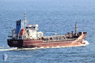
ORATANK
Oil/Chemical Tanker
Current Trip
| Trip Time | 2 days |
|---|---|
| Trip Distance | 744.83 nm |
| AVG Speed | 10.2 Knots |
| MAX Speed | 15.5 Knots |
| Dybgang | 6.1 m |
| AVG Wind | 12.4 knots |
| MAX Wind | 29 knots |
| MIN Temp | 7.3°C / 45.14°F |
| MAX Temp | 12.6°C / 54.68°F |
| Position Modtaget | Nu |
Current Position
| Longitude | --- |
|---|---|
| Latitude | --- |
| Status | Under way using engine |
| Fart | |
| Kurs | 268° |
| Område | Irish Sea and St. George's Channel |
| Station | T-AIS |
| Position Modtaget | Nu |
Information
The current position of ORATANK is in Irish Sea and St. George's Channel with coordinates 53.43364° / -3.00119° as reported on 2025-03-28 03:08 by AIS to our vessel tracker app. The vessel's current speed is 0 Knots and is currently inside the port of LIVERPOOL.
The vessel ORATANK (IMO: 9336713, MMSI: 220516000) is a Oil/Chemical Tanker that was built in 2007 ( 18 år gamle ). It's sailing under the flag of [DK] Denmark.
In this page you can find informations about the vessels current position, last detected port calls, and current voyage information. If the vessels is not in coverage by AIS you will find the latest position.
The current position of ORATANK is detected by our AIS receivers and we are not responsible for the reliability of the data. The last position was recorded while the vessel was in Coverage by the Ais receivers of our vessel tracking app.
The current draught of ORATANK as reported by AIS is 6.1 meters
Weather
| Temperature | 8.7°C / 47.66°F |
|---|---|
| Wind Speed | 15 knots |
| Direction | 258° WSW |
| Pressure | 1007.5 hPa |
| Humidity | 89.4 % |
| Cloud Coverage | 100 % |
Featured Company
Last Port Calls
| Port | Arrival | Departure | Time In Port |
|---|---|---|---|
| 2025-03-24 12:46 | |||
| 2025-03-19 10:15 | 2025-03-21 18:26 | 2 d | |
| 2025-03-09 14:39 | 2025-03-12 08:53 | 2 d | |
| 2025-03-05 18:01 | 2025-03-06 14:11 | 20 h | |
| 2025-03-01 20:41 | 2025-03-02 09:18 | 12 h | |
| 2025-03-01 09:33 | 2025-03-01 13:14 | 3 h | |
| 2025-02-28 03:05 | 2025-02-28 19:03 | 15 h | |
| 2025-02-20 06:03 | 2025-02-21 02:06 | 20 h | |
| 2025-02-18 04:41 | 2025-02-18 05:49 | 1 h | |
| 2025-02-17 00:39 | 2025-02-18 03:09 | 1 d |
Last Trips
| Origin | Departure | Destination | Arrival | Distance | |
|---|---|---|---|---|---|
| 2025-03-21 19:26 | 2025-03-24 12:46 | 744.83 nm | |||
| 2025-03-12 09:53 | 2025-03-19 11:15 | 1432.05 nm | |||
| 2025-03-06 15:11 | 2025-03-09 15:39 | 845.08 nm | |||
| 2025-03-02 10:18 | 2025-03-05 19:01 | 613.54 nm | |||
| 2025-03-01 14:14 | 2025-03-01 21:41 | 100.41 nm | |||
| 2025-02-28 20:03 | 2025-03-01 10:33 | 154.10 nm | |||
| 2025-02-21 03:06 | 2025-02-28 04:05 | 1882.01 nm | |||
| 2025-02-18 06:49 | 2025-02-20 07:03 | 559.19 nm | |||
| 2025-02-18 04:09 | 2025-02-18 05:41 | 9.40 nm | |||
| 2025-02-14 07:11 | 2025-02-17 01:39 | 757.42 nm |
Events
| Tid | Hændelsen | Detaljer | Position / Dest | Info |
|---|---|---|---|---|
| 2025-03-24 14:19 | STOP Sejllads |
53.43288 / -3.00500
[GB] LIVERPOOL
|
Fart: 0.3 kn Kurs: 239° |
|
| 2025-03-24 13:56 | START Sejllads |
53.44405 / -3.01080
[GB] LIVERPOOL
|
Fart: 3.1 kn Kurs: 146° |
|
| 2025-03-24 12:57 | STOP Sejllads |
53.45121 / -3.01792
[GB] LIVERPOOL
|
Fart: 0.3 kn Kurs: 350° |
|
| 2025-03-24 12:46 | Skibe i havn |
|
53.44647 / -3.02106
[GB] LIVERPOOL
|
Fart: 3.4 kn Kurs: 70° |
| 2025-03-24 08:17 | Status er ændret | Under way using engine Default |
53.51300 / -3.84568
GBLIV
|
Fart: 8.4 kn Kurs: 89° |
| 2025-03-24 08:12 | Status er ændret | Default Under way using engine |
53.51288 / -3.86760
GBLIV
|
Fart: 8.5 kn Kurs: 94.5° |
| 2025-03-24 08:04 | Status er ændret | Under way using engine Default |
53.51319 / -3.89859
GBLIV
|
Fart: 8.5 kn Kurs: 96° |
| 2025-03-24 07:52 | Indenfor Dækning |
53.51319 / -3.89859
Irish Sea and St. George's Channel
GBLIV
|
Fart: 8.5 kn Kurs: 94.5° |
|
| 2025-03-24 06:56 | Status er ændret | Default Under way using engine |
53.52675 / -4.11818
GBLIV
|
Fart: 4.3 kn Kurs: 270° |
| 2025-03-24 06:56 | Udenfor Dækning |
53.52679 / -4.11749
Irish Sea and St. George's Channel
GBLIV
|
Fart: 4.3 kn Kurs: 264.6° |