
OPTIMAR
Cargo
Current Trip
| Time Travelled | 18 h, 37 mins |
|---|---|
| Remaining Time | 12 h, 51 mins |
| Distance Travelled | 160.80 nm |
| Remaining Distance | 120.76 nm |
| AVG Speed | 8.7 Knots |
| MAX Speed | 11.2 Knots |
| AVG Wind | 15.3 knots |
| MAX Wind | 21 knots |
| MIN Temp | -2.5°C / 27.5°F |
| MAX Temp | 3.8°C / 38.84°F |
| Dybgang | 3.2 m |
| Position Modtaget | 15 h, 50 m siden |
Current Position
| Longitude | --- |
|---|---|
| Latitude | --- |
| Status | Under way using engine |
| Fart | 8.1 Knots |
| Kurs | 348.2° |
| Område | Gulf of Bothnia |
| Station | T-AIS |
| Position Modtaget | 15 h, 50 m siden |
Info
Information
The current position of OPTIMAR is in Gulf of Bothnia with coordinates 61.36434° / 20.98230° as reported on 2025-12-11 23:32 by AIS to our vessel tracker app. The vessel's current speed is 8.1 Knots and is heading at the port of VIRPIPERA. The estimated time of arrival as calculated by MyShipTracking vessel tracking app is 2025-12-13 04:13 LT
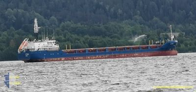
The vessel OPTIMAR (MMSI: 209730000) is a Cargo It's sailing under the flag of [CY] Cyprus.
In this page you can find informations about the vessels current position, last detected port calls, and current voyage information. If the vessels is not in coverage by AIS you will find the latest position.
The current position of OPTIMAR is detected by our AIS receivers and we are not responsible for the reliability of the data. The last position was recorded while the vessel was in Coverage by the Ais receivers of our vessel tracking app.
The current draught of OPTIMAR as reported by AIS is 3.2 meters
Weather
| Temperature | -1.5°C / 29.3°F |
|---|---|
| Wind Speed | 12 knots |
| Direction | 24° NNE |
| Pressure | 1029.3 hPa |
| Humidity | 65.7 % |
| Cloud Coverage | 100 % |
Featured Company
Last Port Calls
| Port | Arrival | Departure | Time In Port |
|---|---|---|---|
| 2025-12-10 19:15 | 2025-12-11 20:45 | 1 d | |
| 2025-12-06 16:44 | 2025-12-09 07:12 | 2 d | |
| 2025-12-05 08:00 | 2025-12-05 19:44 | 11 h | |
| 2025-12-02 04:31 | 2025-12-03 10:21 | 1 d | |
| 2025-11-30 18:10 | 2025-12-01 19:09 | 1 d | |
| 2025-11-26 19:01 | 2025-11-27 18:13 | 23 h | |
| 2025-11-24 07:29 | 2025-11-25 01:00 | 17 h | |
| 2025-11-20 09:45 | 2025-11-23 14:14 | 3 d | |
| 2025-11-16 12:48 | 2025-11-18 16:04 | 2 d | |
| 2025-11-12 08:12 | 2025-11-14 05:23 | 1 d |
Most Visited Ports (Last year)
| Port | Arrivals | |
|---|---|---|
| 19 | ||
| 11 | ||
| 9 | ||
| 7 | ||
| 7 | ||
| 6 |
Last Trips
| Origin | Departure | Destination | Arrival | Distance | |
|---|---|---|---|---|---|
| 2025-12-09 09:12 | 2025-12-10 21:15 | 311.10 nm | |||
| 2025-12-05 20:44 | 2025-12-06 18:44 | 195.07 nm | |||
| 2025-12-03 12:21 | 2025-12-05 09:00 | 489.30 nm | |||
| 2025-12-01 21:09 | 2025-12-02 06:31 | 85.72 nm | |||
| 2025-11-27 19:13 | 2025-11-30 20:10 | 376.36 nm | |||
| 2025-11-25 03:00 | 2025-11-26 20:01 | 429.10 nm | |||
| 2025-11-23 15:14 | 2025-11-24 09:29 | 173.38 nm | |||
| 2025-11-18 17:04 | 2025-11-20 10:45 | 419.69 nm | |||
| 2025-11-14 07:23 | 2025-11-16 13:48 | 421.00 nm | |||
| 2025-11-11 12:08 | 2025-11-12 10:12 | 226.44 nm |
Events
| Tid | Hændelsen | Detaljer | Position / Dest | Info |
|---|---|---|---|---|
| 2025-12-11 23:37 | Status er ændret | Default Under way using engine |
61.37599 / 20.97722
FI RAA
|
Fart: 8.1 kn Kurs: 348.2° |
| 2025-12-11 23:32 | Status er ændret | Under way using engine Default |
61.36434 / 20.98230
FI RAA
|
Fart: 8 kn Kurs: 349° |
| 2025-12-11 23:32 | Udenfor Dækning |
61.36434 / 20.98230
Gulf of Bothnia
FI RAA
|
Fart: 8.1 kn Kurs: 348.2° |
|
| 2025-12-11 23:13 | Status er ændret | Default Under way using engine |
61.32293 / 21.00035
FI RAA
|
Fart: 8.1 kn Kurs: 352.1° |
| 2025-12-11 22:59 | Status er ændret | Under way using engine Default |
61.29257 / 21.01182
FI RAA
|
Fart: 8.2 kn Kurs: 353° |
| 2025-12-11 22:49 | Status er ændret | Default Under way using engine |
61.26975 / 21.01751
FI RAA
|
Fart: 8 kn Kurs: 353.2° |
| 2025-12-11 20:48 | Status er ændret | Under way using engine Moored |
61.11411 / 21.42098
FI RAA
|
Fart: 11 kn Kurs: 267.2° |
| 2025-12-11 20:45 | Afsejlet fra sidste havn |
|
61.11431 / 21.43834
FI RAA
|
Fart: 7.1 kn Kurs: 268° |
| 2025-12-11 20:44 | START Sejllads |
61.11462 / 21.44311
[FI] RAUMA
|
Fart: 4.1 kn Kurs: 262° |
|
| 2025-12-11 20:38 | Status er ændret | Moored Default |
61.11433 / 21.44559
[FI] RAUMA
|
Fart: Kurs: 141° |