
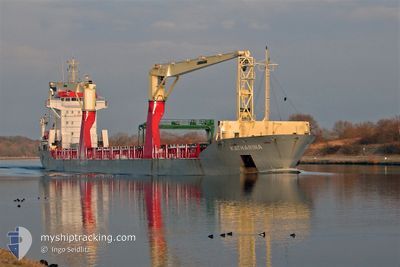
ONEGO ELBE
General Cargo
Current Trip
| Time Travelled | 16 h, 50 mins |
|---|---|
| Remaining Time | --- |
| Distance Travelled | 189.87 nm |
| Remaining Distance | --- |
| AVG Speed | 12.6 Knots |
| MAX Speed | 13.1 Knots |
| AVG Wind | 8 knots |
| MAX Wind | 13 knots |
| MIN Temp | 25.9°C / 78.62°F |
| MAX Temp | 27°C / 80.6°F |
| Dybgang | 5.5 m |
| Position Modtaget | 23 m siden |
Current Position
| Longitude | -79.51667° |
|---|---|
| Latitude | 25.52900° |
| Status | Under way using engine |
| Fart | 11.9 Knots |
| Kurs | 187.6° |
| Område | North Atlantic Ocean |
| Station | T-AIS |
| Position Modtaget | 23 m siden |
Info
Information
The current position of ONEGO ELBE is in North Atlantic Ocean with coordinates 25.52900° / -79.51667° as reported on 2024-05-23 10:45 by AIS to our vessel tracker app. The vessel's current speed is 11.9 Knots and is heading at the port of NEW ORLEANS. The estimated time of arrival as calculated by MyShipTracking vessel tracking app is 2024-05-26 09:00 LT
The vessel ONEGO ELBE (IMO: 9438573, MMSI: 305305000) is a General Cargo that was built in 2008 ( 16 år gamle ). It's sailing under the flag of [AG] Antigua Barbuda.
In this page you can find informations about the vessels current position, last detected port calls, and current voyage information. If the vessels is not in coverage by AIS you will find the latest position.
The current position of ONEGO ELBE is detected by our AIS receivers and we are not responsible for the reliability of the data. The last position was recorded while the vessel was in Coverage by the Ais receivers of our vessel tracking app.
The current draught of ONEGO ELBE as reported by AIS is 5.5 meters
Weather
| Temperature | 27°C / 80.6°F |
|---|---|
| Wind Speed | 8 knots |
| Direction | 86° E |
| Pressure | 1014.4 hPa |
| Humidity | 69.4 % |
| Cloud Coverage | --- |
Featured Company
Last Port Calls
| Port | Arrival | Departure | Time In Port |
|---|---|---|---|
| 2024-05-21 11:37 | 2024-05-22 18:19 | 1 d | |
| 2024-05-03 16:12 | 2024-05-07 08:52 | 3 d | |
| 2024-04-22 16:16 | 2024-04-25 05:16 | 2 d | |
| 2024-03-31 21:15 | 2024-04-02 20:37 | 1 d | |
| 2024-03-18 02:48 | 2024-03-25 13:41 | 7 d |
Most Visited Ports (Last year)
| Port | Arrivals | |
|---|---|---|
| 3 | ||
| 2 | ||
| 2 | ||
| 2 | ||
| 2 | ||
| 1 |
Last Trips
| Origin | Departure | Destination | Arrival | Distance | |
|---|---|---|---|---|---|
| 2024-05-07 10:52 | 2024-05-21 07:37 | 4029.05 nm | |||
| 2024-04-25 08:16 | 2024-05-03 18:12 | 1567.92 nm | |||
| 2024-04-02 15:37 | 2024-04-22 19:16 | 5827.41 nm | |||
| 2024-03-25 08:41 | 2024-03-31 16:15 | 1588.41 nm | |||
| 2024-02-22 19:39 | 2024-03-17 21:48 | 6689.84 nm |
Events
| Tid | Hændelsen | Detaljer | Position / Dest | Info |
|---|---|---|---|---|
| 2024-05-23 10:47 | Status er ændret | Default Under way using engine |
25.52073 / -79.51795
USMSY
|
Fart: 11.9 kn Kurs: 187.6° |
| 2024-05-23 09:49 | Dybgangen er ændret | 5.5 6.8 |
25.71633 / -79.47983
USMSY
|
Fart: 12.3 kn Kurs: 189.3° |
| 2024-05-23 09:49 | Destination er ændret | USMSY USPCV |
25.71633 / -79.47983
USMSY
|
Fart: 12.3 kn Kurs: 189.3° |
| 2024-05-23 09:49 | ETA er ændret | 2024/05/26 09:00 2024/05/20 10:00 |
25.71633 / -79.47983
USMSY
|
Fart: 12.3 kn Kurs: 189.3° |
| 2024-05-23 09:07 | Status er ændret | Under way using engine Default |
25.85577 / -79.45002
USPCV
|
Fart: 12.7 kn Kurs: 192° |
| 2024-05-23 09:05 | Status er ændret | Default Under way using engine |
25.86329 / -79.44829
USPCV
|
Fart: 12.7 kn Kurs: 191.5° |
| 2024-05-23 08:56 | Status er ændret | Under way using engine Default |
25.89392 / -79.44123
USPCV
|
Fart: 12.5 kn Kurs: 185° |
| 2024-05-23 08:50 | Status er ændret | Default Under way using engine |
25.91600 / -79.43816
USPCV
|
Fart: 12.5 kn Kurs: 187.8° |
| 2024-05-23 08:43 | Status er ændret | Under way using engine Default |
25.93967 / -79.43500
USPCV
|
Fart: 12.6 kn Kurs: 187° |
| 2024-05-23 08:09 | Status er ændret | Default Under way using engine |
26.05887 / -79.41675
USPCV
|
Fart: 12.9 kn Kurs: 188.9° |