
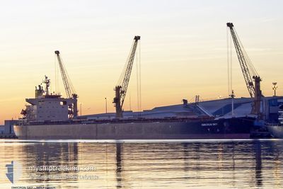
OMICRON SKY
Bulk Carrier
Current Trip
| Time Travelled | 11 days |
|---|---|
| Remaining Time | --- |
| Distance Travelled | 2877.36 nm |
| Remaining Distance | --- |
| AVG Speed | 10.7 Knots |
| MAX Speed | 13.4 Knots |
| AVG Wind | 11.3 knots |
| MAX Wind | 25.8 knots |
| MIN Temp | 2.9°C / 37.22°F |
| MAX Temp | 11.2°C / 52.16°F |
| Dybgang | 13.1 m |
| Position Modtaget | 4 d siden |
Current Position
| Longitude | -166.95872° |
|---|---|
| Latitude | 54.48335° |
| Status | Under way using engine |
| Fart | 11.3 Knots |
| Kurs | 277° |
| Område | Bering Sea |
| Station | T-AIS |
| Position Modtaget | 4 d siden |
Info
Information
The current position of OMICRON SKY is in Bering Sea with coordinates 54.48335° / -166.95872° as reported on 2024-06-01 11:29 by AIS to our vessel tracker app. The vessel's current speed is 11.3 Knots and is heading at the port of QINGDAO. The estimated time of arrival as calculated by MyShipTracking vessel tracking app is 2024-06-10 15:00 LT
The vessel OMICRON SKY (IMO: 9330329, MMSI: 636017169) is a Bulk Carrier that was built in 2006 ( 18 år gamle ). It's sailing under the flag of [LR] Liberia.
In this page you can find informations about the vessels current position, last detected port calls, and current voyage information. If the vessels is not in coverage by AIS you will find the latest position.
The current position of OMICRON SKY is detected by our AIS receivers and we are not responsible for the reliability of the data. The last position was recorded while the vessel was in Coverage by the Ais receivers of our vessel tracking app.
The current draught of OMICRON SKY as reported by AIS is 13.1 meters
Weather
| Temperature | 4.9°C / 40.82°F |
|---|---|
| Wind Speed | 10 knots |
| Direction | 114° ESE |
| Pressure | 1023.2 hPa |
| Humidity | 87.7 % |
| Cloud Coverage | 100 % |
Featured Company
Most Visited Ports (Last year)
| Port | Arrivals | |
|---|---|---|
| 3 | ||
| 3 | ||
| 2 | ||
| 2 | ||
| 1 | ||
| 1 |
Last Trips
| Origin | Departure | Destination | Arrival | Distance | |
|---|---|---|---|---|---|
| 2024-05-20 12:02 | 2024-05-23 17:19 | 14.26 nm | |||
| 2024-05-15 19:37 | 2024-05-19 01:09 | 10.43 nm | |||
| 2024-04-16 16:43 | 2024-05-13 19:29 | 5172.32 nm | |||
| 2024-04-13 16:30 | 2024-04-14 04:22 | 125.53 nm | |||
| 2024-02-23 14:38 | 2024-04-11 04:58 | 7700.75 nm |
Events
| Tid | Hændelsen | Detaljer | Position / Dest | Info |
|---|---|---|---|---|
| 2024-06-01 11:36 | Status er ændret | Default Under way using engine |
54.48618 / -166.99736
QINGDAO,CHINA
|
Fart: 11.3 kn Kurs: 277° |
| 2024-06-01 11:29 | Status er ændret | Under way using engine Default |
54.48335 / -166.95872
QINGDAO,CHINA
|
Fart: 11.4 kn Kurs: 277° |
| 2024-06-01 11:29 | Udenfor Dækning |
54.48335 / -166.95872
Bering Sea
QINGDAO,CHINA
|
Fart: 11.3 kn Kurs: 277° |
|
| 2024-06-01 11:27 | Indenfor Dækning |
54.48335 / -166.95872
Bering Sea
QINGDAO,CHINA
|
Fart: 11.3 kn Kurs: 277° |
|
| 2024-06-01 09:27 | Status er ændret | Default Under way using engine |
54.43706 / -166.31274
QINGDAO,CHINA
|
Fart: 11.7 kn Kurs: 276° |
| 2024-06-01 09:22 | Fundet i havområde | United States (Alaska) part of the Bering Sea |
54.43518 / -166.28490
Bering Sea
QINGDAO,CHINA
|
Fart: 11.7 kn Kurs: 276° |
| 2024-06-01 09:22 | Status er ændret | Under way using engine Default |
54.43518 / -166.28490
QINGDAO,CHINA
|
Fart: 11.7 kn Kurs: 277° |
| 2024-06-01 09:22 | Udenfor Dækning |
54.43518 / -166.28490
Bering Sea
QINGDAO,CHINA
|
Fart: 11.7 kn Kurs: 276° |
|
| 2024-06-01 09:15 | Indenfor Dækning |
54.43518 / -166.28490
Bering Sea
QINGDAO,CHINA
|
Fart: 11.7 kn Kurs: 276° |