
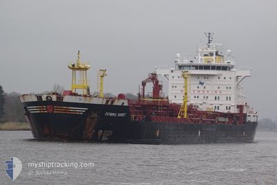
OLYMPIC SPIRIT
Oil/Chemical Tanker
Current Trip
LAST UPDATE TIME
| Time Travelled | 9 days |
|---|---|
| Remaining Time | --- |
| Distance Travelled | 1712.43 nm |
| Remaining Distance | --- |
| AVG Speed | 7.6 Knots |
| MAX Speed | 9.4 Knots |
| AVG Wind | 9.7 knots |
| MAX Wind | 19 knots |
| MIN Temp | 22.4°C / 72.32°F |
| MAX Temp | 28.8°C / 83.84°F |
| Dybgang | 6.1 m |
| Position Modtaget | 3 d siden |
Current Position
| Longitude | -62.27759° |
|---|---|
| Latitude | 26.12906° |
| Status | Under way using engine |
| Fart | 8.3 Knots |
| Kurs | 65.5° |
| Område | North Atlantic Ocean |
| Station | T-AIS |
| Position Modtaget | 3 d siden |
Info
Information
The current position of OLYMPIC SPIRIT is in North Atlantic Ocean with coordinates 26.12906° / -62.27759° as reported on 2024-05-18 12:04 by AIS to our vessel tracker app. The vessel's current speed is 8.3 Knots
The vessel OLYMPIC SPIRIT (IMO: 9327097, MMSI: 636022387) is a Oil/Chemical Tanker that was built in 2005 ( 19 år gamle ). It's sailing under the flag of [LR] Liberia.
In this page you can find informations about the vessels current position, last detected port calls, and current voyage information. If the vessels is not in coverage by AIS you will find the latest position.
The current position of OLYMPIC SPIRIT is detected by our AIS receivers and we are not responsible for the reliability of the data. The last position was recorded while the vessel was in Coverage by the Ais receivers of our vessel tracking app.
The current draught of OLYMPIC SPIRIT as reported by AIS is 6.1 meters
Weather
| Temperature | 22.3°C / 72.14°F |
|---|---|
| Wind Speed | 12 knots |
| Direction | 243° WSW |
| Pressure | 1019.1 hPa |
| Humidity | 93.5 % |
| Cloud Coverage | 98 % |
Featured Company
Last Port Calls
| Port | Arrival | Departure | Time In Port |
|---|---|---|---|
| 2024-05-12 22:58 | 2024-05-12 23:10 | 12 m | |
| 2024-05-08 20:18 | 2024-05-08 20:37 | 18 m | |
| 2024-04-27 17:10 | 2024-05-02 20:54 | 5 d | |
| 2024-04-18 14:01 | 2024-04-19 11:17 | 21 h |
Most Visited Ports (Last year)
| Port | Arrivals | |
|---|---|---|
| 2 | ||
| 1 | ||
| 1 | ||
| 1 |
Last Trips
| Origin | Departure | Destination | Arrival | Distance | |
|---|---|---|---|---|---|
| 2024-05-08 15:37 | 2024-05-12 17:58 | 23.76 nm | |||
| 2024-05-02 16:54 | 2024-05-08 15:18 | 790.23 nm | |||
| 2024-04-19 07:17 | 2024-04-27 13:10 | 538.77 nm |
Events
| Tid | Hændelsen | Detaljer | Position / Dest | Info |
|---|---|---|---|---|
| 2024-05-18 12:21 | Status er ændret | Default Under way using engine |
26.14667 / -62.23667
LAST UPDATE TIME
|
Fart: 8.3 kn Kurs: 65.5° |
| 2024-05-18 12:04 | Ændre havområde | High seas of the North Atlantic Ocean Jamaican part of the Caribbean Sea |
26.12906 / -62.27759
North Atlantic Ocean
|
Fart: 8.3 kn Kurs: 65.5° |
| 2024-05-18 12:04 | Status er ændret | Under way using engine Default |
26.12906 / -62.27759
LAST UPDATE TIME
|
Fart: 8.3 kn Kurs: 64° |
| 2024-05-18 12:04 | Udenfor Dækning |
26.12906 / -62.27759
North Atlantic Ocean
|
Fart: 8.3 kn Kurs: 65.5° |
|
| 2024-05-18 11:48 | Indenfor Dækning |
26.12906 / -62.27759
North Atlantic Ocean
|
Fart: 8.3 kn Kurs: 65.5° |
|
| 2024-05-13 02:25 | Status er ændret | Default Under way using engine |
17.80341 / -76.49043
LAST UPDATE TIME
|
Fart: 7.6 kn Kurs: 102.3° |
| 2024-05-13 02:14 | Status er ændret | Under way using engine Default |
17.81076 / -76.52454
LAST UPDATE TIME
|
Fart: 7.6 kn Kurs: 102° |
| 2024-05-13 02:14 | Udenfor Dækning |
17.81076 / -76.52454
Caribbean Sea
|
Fart: 7.6 kn Kurs: 102.3° |
|
| 2024-05-13 01:58 | Status er ændret | Default Under way using engine |
17.81534 / -76.54879
LAST UPDATE TIME
|
Fart: 7.5 kn Kurs: 100.2° |
| 2024-05-13 01:37 | Status er ændret | Under way using engine Default |
17.82575 / -76.60431
LAST UPDATE TIME
|
Fart: 7.6 kn Kurs: 101° |