
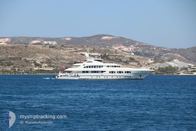
ODYSSEA
Yacht
Current Trip
| Trip Time | 1 day |
|---|---|
| Trip Distance | 237.29 nm |
| AVG Speed | 9.8 Knots |
| MAX Speed | 11.8 Knots |
| Dybgang | 3 m |
| AVG Wind | 12.3 knots |
| MAX Wind | 19.3 knots |
| MIN Temp | 22.6°C / 72.68°F |
| MAX Temp | 34.3°C / 93.74°F |
| Position Modtaget | 1 m siden |
Current Position
| Longitude | -74.00996° |
|---|---|
| Latitude | 40.74844° |
| Status | Under way using engine |
| Fart | |
| Kurs | 279° |
| Område | North Atlantic Ocean |
| Station | T-AIS |
| Position Modtaget | 1 m siden |
Info
Information
The current position of ODYSSEA is in North Atlantic Ocean with coordinates 40.74844° / -74.00996° as reported on 2024-06-24 12:03 by AIS to our vessel tracker app. The vessel's current speed is 0 Knots and is currently inside the port of NEW YORK.
The vessel ODYSSEA (IMO: 1011264, MMSI: 319143700) is a Yacht that was built in 2012 ( 12 år gamle ). It's sailing under the flag of [KY] Cayman Is.
In this page you can find informations about the vessels current position, last detected port calls, and current voyage information. If the vessels is not in coverage by AIS you will find the latest position.
The current position of ODYSSEA is detected by our AIS receivers and we are not responsible for the reliability of the data. The last position was recorded while the vessel was in Coverage by the Ais receivers of our vessel tracking app.
The current draught of ODYSSEA as reported by AIS is 3 meters
Weather
| Temperature | 22.9°C / 73.22°F |
|---|---|
| Wind Speed | 13 knots |
| Direction | 303° WNW |
| Pressure | 1003.9 hPa |
| Humidity | 58.3 % |
| Cloud Coverage | 77 % |
Featured Company
Last Port Calls
| Port | Arrival | Departure | Time In Port |
|---|---|---|---|
| 2024-06-23 15:32 | |||
| 2024-06-21 14:09 | 2024-06-22 14:43 | 1 d | |
| 2024-06-19 16:13 | 2024-06-20 11:12 | 18 h | |
| 2024-05-12 16:20 | 2024-06-02 18:16 | 21 d | |
| 2024-04-29 18:57 | 2024-04-29 19:07 | 9 m | |
| 2024-04-19 15:00 | 2024-04-29 18:49 | 10 d | |
| 2024-04-19 14:14 |
Most Visited Ports (Last year)
| Port | Arrivals | |
|---|---|---|
| 2 | ||
| 2 | ||
| 1 | ||
| 1 | ||
| 1 | ||
| 1 |
Last Trips
| Origin | Departure | Destination | Arrival | Distance | |
|---|---|---|---|---|---|
| 2024-06-22 10:43 | 2024-06-23 11:32 | 237.29 nm | |||
| 2024-06-20 07:12 | 2024-06-21 10:09 | 58.41 nm | |||
| 2024-06-02 14:16 | 2024-06-19 12:13 | 958.17 nm | |||
| 2024-04-29 15:07 | 2024-05-12 12:20 | 566.23 nm | |||
| 2024-04-29 14:49 | 2024-04-29 14:57 | 0.61 nm | |||
| 2024-04-19 10:14 | 2024-04-19 11:00 | 5.86 nm |
Events
| Tid | Hændelsen | Detaljer | Position / Dest | Info |
|---|---|---|---|---|
| 2024-06-23 16:33 | STOP Sejllads |
40.74863 / -74.01182
[US] NEW YORK
|
Fart: Kurs: 23° |
|
| 2024-06-23 15:32 | Skibe i havn |
|
40.57908 / -74.03422
[US] NEW YORK
|
Fart: 10.5 kn Kurs: 330.8° |
| 2024-06-23 15:30 | START Sejllads | 6.32 nm, South of NEW YORK |
40.57183 / -74.02859
NY
|
Fart: 7.2 kn Kurs: 331.7° |
| 2024-06-23 15:27 | STOP Sejllads | 6.33 nm, North of FORT HANCOCK |
40.56994 / -74.02830
NY
|
Fart: 0.2 kn Kurs: 23° |
| 2024-06-23 12:22 | Indenfor Dækning |
40.14731 / -73.74994
North Atlantic Ocean
NY
|
Fart: 11.7 kn Kurs: 358° |
|
| 2024-06-23 09:36 | Udenfor Dækning |
39.63735 / -73.72795
North Atlantic Ocean
NY
|
Fart: 10.5 kn Kurs: 51.2° |
|
| 2024-06-23 07:02 | Indenfor Dækning |
39.33738 / -74.17312
North Atlantic Ocean
NY
|
Fart: 10.9 kn Kurs: 45° |
|
| 2024-06-23 03:47 | Udenfor Dækning |
39.00805 / -74.65896
North Atlantic Ocean
NY
|
Fart: 9.2 kn Kurs: 45° |
|
| 2024-06-23 01:56 | Destination er ændret | NY CHESTERTOWN |
38.81481 / -74.91900
NY
|
Fart: 11.2 kn Kurs: 77.7° |
| 2024-06-23 01:56 | ETA er ændret | 2024/06/24 00:00 2024/06/18 00:00 |
38.81481 / -74.91900
NY
|
Fart: 11.2 kn Kurs: 77.7° |