
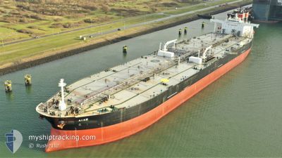
OCEANUS
Crude Oil Tanker
Current Trip
| Time Travelled | --- |
|---|---|
| Remaining Time | --- |
| Distance Travelled | 7253.64 nm |
| Remaining Distance | --- |
| AVG Speed | 11.4 Knots |
| MAX Speed | 11.4 Knots |
| AVG Wind | 11.8 knots |
| MAX Wind | 27 knots |
| MIN Temp | 18.4°C / 65.12°F |
| MAX Temp | 29°C / 84.2°F |
| Dybgang | 15.4 m |
| Position Modtaget | 4 d siden |
Current Position
| Longitude | --- |
|---|---|
| Latitude | --- |
| Status | Under way using engine |
| Fart | 9.7 Knots |
| Kurs | 16.9° |
| Område | North Atlantic Ocean |
| Station | T-AIS |
| Position Modtaget | 4 d siden |
Info
Information
The current position of OCEANUS is in North Atlantic Ocean with coordinates 28.52275° / -14.77062° as reported on 2025-03-10 14:17 by AIS to our vessel tracker app. The vessel's current speed is 9.7 Knots and is heading at the port of ANTIFER. The estimated time of arrival as calculated by MyShipTracking vessel tracking app is 2025-03-15 22:00 LT
The vessel OCEANUS (IMO: 9337004, MMSI: 538009252) is a Crude Oil Tanker that was built in 2008 ( 17 år gamle ). It's sailing under the flag of [MH] Marshall Is.
In this page you can find informations about the vessels current position, last detected port calls, and current voyage information. If the vessels is not in coverage by AIS you will find the latest position.
The current position of OCEANUS is detected by our AIS receivers and we are not responsible for the reliability of the data. The last position was recorded while the vessel was in Coverage by the Ais receivers of our vessel tracking app.
The current draught of OCEANUS as reported by AIS is 15.4 meters
Weather
| Temperature | 8.4°C / 47.12°F |
|---|---|
| Wind Speed | 13 knots |
| Direction | 43° NE |
| Pressure | 1018.4 hPa |
| Humidity | 67.8 % |
| Cloud Coverage | 66 % |
Featured Company
Last Port Calls
Last Trips
| Origin | Departure | Destination | Arrival | Distance |
|---|
Events
| Tid | Hændelsen | Detaljer | Position / Dest | Info |
|---|---|---|---|---|
| 2025-03-10 14:34 | Status er ændret | Default Under way using engine |
28.56661 / -14.75815
ANTIFER
|
Fart: 9.7 kn Kurs: 16.9° |
| 2025-03-10 14:17 | Status er ændret | Under way using engine Default |
28.52275 / -14.77062
ANTIFER
|
Fart: 9.6 kn Kurs: 17° |
| 2025-03-10 14:17 | Udenfor Dækning |
28.52275 / -14.77062
North Atlantic Ocean
ANTIFER
|
Fart: 9.7 kn Kurs: 16.9° |
|
| 2025-03-10 14:14 | Status er ændret | Default Under way using engine |
28.51404 / -14.77344
ANTIFER
|
Fart: 9.3 kn Kurs: 17.4° |
| 2025-03-10 14:08 | Status er ændret | Under way using engine Default |
28.49990 / -14.77845
ANTIFER
|
Fart: 9.7 kn Kurs: 15° |
| 2025-03-10 13:56 | Status er ændret | Default Under way using engine |
28.46545 / -14.78846
ANTIFER
|
Fart: 10.1 kn Kurs: 17.5° |
| 2025-03-10 13:48 | Status er ændret | Under way using engine Default |
28.44557 / -14.79467
ANTIFER
|
Fart: 9.8 kn Kurs: 15° |
| 2025-03-10 13:48 | Status er ændret | Default Under way using engine |
28.44340 / -14.79531
ANTIFER
|
Fart: 9.3 kn Kurs: 15.4° |
| 2025-03-10 13:25 | Status er ændret | Under way using engine Default |
28.38596 / -14.81343
ANTIFER
|
Fart: 10.3 kn Kurs: 17° |
| 2025-03-10 13:23 | Status er ændret | Default Under way using engine |
28.38098 / -14.81515
ANTIFER
|
Fart: 10.3 kn Kurs: 15.6° |