

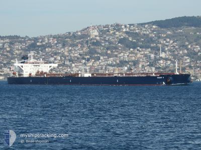
OCEAN II
Crude Oil Tanker

Current Trip
ARMED GUARDS ONBOARD
| Time Travelled | 18 days |
|---|---|
| Remaining Time | --- |
| Distance Travelled | 3939.34 nm |
| Remaining Distance | --- |
| AVG Speed | 11.4 Knots |
| MAX Speed | 14 Knots |
| AVG Wind | 11.7 knots |
| MAX Wind | 28.2 knots |
| MIN Temp | 8.4°C / 47.12°F |
| MAX Temp | 29.8°C / 85.64°F |
| Dybgang | 16.7 m |
| Position Modtaget | 5 d siden |
Current Position
| Longitude | --- |
|---|---|
| Latitude | --- |
| Status | Under way using engine |
| Fart | 12.5 Knots |
| Kurs | 154.1° |
| Område | Red Sea |
| Station | T-AIS |
| Position Modtaget | 5 d siden |
Information
The current position of OCEAN II is in Red Sea with coordinates 13.11802° / 43.07168° as reported on 2025-03-22 12:57 by AIS to our vessel tracker app. The vessel's current speed is 12.5 Knots
The vessel OCEAN II (IMO: 9233777, MMSI: 305203000) is a Crude Oil Tanker that was built in 2003 ( 22 år gamle ). It's sailing under the flag of [AG] Antigua Barbuda.
In this page you can find informations about the vessels current position, last detected port calls, and current voyage information. If the vessels is not in coverage by AIS you will find the latest position.
The current position of OCEAN II is detected by our AIS receivers and we are not responsible for the reliability of the data. The last position was recorded while the vessel was in Coverage by the Ais receivers of our vessel tracking app.
The current draught of OCEAN II as reported by AIS is 16.7 meters
Weather
| Temperature | 25.8°C / 78.44°F |
|---|---|
| Wind Speed | 11 knots |
| Direction | 339° NNW |
| Pressure | 1010.8 hPa |
| Humidity | 53.6 % |
| Cloud Coverage | 69 % |


Featured Company
Last Port Calls
| Port | Arrival | Departure | Time In Port |
|---|---|---|---|
| 2025-03-18 07:25 | 2025-03-18 17:16 | 9 h | |
| 2025-03-07 18:22 | 2025-03-09 08:01 | 1 d | |
| 2025-02-16 11:43 | 2025-02-16 20:45 | 9 h | |
| 2025-01-22 10:28 | 2025-01-22 20:07 | 9 h | |
| 2025-01-08 06:57 | 2025-01-09 09:44 | 1 d |
Most Visited Ports (Last year)
| Port | Arrivals | |
|---|---|---|
| 5 | ||
| 2 | ||
| 1 |
Last Trips
| Origin | Departure | Destination | Arrival | Distance | |
|---|---|---|---|---|---|
| 2025-03-09 08:01 | 2025-03-18 07:25 | 1290.05 nm | |||
| 2025-01-09 09:44 | 2025-03-07 18:22 | 5622.95 nm | |||
| 2025-01-09 09:44 | 2025-02-16 11:43 | 7797.68 nm | |||
| 2025-01-09 09:44 | 2025-01-22 10:28 | 1463.46 nm | |||
| 2024-12-18 17:08 | 2025-01-08 06:57 | 911.76 nm |
Events
| Tid | Hændelsen | Detaljer | Position / Dest | Info |
|---|---|---|---|---|
| 2025-03-22 13:36 | Status er ændret | Default Under way using engine |
12.99193 / 43.13341
ARMED GUARDS ONBOARD
|
Fart: 12.5 kn Kurs: 154.1° |
| 2025-03-22 12:57 | Udenfor Dækning |
13.11802 / 43.07168
Red Sea
ARMED GUARDS ONBOARD
|
Fart: 12.5 kn Kurs: 154.1° |
|
| 2025-03-22 12:56 | Status er ændret | Under way using engine Default |
13.12332 / 43.06908
ARMED GUARDS ONBOARD
|
Fart: 12.4 kn Kurs: 150° |
| 2025-03-22 12:23 | Status er ændret | Default Under way using engine |
13.22197 / 43.01346
ARMED GUARDS ONBOARD
|
Fart: 13.1 kn Kurs: 123.1° |
| 2025-03-22 09:56 | Ændre havområde | Eritrean part of the Red Sea Sudanese part of the Red Sea |
13.53716 / 42.56944
Red Sea
ARMED GUARDS ONBOARD
|
Fart: 13.2 kn Kurs: 156.8° |
| 2025-03-22 09:56 | Status er ændret | Under way using engine Default |
13.53716 / 42.56944
ARMED GUARDS ONBOARD
|
Fart: 13 kn Kurs: 156° |
| 2025-03-22 09:49 | Indenfor Dækning |
13.53716 / 42.56944
Red Sea
ARMED GUARDS ONBOARD
|
Fart: 13.2 kn Kurs: 156.8° |
|
| 2025-03-20 18:38 | Status er ændret | Default Under way using engine |
20.63411 / 38.25343
ARMED GUARDS ONBOARD
|
Fart: 12.6 kn Kurs: 153.7° |
| 2025-03-20 18:33 | Status er ændret | Under way using engine Default |
20.64837 / 38.24592
ARMED GUARDS ONBOARD
|
Fart: 12.5 kn Kurs: 154° |
| 2025-03-20 18:33 | Udenfor Dækning |
20.64837 / 38.24592
Red Sea
ARMED GUARDS ONBOARD
|
Fart: 12.6 kn Kurs: 153.7° |