
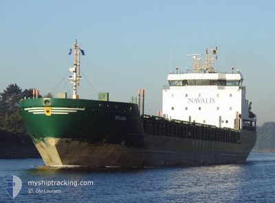
NYLAND
General Cargo
Current Trip
| Time Travelled | 1 day |
|---|---|
| Remaining Time | --- |
| Distance Travelled | 374.55 nm |
| Remaining Distance | --- |
| AVG Speed | 9.6 Knots |
| MAX Speed | 10.8 Knots |
| AVG Wind | 11.6 knots |
| MAX Wind | 19.4 knots |
| MIN Temp | -7°C / 19.4°F |
| MAX Temp | -0.6°C / 30.92°F |
| Dybgang | 6.4 m |
| Position Modtaget | 14 h, 47 m siden |
Current Position
| Longitude | --- |
|---|---|
| Latitude | --- |
| Status | Under way using engine |
| Fart | 9.2 Knots |
| Kurs | 341.6° |
| Område | Gulf of Bothnia |
| Station | T-AIS |
| Position Modtaget | 14 h, 47 m siden |
Info
Information
The current position of NYLAND is in Gulf of Bothnia with coordinates 60.22132° / 19.06994° as reported on 2025-02-17 08:03 by AIS to our vessel tracker app. The vessel's current speed is 9.2 Knots and is heading at the port of HUSUM. The estimated time of arrival as calculated by MyShipTracking vessel tracking app is 2025-02-18 01:00 LT
The vessel NYLAND (IMO: 9436240, MMSI: 210438000) is a General Cargo that was built in 2009 ( 16 år gamle ). It's sailing under the flag of [CY] Cyprus.
In this page you can find informations about the vessels current position, last detected port calls, and current voyage information. If the vessels is not in coverage by AIS you will find the latest position.
The current position of NYLAND is detected by our AIS receivers and we are not responsible for the reliability of the data. The last position was recorded while the vessel was in Coverage by the Ais receivers of our vessel tracking app.
The current draught of NYLAND as reported by AIS is 6.4 meters
Weather
| Temperature | -1.9°C / 28.58°F |
|---|---|
| Wind Speed | 10 knots |
| Direction | 314° NW |
| Pressure | 1018 hPa |
| Humidity | 70.1 % |
| Cloud Coverage | 13 % |
Featured Company
Last Port Calls
| Port | Arrival | Departure | Time In Port |
|---|---|---|---|
| 2025-02-15 06:56 | 2025-02-16 09:26 | 1 d | |
| 2025-02-13 22:24 | 2025-02-13 23:08 | 44 m | |
| 2025-02-10 04:35 | 2025-02-13 15:01 | 3 d | |
| 2025-02-09 21:21 | 2025-02-09 21:52 | 31 m | |
| 2025-02-03 17:45 | 2025-02-05 08:21 | 1 d | |
| 2025-01-29 16:02 | 2025-01-31 12:31 | 1 d | |
| 2025-01-26 10:07 | 2025-01-28 20:50 | 2 d | |
| 2025-01-22 07:17 | 2025-01-23 00:21 | 17 h | |
| 2025-01-20 08:17 | 2025-01-21 16:29 | 1 d | |
| 2025-01-14 03:01 | 2025-01-15 23:49 | 1 d |
Most Visited Ports (Last year)
| Port | Arrivals | |
|---|---|---|
| 14 | ||
| 11 | ||
| 6 | ||
| 5 | ||
| 4 | ||
| 4 |
Last Trips
| Origin | Departure | Destination | Arrival | Distance | |
|---|---|---|---|---|---|
| 2025-02-13 23:08 | 2025-02-15 06:56 | 314.43 nm | |||
| 2025-02-13 15:01 | 2025-02-13 22:24 | 65.42 nm | |||
| 2025-02-09 21:52 | 2025-02-10 04:35 | 65.89 nm | |||
| 2025-02-05 08:21 | 2025-02-09 21:21 | 787.64 nm | |||
| 2025-01-31 12:31 | 2025-02-03 17:45 | 763.52 nm | |||
| 2025-01-28 20:50 | 2025-01-29 16:02 | 208.81 nm | |||
| 2025-01-23 00:21 | 2025-01-26 10:07 | 719.46 nm | |||
| 2025-01-21 16:29 | 2025-01-22 07:17 | 130.40 nm | |||
| 2025-01-15 23:49 | 2025-01-20 08:17 | 666.89 nm | |||
| 2025-01-12 08:00 | 2025-01-14 03:01 | 405.45 nm |
Events
| Tid | Hændelsen | Detaljer | Position / Dest | Info |
|---|---|---|---|---|
| 2025-02-17 08:09 | Status er ændret | Default Under way using engine |
60.23675 / 19.05988
HUSUM PEC 52 288
|
Fart: 9.2 kn Kurs: 341.6° |
| 2025-02-17 08:03 | Udenfor Dækning |
60.22132 / 19.06994
Gulf of Bothnia
HUSUM PEC 52 288
|
Fart: 9.2 kn Kurs: 341.6° |
|
| 2025-02-17 07:58 | Ændre havområde | Swedish part of the Gulf of Bothnia Finnish part of the Gulf of Bothnia |
60.20865 / 19.07880
Gulf of Bothnia
HUSUM PEC 52 288
|
Fart: 9.5 kn Kurs: 341.2° |
| 2025-02-17 07:58 | Status er ændret | Under way using engine Default |
60.20765 / 19.07952
HUSUM PEC 52 288
|
Fart: 9.5 kn Kurs: 333° |
| 2025-02-17 07:41 | Status er ændret | Default Under way using engine |
60.17272 / 19.12722
HUSUM PEC 52 288
|
Fart: 9 kn Kurs: 319.9° |
| 2025-02-17 04:30 | Ændre havområde | Finnish part of the Gulf of Bothnia Finnish part of the Baltic Sea |
59.78306 / 19.81311
Gulf of Bothnia
HUSUM PEC 52 288
|
Fart: 10 kn Kurs: 272.3° |
| 2025-02-17 04:30 | Indenfor Dækning |
59.78306 / 19.81311
Gulf of Bothnia
HUSUM PEC 52 288
|
Fart: 10 kn Kurs: 272.3° |
|
| 2025-02-17 04:27 | Status er ændret | Under way using engine Default |
59.78250 / 19.82951
HUSUM PEC 52 288
|
Fart: 10 kn Kurs: 274° |
| 2025-02-16 20:41 | Status er ændret | Default Under way using engine |
59.58017 / 22.29748
HUSUM PEC 52 288
|
Fart: 10.5 kn Kurs: 266.1° |
| 2025-02-16 20:34 | Udenfor Dækning |
59.58149 / 22.34022
Baltic Sea
HUSUM PEC 52 288
|
Fart: 10.5 kn Kurs: 266.1° |