
NSU RESPONSIBILITY
Cargo
Current Trip
| Trip Time | 6 days |
|---|---|
| Trip Distance | 932.73 nm |
| AVG Speed | 11.2 Knots |
| MAX Speed | 17.5 Knots |
| Dybgang | 10.6 m |
| AVG Wind | 8.8 knots |
| MAX Wind | 26.6 knots |
| MIN Temp | 0.9°C / 33.62°F |
| MAX Temp | 15.6°C / 60.08°F |
| Position Modtaget | 1 d siden |
Current Position
| Longitude | --- |
|---|---|
| Latitude | --- |
| Status | Under way using engine |
| Fart | 14.6 Knots |
| Kurs | 17.3° |
| Område | North Pacific Ocean |
| Station | T-AIS |
| Position Modtaget | 1 d siden |
Info
Information
The current position of NSU RESPONSIBILITY is in North Pacific Ocean with coordinates 35.73983° / 141.27255° as reported on 2025-02-16 08:22 by AIS to our vessel tracker app. The vessel's current speed is 14.6 Knots and is currently inside the port of KAMAISHI.
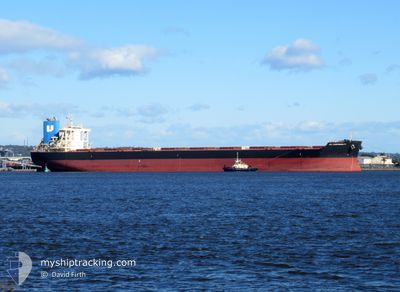
The vessel NSU RESPONSIBILITY (IMO: 9738856, MMSI: 431846000) is a Cargo It's sailing under the flag of [JP] Japan.
In this page you can find informations about the vessels current position, last detected port calls, and current voyage information. If the vessels is not in coverage by AIS you will find the latest position.
The current position of NSU RESPONSIBILITY is detected by our AIS receivers and we are not responsible for the reliability of the data. The last position was recorded while the vessel was in Coverage by the Ais receivers of our vessel tracking app.
The current draught of NSU RESPONSIBILITY as reported by AIS is 10.6 meters
Weather
| Temperature | -0.7°C / 30.74°F |
|---|---|
| Wind Speed | 16 knots |
| Direction | 288° WNW |
| Pressure | 1006.9 hPa |
| Humidity | 54.2 % |
| Cloud Coverage | --- |
Featured Company
Last Port Calls
| Port | Arrival | Departure | Time In Port |
|---|---|---|---|
| 2025-02-17 04:19 | |||
| 2025-02-09 00:37 | 2025-02-11 01:57 | 2 d | |
| 2025-02-08 05:29 | 2025-02-08 23:45 | 18 h | |
| 2025-01-21 23:22 | 2025-01-23 05:54 | 1 d | |
| 2025-01-03 21:57 | 2025-01-05 10:01 | 1 d | |
| 2024-12-31 20:23 | 2025-01-02 02:53 | 1 d | |
| 2024-12-25 13:34 | 2024-12-28 22:20 | 3 d |
Last Trips
| Origin | Departure | Destination | Arrival | Distance | |
|---|---|---|---|---|---|
| 2025-02-11 10:57 | 2025-02-17 13:19 | 932.73 nm | |||
| 2025-02-09 08:45 | 2025-02-09 09:37 | 5.79 nm | |||
| 2025-01-23 16:54 | 2025-02-08 14:29 | 4373.04 nm | |||
| 2025-01-05 19:01 | 2025-01-22 10:22 | 4606.77 nm | |||
| 2025-01-02 11:53 | 2025-01-04 06:57 | 392.16 nm | |||
| 2024-12-29 07:20 | 2025-01-01 05:23 | 233.30 nm | |||
| 2024-09-30 03:35 | 2024-12-25 22:34 | 14420.10 nm |
Events
| Tid | Hændelsen | Detaljer | Position / Dest | Info |
|---|---|---|---|---|
| 2025-02-17 04:19 | Skibe i havn |
|
39.25841 / 141.92194
[JP] KAMAISHI
|
Fart: 8.2 kn Kurs: 252° |
| 2025-02-17 01:13 | START Sejllads | 14.34 nm, South East of KAMAISHI |
39.08873 / 142.12384
JP KIS
|
Fart: 3.1 kn Kurs: 359° |
| 2025-02-17 00:59 | STOP Sejllads | 14.69 nm, South East of KAMAISHI |
39.08482 / 142.12944
JP KIS
|
Fart: 0.3 kn Kurs: 298° |
| 2025-02-16 08:34 | Status er ændret | Default Under way using engine |
35.78373 / 141.29097
JP KIS
|
Fart: 14.6 kn Kurs: 17.3° |
| 2025-02-16 08:22 | Udenfor Dækning |
35.73983 / 141.27255
North Pacific Ocean
JP KIS
|
Fart: 14.6 kn Kurs: 17.3° |
|
| 2025-02-16 08:16 | Status er ændret | Under way using engine Default |
35.71258 / 141.26188
JP KIS
|
Fart: 16.2 kn Kurs: 16° |
| 2025-02-16 07:53 | Status er ændret | Default Under way using engine |
35.61556 / 141.22659
JP KIS
|
Fart: 14.5 kn Kurs: 18.3° |
| 2025-02-16 01:17 | Fundet i havområde | Japanese part of the North Pacific Ocean |
34.31912 / 140.01892
North Pacific Ocean
JP KIS
|
Fart: 14.4 kn Kurs: 21.7° |
| 2025-02-16 01:15 | Status er ændret | Under way using engine Default |
34.31246 / 140.01572
JP KIS
|
Fart: 16 kn Kurs: 17° |
| 2025-02-16 01:15 | Indenfor Dækning |
34.31912 / 140.01892
North Pacific Ocean
JP KIS
|
Fart: 14.4 kn Kurs: 21.7° |