
NQ MILLA
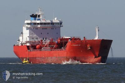
Oil/Chemical Tanker
Current Trip
USPAB!
| Time Travelled | 5 days |
|---|---|
| Remaining Time | --- |
| Distance Travelled | 1650.60 nm |
| Remaining Distance | --- |
| AVG Speed | 11.9 Knots |
| MAX Speed | 13 Knots |
| AVG Wind | 13.2 knots |
| MAX Wind | 21 knots |
| MIN Temp | 20°C / 68°F |
| MAX Temp | 24.4°C / 75.92°F |
| Dybgang | 6 m |
| Position Modtaget | 7 d siden |
Current Position
| Longitude | --- |
|---|---|
| Latitude | --- |
| Status | Moored |
| Fart | 0.1 Knots |
| Kurs | 265° |
| Område | North Atlantic Ocean |
| Station | T-AIS |
| Position Modtaget | 7 d siden |
Info
Information
The current position of NQ MILLA is in North Atlantic Ocean with coordinates 26.76637° / -80.05115° as reported on 2025-12-27 02:29 by AIS to our vessel tracker app. The vessel's current speed is 0.1 Knots
The vessel NQ MILLA (IMO: 9261516, MMSI: 229545000) is a Oil/Chemical Tanker that was built in 2003 ( 23 år gamle ). It's sailing under the flag of [MT] Malta.
In this page you can find informations about the vessels current position, last detected port calls, and current voyage information. If the vessels is not in coverage by AIS you will find the latest position.
The current position of NQ MILLA is detected by our AIS receivers and we are not responsible for the reliability of the data. The last position was recorded while the vessel was in Coverage by the Ais receivers of our vessel tracking app.
The current draught of NQ MILLA as reported by AIS is 6 meters
Weather
| Temperature | 20.4°C / 68.72°F |
|---|---|
| Wind Speed | 13 knots |
| Direction | 231° SW |
| Pressure | 1016.7 hPa |
| Humidity | 74.4 % |
| Cloud Coverage | 75 % |
Featured Company
Last Port Calls
| Port | Arrival | Departure | Time In Port |
|---|---|---|---|
| 2025-12-25 07:15 | 2025-12-28 15:21 | 3 d | |
| 2025-12-04 06:36 | 2025-12-05 16:49 | 1 d | |
| 2025-11-30 19:09 | 2025-12-02 13:56 | 1 d | |
| 2025-11-24 22:32 | 2025-11-27 09:05 | 2 d | |
| 2025-11-18 13:43 | 2025-11-21 04:18 | 2 d | |
| 2025-11-17 09:47 | 2025-11-18 12:04 | 1 d |
Last Trips
| Origin | Departure | Destination | Arrival | Distance | |
|---|---|---|---|---|---|
| 2025-12-05 16:49 | 2025-12-25 07:15 | 4414.79 nm | |||
| 2025-12-02 13:56 | 2025-12-04 06:36 | 62.62 nm | |||
| 2025-11-27 09:05 | 2025-11-30 19:09 | 981.45 nm | |||
| 2025-11-21 04:18 | 2025-11-24 22:32 | 1007.32 nm | |||
| 2025-11-18 12:04 | 2025-11-18 13:43 | 13.62 nm | |||
| 2025-10-25 10:49 | 2025-11-17 09:47 | 2599.33 nm |
Events
| Tid | Hændelsen | Detaljer | Position / Dest | Info |
|---|---|---|---|---|
| 2025-12-28 20:21 | Afsejlet fra sidste havn |
|
26.79860 / -79.94559
USPAB!
|
Fart: Kurs: 264° |
| 2025-12-27 02:29 | Udenfor Dækning |
26.76637 / -80.05115
North Atlantic Ocean
[US] PALM BEACH
|
Fart: 0.1 kn Kurs: 198.7° |
|
| 2025-12-27 00:05 | Status er ændret | Moored Default |
26.76638 / -80.05116
[US] PALM BEACH
|
Fart: 0.1 kn Kurs: 264° |
| 2025-12-26 23:59 | Status er ændret | Default Moored |
26.76637 / -80.05115
[US] PALM BEACH
|
Fart: 0.1 kn Kurs: 264° |
| 2025-12-26 23:35 | Status er ændret | Moored Default |
26.76639 / -80.05113
[US] PALM BEACH
|
Fart: 0.1 kn Kurs: 264° |
| 2025-12-26 23:05 | Status er ændret | Default Moored |
26.76636 / -80.05114
[US] PALM BEACH
|
Fart: 0.1 kn Kurs: 264° |
| 2025-12-26 21:38 | Status er ændret | Moored Default |
26.76634 / -80.05113
[US] PALM BEACH
|
Fart: 0.1 kn Kurs: 264° |
| 2025-12-26 21:38 | Indenfor Dækning |
26.76634 / -80.05113
North Atlantic Ocean
[US] PALM BEACH
|
Fart: 0.1 kn Kurs: 140.1° |
|
| 2025-12-26 20:05 | Udenfor Dækning |
26.76638 / -80.05114
North Atlantic Ocean
[US] PALM BEACH
|
Fart: Kurs: 101.7° |
|
| 2025-12-26 19:41 | Indenfor Dækning |
26.76636 / -80.05115
North Atlantic Ocean
[US] PALM BEACH
|
Fart: Kurs: 101.7° |