
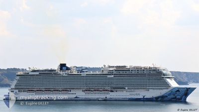
NORWEGIAN BLISS
Passenger
Current Trip
| Time Travelled | 19 h, 46 mins |
|---|---|
| Remaining Time | 23 h, 1 mins |
| Distance Travelled | 273.67 nm |
| Remaining Distance | 482.92 nm |
| AVG Speed | 13.7 Knots |
| MAX Speed | 16.7 Knots |
| AVG Wind | 13 knots |
| MAX Wind | 19.5 knots |
| MIN Temp | 23.9°C / 75.02°F |
| MAX Temp | 24.9°C / 76.82°F |
| Dybgang | 8.8 m |
| Position Modtaget | 9 h, 44 m siden |
Current Position
| Longitude | --- |
|---|---|
| Latitude | --- |
| Status | Under way using engine |
| Fart | 14.9 Knots |
| Kurs | 233.4° |
| Område | North Atlantic Ocean |
| Station | T-AIS |
| Position Modtaget | 9 h, 44 m siden |
Info
Information
The current position of NORWEGIAN BLISS is in North Atlantic Ocean with coordinates 24.19495° / -81.62317° as reported on 2025-02-16 07:34 by AIS to our vessel tracker app. The vessel's current speed is 14.9 Knots and is heading at the port of COSTA MAYA. The estimated time of arrival as calculated by MyShipTracking vessel tracking app is 2025-02-17 16:20 LT
The vessel NORWEGIAN BLISS (IMO: 9751509, MMSI: 311000710) is a Passenger It's sailing under the flag of [BS] Bahamas.
In this page you can find informations about the vessels current position, last detected port calls, and current voyage information. If the vessels is not in coverage by AIS you will find the latest position.
The current position of NORWEGIAN BLISS is detected by our AIS receivers and we are not responsible for the reliability of the data. The last position was recorded while the vessel was in Coverage by the Ais receivers of our vessel tracking app.
The current draught of NORWEGIAN BLISS as reported by AIS is 8.8 meters
Weather
| Temperature | 26.1°C / 78.98°F |
|---|---|
| Wind Speed | 2 knots |
| Direction | 307° NW |
| Pressure | 1016.2 hPa |
| Humidity | 71.3 % |
| Cloud Coverage | 74 % |
Featured Company
Last Port Calls
| Port | Arrival | Departure | Time In Port |
|---|---|---|---|
| 2025-02-15 09:37 | 2025-02-15 21:33 | 11 h | |
| 2025-02-06 06:59 | 2025-02-06 18:23 | 11 h | |
| 2025-02-05 07:49 | 2025-02-05 16:14 | 8 h | |
| 2025-02-03 03:52 | 2025-02-03 18:21 | 14 h | |
| 2025-02-02 03:51 | 2025-02-02 17:41 | 13 h | |
| 2025-01-18 14:29 | 2025-02-01 06:12 | 13 d | |
| 2025-01-17 03:47 | 2025-01-17 16:06 | 12 h | |
| 2025-01-16 07:25 | 2025-01-16 21:19 | 13 h | |
| 2025-01-14 10:08 | 2025-01-14 18:19 | 8 h | |
| 2025-01-13 07:31 | 2025-01-13 20:24 | 12 h |
Most Visited Ports (Last year)
| Port | Arrivals | |
|---|---|---|
| 30 | ||
| 30 | ||
| 29 | ||
| 14 | ||
| 11 | ||
| 10 |
Last Trips
| Origin | Departure | Destination | Arrival | Distance | |
|---|---|---|---|---|---|
| 2025-02-06 18:23 | 2025-02-15 04:37 | 3702.77 nm | |||
| 2025-02-05 17:14 | 2025-02-06 06:59 | 285.88 nm | |||
| 2025-02-03 19:21 | 2025-02-05 08:49 | 740.18 nm | |||
| 2025-02-02 17:41 | 2025-02-03 04:52 | 111.56 nm | |||
| 2025-02-01 07:12 | 2025-02-02 03:51 | 319.15 nm | |||
| 2025-01-17 16:06 | 2025-01-18 15:29 | 331.25 nm | |||
| 2025-01-16 22:19 | 2025-01-17 03:47 | 106.11 nm | |||
| 2025-01-14 19:19 | 2025-01-16 08:25 | 714.67 nm | |||
| 2025-01-13 20:24 | 2025-01-14 11:08 | 262.45 nm | |||
| 2025-01-04 16:51 | 2025-01-13 07:31 | 3824.63 nm |
Events
| Tid | Hændelsen | Detaljer | Position / Dest | Info |
|---|---|---|---|---|
| 2025-02-16 07:42 | Status er ændret | Default Under way using engine |
24.17516 / -81.65393
COSTA MAYA, MX
|
Fart: 14.9 kn Kurs: 233.4° |
| 2025-02-16 07:34 | Udenfor Dækning |
24.19495 / -81.62317
North Atlantic Ocean
COSTA MAYA, MX
|
Fart: 14.9 kn Kurs: 233.4° |
|
| 2025-02-16 07:33 | Status er ændret | Under way using engine Default |
24.19742 / -81.61953
COSTA MAYA, MX
|
Fart: 14.9 kn Kurs: 234° |
| 2025-02-16 07:30 | Status er ændret | Default Under way using engine |
24.20484 / -81.60861
COSTA MAYA, MX
|
Fart: 14.8 kn Kurs: 236.2° |
| 2025-02-16 07:13 | Status er ændret | Under way using engine Default |
24.24182 / -81.54648
COSTA MAYA, MX
|
Fart: 14.8 kn Kurs: 250° |
| 2025-02-16 06:54 | Status er ændret | Default Under way using engine |
24.26758 / -81.46591
COSTA MAYA, MX
|
Fart: 14.7 kn Kurs: 239.9° |
| 2025-02-16 06:44 | Status er ændret | Under way using engine Default |
24.28678 / -81.42231
COSTA MAYA, MX
|
Fart: 14.9 kn Kurs: 240° |
| 2025-02-16 06:44 | Indenfor Dækning |
24.28678 / -81.42231
North Atlantic Ocean
COSTA MAYA, MX
|
Fart: 14.7 kn Kurs: 239.9° |
|
| 2025-02-16 04:06 | Status er ændret | Default Under way using engine |
24.59602 / -80.80289
COSTA MAYA, MX
|
Fart: 14.3 kn Kurs: 240.6° |
| 2025-02-16 04:02 | Udenfor Dækning |
24.60490 / -80.78585
North Atlantic Ocean
COSTA MAYA, MX
|
Fart: 14.3 kn Kurs: 240.6° |