
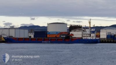
BONA STAR
General Cargo
Current Trip
| Time Travelled | 1 day |
|---|---|
| Remaining Time | --- |
| Distance Travelled | 311.38 nm |
| Remaining Distance | --- |
| AVG Speed | 10.7 Knots |
| MAX Speed | 12.3 Knots |
| AVG Wind | 3.4 knots |
| MAX Wind | 8.3 knots |
| MIN Temp | 1.8°C / 35.24°F |
| MAX Temp | 8.2°C / 46.76°F |
| Dybgang | 3.7 m |
| Position Modtaget | 4 h, 27 m siden |
Current Position
| Longitude | 9.79458° |
|---|---|
| Latitude | 64.03032° |
| Status | Under way using engine |
| Fart | 10.3 Knots |
| Kurs | 14.5° |
| Område | Norwegian Sea |
| Station | T-AIS |
| Position Modtaget | 4 h, 27 m siden |
Info
Information
The current position of BONA STAR is in Norwegian Sea with coordinates 64.03032° / 9.79458° as reported on 2024-04-26 14:07 by AIS to our vessel tracker app. The vessel's current speed is 10.3 Knots
The vessel BONA STAR (IMO: 9007075, MMSI: 258829000) is a General Cargo that was built in 1991 ( 33 år gamle ). It's sailing under the flag of [NO] Norway.
In this page you can find informations about the vessels current position, last detected port calls, and current voyage information. If the vessels is not in coverage by AIS you will find the latest position.
The current position of BONA STAR is detected by our AIS receivers and we are not responsible for the reliability of the data. The last position was recorded while the vessel was in Coverage by the Ais receivers of our vessel tracking app.
The current draught of BONA STAR as reported by AIS is 3.7 meters
Weather
| Temperature | 7.1°C / 44.78°F |
|---|---|
| Wind Speed | 7 knots |
| Direction | 119° ESE |
| Pressure | 1011.1 hPa |
| Humidity | 49.9 % |
| Cloud Coverage | 81 % |
Featured Company
Last Port Calls
| Port | Arrival | Departure | Time In Port |
|---|---|---|---|
| 2024-04-23 21:39 | 2024-04-25 06:13 | 1 d | |
| 2024-04-22 15:39 | 2024-04-23 13:56 | 22 h | |
| 2024-04-20 08:46 | 2024-04-21 12:40 | 1 d | |
| 2024-04-12 06:17 | 2024-04-15 00:18 | 2 d | |
| 2024-04-06 11:52 | 2024-04-07 13:13 | 1 d | |
| 2024-03-31 21:15 | 2024-04-02 20:50 | 1 d | |
| 2024-03-26 08:19 | 2024-03-27 15:45 | 1 d | |
| 2024-03-11 11:20 | 2024-03-19 07:20 | 7 d | |
| 2024-03-11 08:49 | 2024-03-11 11:03 | 2 h | |
| 2024-03-04 13:12 | 2024-03-05 19:13 | 1 d |
Most Visited Ports (Last year)
| Port | Arrivals | |
|---|---|---|
| 23 | ||
| 4 | ||
| 4 | ||
| 3 | ||
| 2 | ||
| 2 |
Last Trips
| Origin | Departure | Destination | Arrival | Distance | |
|---|---|---|---|---|---|
| 2024-04-23 15:56 | 2024-04-23 23:39 | 74.68 nm | |||
| 2024-04-21 14:40 | 2024-04-22 17:39 | 2.75 nm | |||
| 2024-04-15 02:18 | 2024-04-20 10:46 | 517.78 nm | |||
| 2024-04-07 15:13 | 2024-04-12 08:17 | 528.04 nm | |||
| 2024-04-02 22:50 | 2024-04-06 13:52 | 484.80 nm | |||
| 2024-03-27 16:45 | 2024-03-31 23:15 | 173.39 nm | |||
| 2024-03-19 08:20 | 2024-03-26 09:19 | 246.21 nm | |||
| 2024-03-11 12:03 | 2024-03-11 12:20 | 1.69 nm | |||
| 2024-03-05 20:13 | 2024-03-11 09:49 | 335.96 nm | |||
| 2024-03-03 20:46 | 2024-03-04 14:12 | 178.96 nm |
Events
| Tid | Hændelsen | Detaljer | Position / Dest | Info |
|---|---|---|---|---|
| 2024-04-26 16:46 | STOP Sejllads | 0.59 nm, South of SANDVIKSBERGET |
64.31267 / 10.44115
SANDVIKSBERGET ANCH
|
Fart: 0.3 kn Kurs: 25° |
| 2024-04-26 14:12 | Status er ændret | Default Under way using engine |
64.04243 / 9.80803
SANDVIKSBERGET ANCH
|
Fart: 10.3 kn Kurs: 14.5° |
| 2024-04-26 14:07 | Udenfor Dækning |
64.03032 / 9.79458
Norwegian Sea
SANDVIKSBERGET ANCH
|
Fart: 10.3 kn Kurs: 14.5° |
|
| 2024-04-26 11:46 | START Sejllads | 4.92 nm, South West of UTHAUG |
63.66894 / 9.45662
SANDVIKSBERGET ANCH
|
Fart: 3.1 kn Kurs: 28° |
| 2024-04-26 10:43 | STOP Sejllads | 4.96 nm, South West of UTHAUG |
63.66525 / 9.46314
SANDVIKSBERGET ANCH
|
Fart: 0.3 kn Kurs: 22° |
| 2024-04-25 20:55 | ETA er ændret | 2024/04/26 18:00 2024/04/26 16:00 |
62.25068 / 5.25117
SANDVIKSBERGET ANCH
|
Fart: 11.1 kn Kurs: 58.7° |
| 2024-04-25 18:51 | START Sejllads | 0.18 nm, East of MALOY |
61.93431 / 5.12599
SANDVIKSBERGET ANCH
|
Fart: 4.9 kn Kurs: 30° |
| 2024-04-25 18:43 | Destination er ændret | SANDVIKSBERGET ANCH MAALOEY |
61.93229 / 5.12682
SANDVIKSBERGET ANCH
|
Fart: Kurs: 203° |
| 2024-04-25 18:43 | ETA er ændret | 2024/04/26 16:00 2024/04/25 18:00 |
61.93229 / 5.12682
SANDVIKSBERGET ANCH
|
Fart: Kurs: 203° |
| 2024-04-25 18:42 | Status er ændret | Under way using engine Moored |
61.93229 / 5.12682
MAALOEY
|
Fart: Kurs: 203° |