
NORHEIM
General Cargo
Current Trip
| Time Travelled | 2 days |
|---|---|
| Remaining Time | 17 h, 48 mins |
| Distance Travelled | 338.64 nm |
| Remaining Distance | 190.57 nm |
| AVG Speed | 9.9 Knots |
| MAX Speed | 12 Knots |
| AVG Wind | 13.5 knots |
| MAX Wind | 20.9 knots |
| MIN Temp | -4.8°C / 23.36°F |
| MAX Temp | 1.3°C / 34.34°F |
| Dybgang | 6.3 m |
| Position Modtaget | Nu |
Current Position
| Longitude | --- |
|---|---|
| Latitude | --- |
| Status | Under way using engine |
| Fart | 10.9 Knots |
| Kurs | 343.9° |
| Område | Kattegat |
| Station | T-AIS |
| Position Modtaget | Nu |
Info
Information
The current position of NORHEIM is in Kattegat with coordinates 56.80460° / 12.15994° as reported on 2025-02-18 10:50 by AIS to our vessel tracker app. The vessel's current speed is 10.9 Knots and is heading at the port of DRAMMEN. The estimated time of arrival as calculated by MyShipTracking vessel tracking app is 2025-02-19 04:39 LT
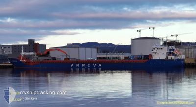
The vessel NORHEIM (IMO: 9433377, MMSI: 257782000) is a General Cargo that was built in 2011 ( 14 år gamle ). It's sailing under the flag of [NO] Norway.
In this page you can find informations about the vessels current position, last detected port calls, and current voyage information. If the vessels is not in coverage by AIS you will find the latest position.
The current position of NORHEIM is detected by our AIS receivers and we are not responsible for the reliability of the data. The last position was recorded while the vessel was in Coverage by the Ais receivers of our vessel tracking app.
The current draught of NORHEIM as reported by AIS is 6.3 meters
Weather
| Temperature | 1.2°C / 34.16°F |
|---|---|
| Wind Speed | 12 knots |
| Direction | 300° WNW |
| Pressure | 1027.9 hPa |
| Humidity | 81.4 % |
| Cloud Coverage | 9 % |
Featured Company
Last Port Calls
| Port | Arrival | Departure | Time In Port |
|---|---|---|---|
| 2025-02-15 06:29 | 2025-02-15 18:20 | 11 h | |
| 2025-02-13 05:05 | 2025-02-13 18:44 | 13 h | |
| 2025-02-10 23:11 | 2025-02-12 14:09 | 1 d | |
| 2025-02-09 14:12 | 2025-02-09 16:24 | 2 h | |
| 2025-02-05 14:01 | 2025-02-06 11:28 | 21 h | |
| 2025-02-05 07:50 | 2025-02-05 08:52 | 1 h | |
| 2025-02-01 20:56 | 2025-02-02 13:58 | 17 h | |
| 2025-01-27 19:17 | 2025-01-28 22:17 | 1 d | |
| 2025-01-25 16:21 | 2025-01-26 15:12 | 22 h | |
| 2025-01-22 16:26 | 2025-01-22 18:13 | 1 h |
Most Visited Ports (Last year)
| Port | Arrivals | |
|---|---|---|
| 20 | ||
| 9 | ||
| 7 | ||
| 7 | ||
| 6 | ||
| 5 |
Last Trips
| Origin | Departure | Destination | Arrival | Distance | |
|---|---|---|---|---|---|
| 2025-02-13 19:44 | 2025-02-15 07:29 | 377.06 nm | |||
| 2025-02-12 15:09 | 2025-02-13 06:05 | 164.00 nm | |||
| 2025-02-09 17:24 | 2025-02-11 00:11 | 301.12 nm | |||
| 2025-02-06 12:28 | 2025-02-09 15:12 | 519.16 nm | |||
| 2025-02-05 09:52 | 2025-02-05 15:01 | 58.35 nm | |||
| 2025-02-02 14:58 | 2025-02-05 08:50 | 425.45 nm | |||
| 2025-01-28 23:17 | 2025-02-01 21:56 | 677.52 nm | |||
| 2025-01-26 16:12 | 2025-01-27 20:17 | 294.77 nm | |||
| 2025-01-22 19:13 | 2025-01-25 17:21 | 676.21 nm | |||
| 2025-01-19 21:41 | 2025-01-22 17:26 | 482.57 nm |
Events
| Tid | Hændelsen | Detaljer | Position / Dest | Info |
|---|---|---|---|---|
| 2025-02-18 04:44 | Ændre havområde | Swedish part of the Kattegat Danish part of the Kattegat |
55.81260 / 12.72470
Kattegat
NODRM
|
Fart: 10.5 kn Kurs: 16.5° |
| 2025-02-18 02:44 | Ændre havområde | Danish part of the Kattegat Swedish part of the Kattegat |
55.48720 / 12.71153
Kattegat
NODRM
|
Fart: 10.2 kn Kurs: 7.6° |
| 2025-02-18 01:50 | Ændre havområde | Swedish part of the Kattegat Swedish part of the Baltic Sea |
55.33545 / 12.66759
Kattegat
NODRM
|
Fart: 9.9 kn Kurs: 11.4° |
| 2025-02-18 00:11 | Status er ændret | Under way using engine Default |
55.16471 / 13.03191
NODRM
|
Fart: 10.3 kn Kurs: 317° |
| 2025-02-18 00:10 | Status er ændret | Default Under way using engine |
55.16266 / 13.03534
NODRM
|
Fart: 10.3 kn Kurs: 317.2° |
| 2025-02-17 23:05 | Ændre havområde | Swedish part of the Baltic Sea German part of the Baltic Sea |
55.02415 / 13.25489
Baltic Sea
NODRM
|
Fart: 10.2 kn Kurs: 320.4° |
| 2025-02-17 22:32 | Status er ændret | Under way using engine Default |
54.94887 / 13.34799
NODRM
|
Fart: 10.7 kn Kurs: 326° |
| 2025-02-17 22:01 | Status er ændret | Default Under way using engine |
54.87307 / 13.43838
NODRM
|
Fart: 10.8 kn Kurs: 324.6° |
| 2025-02-17 21:56 | Status er ændret | Under way using engine Default |
54.86050 / 13.45363
NODRM
|
Fart: 10.7 kn Kurs: 325° |
| 2025-02-17 21:49 | Status er ændret | Default Under way using engine |
54.84423 / 13.47330
NODRM
|
Fart: 10.7 kn Kurs: 325.5° |