
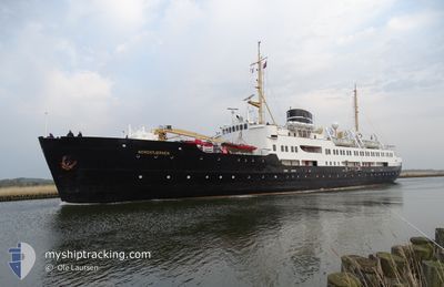
NORDSTJERNEN
Passenger/Cargo Ship
Current Trip
SKANSBUKTA
| Time Travelled | 24 days |
|---|---|
| Remaining Time | --- |
| Distance Travelled | 3217.97 nm |
| Remaining Distance | --- |
| AVG Speed | 10.2 Knots |
| MAX Speed | 14.5 Knots |
| AVG Wind | 9.3 knots |
| MAX Wind | 29 knots |
| MIN Temp | -11°C / 12.2°F |
| MAX Temp | 16.9°C / 62.42°F |
| Dybgang | 4.7 m |
| Position Modtaget | 2 m siden |
Current Position
| Longitude | 16.33149° |
|---|---|
| Latitude | 78.53698° |
| Status | Under way using engine |
| Fart | 13.1 Knots |
| Kurs | 196.5° |
| Område | Greenland Sea |
| Station | T-AIS |
| Position Modtaget | 2 m siden |
Info
Information
The current position of NORDSTJERNEN is in Greenland Sea with coordinates 78.53698° / 16.33149° as reported on 2024-05-27 17:57 by AIS to our vessel tracker app. The vessel's current speed is 13.1 Knots
The vessel NORDSTJERNEN (IMO: 5255777, MMSI: 257276000) is a Passenger/Cargo Ship that was built in 1956 ( 68 år gamle ). It's sailing under the flag of [NO] Norway.
In this page you can find informations about the vessels current position, last detected port calls, and current voyage information. If the vessels is not in coverage by AIS you will find the latest position.
The current position of NORDSTJERNEN is detected by our AIS receivers and we are not responsible for the reliability of the data. The last position was recorded while the vessel was in Coverage by the Ais receivers of our vessel tracking app.
The current draught of NORDSTJERNEN as reported by AIS is 4.7 meters
Weather
| Temperature | -3.6°C / 25.52°F |
|---|---|
| Wind Speed | 3 knots |
| Direction | 117° ESE |
| Pressure | 1018.8 hPa |
| Humidity | 66.3 % |
| Cloud Coverage | 71 % |
Featured Company
Most Visited Ports (Last year)
| Port | Arrivals | |
|---|---|---|
| 4 | ||
| 1 | ||
| 1 | ||
| 1 | ||
| 1 | ||
| 1 |
Events
| Tid | Hændelsen | Detaljer | Position / Dest | Info |
|---|---|---|---|---|
| 2024-05-27 17:52 | START Sejllads |
78.55311 / 16.35530
SKANSBUKTA
|
Fart: 12.9 kn Kurs: 197.1° |
|
| 2024-05-27 17:34 | STOP Sejllads |
78.57653 / 16.38611
SKANSBUKTA
|
Fart: 0.3 kn Kurs: 107° |
|
| 2024-05-27 16:52 | START Sejllads |
78.52183 / 16.04240
SKANSBUKTA
|
Fart: 9.5 kn Kurs: 135.5° |
|
| 2024-05-27 16:46 | Status er ændret | Under way using engine At anchor |
78.52624 / 16.03257
SKANSBUKTA
|
Fart: 0.3 kn Kurs: 207° |
| 2024-05-27 13:56 | Status er ændret | At anchor Under way using engine |
78.52648 / 16.03378
SKANSBUKTA
|
Fart: 0.2 kn Kurs: 331° |
| 2024-05-27 13:50 | STOP Sejllads |
78.52614 / 16.03289
SKANSBUKTA
|
Fart: 0.3 kn Kurs: 337° |
|
| 2024-05-27 12:01 | START Sejllads |
78.23049 / 15.60588
SKANSBUKTA
|
Fart: 4.6 kn Kurs: 349° |
|
| 2024-05-27 11:59 | Status er ændret | Under way using engine Moored |
78.22928 / 15.60695
SKANSBUKTA
|
Fart: 0.4 kn Kurs: 346° |
| 2024-05-27 11:36 | ETA er ændret | 2024/05/27 18:00 2024/05/27 08:30 |
78.22859 / 15.60676
SKANSBUKTA
|
Fart: Kurs: 311° |
| 2024-05-27 11:35 | Destination er ændret | SKANSBUKTA LONGYEARBYEN |
78.22858 / 15.60666
SKANSBUKTA
|
Fart: Kurs: 311° |