
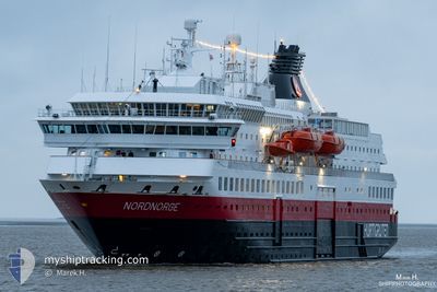
NORDNORGE
Ro-Ro/Passenger Ship
Current Trip
| Time Travelled | 1 h, 17 mins |
|---|---|
| Remaining Time | 1 day |
| Distance Travelled | 16.96 nm |
| Remaining Distance | 586.51 nm |
| AVG Speed | 13.4 Knots |
| MAX Speed | 15.1 Knots |
| AVG Wind | 8 knots |
| MAX Wind | 8.8 knots |
| MIN Temp | -1.3°C / 29.66°F |
| MAX Temp | -0.4°C / 31.28°F |
| Dybgang | 5.1 m |
| Position Modtaget | 2 m siden |
Current Position
| Longitude | --- |
|---|---|
| Latitude | --- |
| Status | Under way using engine |
| Fart | 14.3 Knots |
| Kurs | 212.4° |
| Område | Norwegian Sea |
| Station | T-AIS |
| Position Modtaget | 2 m siden |
Info
Information
The current position of NORDNORGE is in Norwegian Sea with coordinates 68.38939° / 15.08713° as reported on 2025-02-16 15:32 by AIS to our vessel tracker app. The vessel's current speed is 14.3 Knots and is heading at the port of BERGEN. The estimated time of arrival as calculated by MyShipTracking vessel tracking app is 2025-02-18 09:46 LT
The vessel NORDNORGE (IMO: 9107784, MMSI: 259371000) is a Ro-Ro/Passenger Ship that was built in 1997 ( 28 år gamle ). It's sailing under the flag of [NO] Norway.
In this page you can find informations about the vessels current position, last detected port calls, and current voyage information. If the vessels is not in coverage by AIS you will find the latest position.
The current position of NORDNORGE is detected by our AIS receivers and we are not responsible for the reliability of the data. The last position was recorded while the vessel was in Coverage by the Ais receivers of our vessel tracking app.
The current draught of NORDNORGE as reported by AIS is 5.1 meters
Weather
| Temperature | -0.4°C / 31.28°F |
|---|---|
| Wind Speed | 9 knots |
| Direction | 354° N |
| Pressure | 1020.3 hPa |
| Humidity | 85.9 % |
| Cloud Coverage | 99 % |
Featured Company
Last Port Calls
| Port | Arrival | Departure | Time In Port |
|---|---|---|---|
| 2025-02-16 13:18 | 2025-02-16 14:18 | 1 h | |
| 2025-02-16 11:33 | 2025-02-16 12:04 | 30 m | |
| 2025-02-16 06:49 | 2025-02-16 07:32 | 43 m | |
| 2025-02-16 03:25 | 2025-02-16 03:44 | 18 m | |
| 2025-02-15 22:48 | 2025-02-16 00:34 | 1 h | |
| 2025-02-15 09:58 | 2025-02-15 12:02 | 2 h | |
| 2025-02-15 07:16 | 2025-02-15 07:26 | 10 m | |
| 2025-02-15 04:59 | 2025-02-15 05:19 | 20 m | |
| 2025-02-15 02:37 | 2025-02-15 03:00 | 22 m | |
| 2025-02-15 00:26 | 2025-02-15 00:40 | 14 m |
Last Trips
| Origin | Departure | Destination | Arrival | Distance | |
|---|---|---|---|---|---|
| 2025-02-16 13:04 | 2025-02-16 14:18 | 15.56 nm | |||
| 2025-02-16 08:32 | 2025-02-16 12:33 | 43.94 nm | |||
| 2025-02-16 04:44 | 2025-02-16 07:49 | 43.05 nm | |||
| 2025-02-16 01:34 | 2025-02-16 04:25 | 37.04 nm | |||
| 2025-02-15 13:02 | 2025-02-15 23:48 | 140.87 nm | |||
| 2025-02-15 08:26 | 2025-02-15 10:58 | 36.74 nm | |||
| 2025-02-15 06:19 | 2025-02-15 08:16 | 26.37 nm | |||
| 2025-02-15 04:00 | 2025-02-15 05:59 | 28.50 nm | |||
| 2025-02-15 01:40 | 2025-02-15 03:37 | 25.47 nm | |||
| 2025-02-14 22:49 | 2025-02-15 01:26 | 34.74 nm |
Events
| Tid | Hændelsen | Detaljer | Position / Dest | Info |
|---|---|---|---|---|
| 2025-02-16 14:19 | START Sejllads | 0.42 nm, North of STOKMARKNES |
68.57462 / 14.91575
NO BGO
|
Fart: 9.5 kn Kurs: 74° |
| 2025-02-16 14:18 | Afsejlet fra sidste havn |
|
68.57462 / 14.91575
NO BGO
|
Fart: 5.4 kn Kurs: 343° |
| 2025-02-16 13:18 | STOP Sejllads |
68.57114 / 14.91193
[NO] STOKMARKNES
|
Fart: 0.1 kn Kurs: 306° |
|
| 2025-02-16 13:18 | Skibe i havn |
|
68.57114 / 14.91193
[NO] STOKMARKNES
|
Fart: 2 kn Kurs: 268° |
| 2025-02-16 12:06 | START Sejllads | 0.19 nm, East of SORTLAND |
68.69616 / 15.43021
NO BGO
|
Fart: 8.9 kn Kurs: 169.8° |
| 2025-02-16 12:04 | Afsejlet fra sidste havn |
|
68.69902 / 15.42714
NO BGO
|
Fart: 2.3 kn Kurs: 255° |
| 2025-02-16 11:33 | STOP Sejllads |
68.69864 / 15.42088
[NO] SORTLAND
|
Fart: 0.3 kn Kurs: 344° |
|
| 2025-02-16 11:33 | Skibe i havn |
|
68.69864 / 15.42088
[NO] SORTLAND
|
Fart: 1.1 kn Kurs: 326° |
| 2025-02-16 10:03 | START Sejllads | 10.26 nm, South of VARDHOLMEN |
68.96995 / 15.65233
NO BGO
|
Fart: 3.8 kn Kurs: 72° |
| 2025-02-16 09:35 | STOP Sejllads | 10.4 nm, South of VARDHOLMEN |
68.96785 / 15.64196
NO BGO
|
Fart: 0.3 kn Kurs: 42° |