
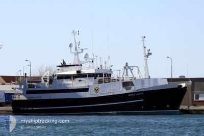
NORD VISTA
Fishing Vessel
Current Trip
Current Position
| Longitude | 13.85337° |
|---|---|
| Latitude | 68.12548° |
| Status | Moored |
| Fart | |
| Kurs | 82° |
| Område | Norwegian Sea |
| Station | T-AIS |
| Position Modtaget | 1 m siden |
Info
Information
The current position of NORD VISTA is in Norwegian Sea with coordinates 68.12548° / 13.85337° as reported on 2024-05-06 15:34 by AIS to our vessel tracker app. The vessel's current speed is 0 Knots and is currently inside the port of STAMSUND.
The vessel NORD VISTA (IMO: 8814653, MMSI: 259016100) is a Fishing Vessel that was built in 1989 ( 35 år gamle ). It's sailing under the flag of [NO] Norway.
In this page you can find informations about the vessels current position, last detected port calls, and current voyage information. If the vessels is not in coverage by AIS you will find the latest position.
The current position of NORD VISTA is detected by our AIS receivers and we are not responsible for the reliability of the data. The last position was recorded while the vessel was in Coverage by the Ais receivers of our vessel tracking app.
The current draught of NORD VISTA as reported by AIS is 6.5 meters
Weather
| Temperature | 6.2°C / 43.16°F |
|---|---|
| Wind Speed | 5 knots |
| Direction | 23° NNE |
| Pressure | 1018.1 hPa |
| Humidity | 50.6 % |
| Cloud Coverage | 27 % |
Featured Company
Last Port Calls
| Port | Arrival | Departure | Time In Port |
|---|---|---|---|
| 2024-05-04 15:54 | |||
| 2024-04-27 16:30 | 2024-04-27 17:39 | 1 h | |
| 2024-04-26 11:24 | 2024-04-27 14:26 | 1 d | |
| 2024-04-19 10:42 | 2024-04-19 12:26 | 1 h | |
| 2024-04-10 17:21 | 2024-04-10 20:45 | 3 h | |
| 2024-04-07 06:28 | 2024-04-08 17:28 | 1 d | |
| 2024-04-07 06:06 |
Last Trips
| Origin | Departure | Destination | Arrival | Distance | |
|---|---|---|---|---|---|
| 2024-04-27 19:39 | 2024-05-04 17:54 | 79.72 nm | |||
| 2024-04-27 16:26 | 2024-04-27 18:30 | 18.71 nm | |||
| 2024-04-19 14:26 | 2024-04-26 13:24 | 65.61 nm | |||
| 2024-04-10 22:45 | 2024-04-19 12:42 | 139.95 nm | |||
| 2024-04-08 19:28 | 2024-04-10 19:21 | 131.69 nm | |||
| 2024-04-07 08:06 | 2024-04-07 08:28 | 1.34 nm |
Events
| Tid | Hændelsen | Detaljer | Position / Dest | Info |
|---|---|---|---|---|
| 2024-05-05 19:30 | STOP Sejllads |
68.12548 / 13.85344
[NO] STAMSUND
|
Fart: Kurs: 82° |
|
| 2024-05-05 19:18 | START Sejllads |
68.11985 / 13.84574
[NO] STAMSUND
|
Fart: 3.9 kn Kurs: 64° |
|
| 2024-05-04 16:11 | Status er ændret | Moored Under way using engine |
68.12012 / 13.84003
[NO] STAMSUND
|
Fart: Kurs: 98° |
| 2024-05-04 16:01 | STOP Sejllads |
68.12009 / 13.83966
[NO] STAMSUND
|
Fart: 0.2 kn Kurs: 92° |
|
| 2024-05-04 15:54 | Skibe i havn |
|
68.11860 / 13.83319
[NO] STAMSUND
|
Fart: 2.7 kn Kurs: 1° |
| 2024-05-04 11:25 | START Sejllads | 13.24 nm, South East of FISKEBOL |
68.31733 / 15.33718
STAMSUND
|
Fart: 5.3 kn Kurs: 206.4° |
| 2024-05-04 11:11 | Destination er ændret | STAMSUND SVELLINGSFLAKET |
68.31898 / 15.34309
STAMSUND
|
Fart: 0.4 kn Kurs: 35° |
| 2024-05-04 11:11 | ETA er ændret | 2025/04/04 17:00 2025/04/27 18:00 |
68.31898 / 15.34309
STAMSUND
|
Fart: 0.4 kn Kurs: 35° |
| 2024-05-04 11:05 | Status er ændret | Under way using engine At anchor |
68.31876 / 15.34286
SVELLINGSFLAKET
|
Fart: Kurs: 1° |
| 2024-05-01 00:02 | ETA er ændret | 2025/04/27 18:00 2024/04/27 18:00 |
68.31925 / 15.34238
SVELLINGSFLAKET
|
Fart: Kurs: 358° |