
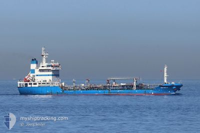
NISYROS
Oil Products Tanker
Current Trip
| Time Travelled | 6 h, 17 mins |
|---|---|
| Remaining Time | --- |
| Distance Travelled | 20.71 nm |
| Remaining Distance | 2.24 nm |
| AVG Speed | 7.3 Knots |
| MAX Speed | 12 Knots |
| AVG Wind | 12.8 knots |
| MAX Wind | 20.5 knots |
| MIN Temp | 12.7°C / 54.86°F |
| MAX Temp | 17.8°C / 64.04°F |
| Dybgang | 6.2 m |
| Position Modtaget | 2 m siden |
Current Position
| Longitude | -5.35756° |
|---|---|
| Latitude | 36.12070° |
| Status | Moored |
| Fart | |
| Kurs | 290° |
| Område | Strait of Gibraltar |
| Station | T-AIS |
| Position Modtaget | 2 m siden |
Info
Information
The current position of NISYROS is in Strait of Gibraltar with coordinates 36.12070° / -5.35756° as reported on 2024-04-29 13:30 by AIS to our vessel tracker app. The vessel's current speed is 0 Knots and is heading at the port of GIBRALTAR. The estimated time of arrival as calculated by MyShipTracking vessel tracking app is 2024-04-29 08:30 LT
The vessel NISYROS (IMO: 9382138, MMSI: 236590000) is a Oil Products Tanker that was built in 2010 ( 14 år gamle ). It's sailing under the flag of [GI] Gibraltar.
In this page you can find informations about the vessels current position, last detected port calls, and current voyage information. If the vessels is not in coverage by AIS you will find the latest position.
The current position of NISYROS is detected by our AIS receivers and we are not responsible for the reliability of the data. The last position was recorded while the vessel was in Coverage by the Ais receivers of our vessel tracking app.
The current draught of NISYROS as reported by AIS is 6.2 meters
Weather
| Temperature | 16.7°C / 62.06°F |
|---|---|
| Wind Speed | 20 knots |
| Direction | 257° WSW |
| Pressure | 1016.1 hPa |
| Humidity | 65.5 % |
| Cloud Coverage | 1 % |
Featured Company
Last Port Calls
| Port | Arrival | Departure | Time In Port |
|---|---|---|---|
| 2024-04-29 01:46 | 2024-04-29 07:15 | 5 h | |
| 2024-04-27 13:56 | 2024-04-27 21:10 | 7 h | |
| 2024-04-25 20:01 | 2024-04-27 01:58 | 1 d | |
| 2024-04-24 06:11 | 2024-04-24 14:20 | 8 h | |
| 2024-04-20 18:00 | 2024-04-21 07:53 | 13 h | |
| 2024-04-18 14:47 | 2024-04-19 02:22 | 11 h | |
| 2024-04-18 06:23 | 2024-04-18 13:00 | 6 h | |
| 2024-04-18 03:41 | 2024-04-18 03:43 | 2 m | |
| 2024-04-17 16:39 | 2024-04-17 21:49 | 5 h | |
| 2024-04-17 05:31 | 2024-04-17 11:14 | 5 h |
Most Visited Ports (Last year)
| Port | Arrivals | |
|---|---|---|
| 173 | ||
| 111 | ||
| 4 | ||
| 3 | ||
| 2 | ||
| 1 |
Last Trips
| Origin | Departure | Destination | Arrival | Distance | |
|---|---|---|---|---|---|
| 2024-04-27 22:10 | 2024-04-29 02:46 | 25.54 nm | |||
| 2024-04-27 03:58 | 2024-04-27 14:56 | 20.86 nm | |||
| 2024-04-24 15:20 | 2024-04-25 22:01 | 24.15 nm | |||
| 2024-04-21 09:53 | 2024-04-24 07:11 | 35.00 nm | |||
| 2024-04-19 03:22 | 2024-04-20 20:00 | 26.17 nm | |||
| 2024-04-18 15:00 | 2024-04-18 15:47 | 17.01 nm | |||
| 2024-04-18 05:43 | 2024-04-18 08:23 | 1.38 nm | |||
| 2024-04-17 23:49 | 2024-04-18 05:41 | 1.54 nm | |||
| 2024-04-17 13:14 | 2024-04-17 18:39 | 6.45 nm | |||
| 2024-04-16 16:52 | 2024-04-17 07:31 | 3.23 nm |
Events
| Tid | Hændelsen | Detaljer | Position / Dest | Info |
|---|---|---|---|---|
| 2024-04-29 12:48 | Status er ændret | Moored Default |
36.12217 / -5.35807
GIBRALTAR
|
Fart: Kurs: 239° |
| 2024-04-29 12:42 | Status er ændret | Default Moored |
36.12236 / -5.35816
GIBRALTAR
|
Fart: 0.1 kn Kurs: 238° |
| 2024-04-29 11:42 | Status er ændret | Moored Under way using engine |
36.12183 / -5.35814
GIBRALTAR
|
Fart: 0.2 kn Kurs: 248° |
| 2024-04-29 11:32 | STOP Sejllads | 1.51 nm, South of GIBRALTAR |
36.12246 / -5.35884
GIBRALTAR
|
Fart: 0.3 kn Kurs: 225° |
| 2024-04-29 10:48 | START Sejllads | 1.04 nm, West of GIBRALTAR |
36.14469 / -5.38373
GIBRALTAR
|
Fart: 3.1 kn Kurs: 175° |
| 2024-04-29 09:50 | ETA er ændret | 2024/04/29 08:30 2024/04/29 14:30 |
36.14729 / -5.38009
GIBRALTAR
|
Fart: 0.5 kn Kurs: 306° |
| 2024-04-29 09:44 | ETA er ændret | 2024/04/29 14:30 2025/03/28 14:30 |
36.14753 / -5.38052
GIBRALTAR
|
Fart: 0.1 kn Kurs: 295° |
| 2024-04-29 09:28 | STOP Sejllads | 0.76 nm, West of GIBRALTAR |
36.14610 / -5.37829
GIBRALTAR
|
Fart: 0.3 kn Kurs: 314° |
| 2024-04-29 08:20 | Ændre havområde | Gibraltarian part of the Strait of Gibraltar Spanish part of the Strait of Gibraltar |
36.05910 / -5.35998
Strait of Gibraltar
|
Fart: 8.5 kn Kurs: 28.6° |
| 2024-04-29 07:50 | Ændre havområde | Spanish part of the Strait of Gibraltar Moroccan part of the Strait of Gibraltar |
35.98983 / -5.40988
Strait of Gibraltar
|
Fart: 11.3 kn Kurs: 32.2° |