
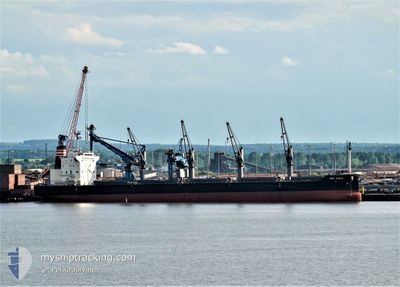
NEW NOBLE
Cargo
Current Trip
| Time Travelled | 8 days |
|---|---|
| Remaining Time | 9 days |
| Distance Travelled | 2381.99 nm |
| Remaining Distance | 2718.99 nm |
| AVG Speed | 11.3 Knots |
| MAX Speed | 14.3 Knots |
| AVG Wind | 15.7 knots |
| MAX Wind | 26.6 knots |
| MIN Temp | 9.5°C / 49.1°F |
| MAX Temp | 20.5°C / 68.9°F |
| Dybgang | 7.5 m |
| Position Modtaget | 8 d siden |
Current Position
| Longitude | 141.07891° |
|---|---|
| Latitude | 35.05079° |
| Status | Under way using engine |
| Fart | 11.7 Knots |
| Kurs | 80.3° |
| Område | North Pacific Ocean |
| Station | T-AIS |
| Position Modtaget | 8 d siden |
Info
Information
The current position of NEW NOBLE is in North Pacific Ocean with coordinates 35.05079° / 141.07891° as reported on 2024-04-29 15:40 by AIS to our vessel tracker app. The vessel's current speed is 11.7 Knots and is heading at the port of LOS ANGELES. The estimated time of arrival as calculated by MyShipTracking vessel tracking app is 2024-05-17 07:47 LT
The vessel NEW NOBLE (IMO: 9836892, MMSI: 636018843) is a Cargo It's sailing under the flag of [LR] Liberia.
In this page you can find informations about the vessels current position, last detected port calls, and current voyage information. If the vessels is not in coverage by AIS you will find the latest position.
The current position of NEW NOBLE is detected by our AIS receivers and we are not responsible for the reliability of the data. The last position was recorded while the vessel was in Coverage by the Ais receivers of our vessel tracking app.
The current draught of NEW NOBLE as reported by AIS is 7.5 meters
Weather
| Temperature | 10.7°C / 51.26°F |
|---|---|
| Wind Speed | 23 knots |
| Direction | 317° NW |
| Pressure | 1019.8 hPa |
| Humidity | 59 % |
| Cloud Coverage | 27 % |
Featured Company
Events
| Tid | Hændelsen | Detaljer | Position / Dest | Info |
|---|---|---|---|---|
| 2024-04-29 15:51 | Status er ændret | Default Under way using engine |
35.05759 / 141.12418
US LGB
|
Fart: 11.7 kn Kurs: 80.3° |
| 2024-04-29 15:40 | Udenfor Dækning |
35.05079 / 141.07891
North Pacific Ocean
US LGB
|
Fart: 11.7 kn Kurs: 80.3° |
|
| 2024-04-29 15:27 | Status er ændret | Under way using engine Default |
35.04237 / 141.02937
US LGB
|
Fart: 11.7 kn Kurs: 79° |
| 2024-04-29 15:11 | Status er ændret | Default Under way using engine |
35.03302 / 140.96683
US LGB
|
Fart: 12.2 kn Kurs: 78.5° |
| 2024-04-29 10:18 | Status er ændret | Under way using engine Default |
34.90575 / 139.76722
US LGB
|
Fart: 12.6 kn Kurs: 140° |
| 2024-04-29 10:18 | Indenfor Dækning |
34.90177 / 139.77147
North Pacific Ocean
US LGB
|
Fart: 12.7 kn Kurs: 138.4° |
|
| 2024-04-29 08:44 | Status er ændret | Default Under way using engine |
35.18272 / 139.76228
US LGB
|
Fart: 10.4 kn Kurs: 193° |
| 2024-04-29 08:37 | Udenfor Dækning |
35.20457 / 139.76894
North Pacific Ocean
US LGB
|
Fart: 10.4 kn Kurs: 193° |
|
| 2024-04-29 07:22 | Status er ændret | Under way using engine Default |
35.40729 / 139.71088
US LGB
|
Fart: 10.5 kn Kurs: 195° |
| 2024-04-29 07:08 | Afsejlet fra sidste havn |
|
35.44550 / 139.72119
US LGB
|
Fart: 8.8 kn Kurs: 150° |