
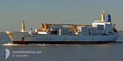
NEDERLAND STREAM
Reefer
Current Trip
| Time Travelled | 8 days |
|---|---|
| Remaining Time | 6 days |
| Distance Travelled | 2931.49 nm |
| Remaining Distance | 2789.67 nm |
| AVG Speed | 15.2 Knots |
| MAX Speed | 18.7 Knots |
| AVG Wind | 10.5 knots |
| MAX Wind | 23 knots |
| MIN Temp | 15.2°C / 59.36°F |
| MAX Temp | 29.4°C / 84.92°F |
| Dybgang | 7.3 m |
| Position Modtaget | 5 d siden |
Current Position
| Longitude | 128.99638° |
|---|---|
| Latitude | 34.64242° |
| Status | Under way using engine |
| Fart | 17.4 Knots |
| Kurs | 194.4° |
| Område | Japan Sea |
| Station | T-AIS |
| Position Modtaget | 5 d siden |
Info
Information
The current position of NEDERLAND STREAM is in Japan Sea with coordinates 34.64242° / 128.99638° as reported on 2024-04-28 16:47 by AIS to our vessel tracker app. The vessel's current speed is 17.4 Knots and is heading at the port of TAURANGA. The estimated time of arrival as calculated by MyShipTracking vessel tracking app is 2024-05-11 06:45 LT
The vessel NEDERLAND STREAM (IMO: 9015199, MMSI: 308122000) is a Reefer that was built in 1991 ( 33 år gamle ). It's sailing under the flag of [BS] Bahamas.
In this page you can find informations about the vessels current position, last detected port calls, and current voyage information. If the vessels is not in coverage by AIS you will find the latest position.
The current position of NEDERLAND STREAM is detected by our AIS receivers and we are not responsible for the reliability of the data. The last position was recorded while the vessel was in Coverage by the Ais receivers of our vessel tracking app.
The current draught of NEDERLAND STREAM as reported by AIS is 7.3 meters
Weather
| Temperature | 29.1°C / 84.38°F |
|---|---|
| Wind Speed | 6 knots |
| Direction | 67° ENE |
| Pressure | 1007.7 hPa |
| Humidity | 74.6 % |
| Cloud Coverage | 79 % |
Featured Company
Most Visited Ports (Last year)
| Port | Arrivals | |
|---|---|---|
| 8 | ||
| 6 | ||
| 6 | ||
| 6 | ||
| 6 | ||
| 5 |
Events
| Tid | Hændelsen | Detaljer | Position / Dest | Info |
|---|---|---|---|---|
| 2024-04-28 16:52 | Status er ændret | Default Under way using engine |
34.61441 / 128.98761
NZTRG
|
Fart: 17.4 kn Kurs: 194.4° |
| 2024-04-28 16:47 | Udenfor Dækning |
34.64242 / 128.99638
Japan Sea
NZTRG
|
Fart: 17.4 kn Kurs: 194.4° |
|
| 2024-04-28 16:46 | Status er ændret | Under way using engine Default |
34.64345 / 128.99670
NZTRG
|
Fart: 17.4 kn Kurs: 196° |
| 2024-04-28 16:45 | Status er ændret | Default Under way using engine |
34.65183 / 128.99930
NZTRG
|
Fart: 17.3 kn Kurs: 189.1° |
| 2024-04-28 15:12 | Dybgangen er ændret | 7.3 8.4 |
35.05353 / 129.00450
NZTRG
|
Fart: 7.5 kn Kurs: 149.1° |
| 2024-04-28 15:12 | Destination er ændret | NZTRG KRPUS |
35.05353 / 129.00450
NZTRG
|
Fart: 7.5 kn Kurs: 149.1° |
| 2024-04-28 15:12 | ETA er ændret | 2024/05/10 08:00 2024/04/27 12:00 |
35.05353 / 129.00450
NZTRG
|
Fart: 7.5 kn Kurs: 149.1° |
| 2024-04-28 15:04 | START Sejllads | 2.93 nm, South West of BUSAN |
35.06590 / 129.00715
KRPUS
|
Fart: 4.8 kn Kurs: 274° |
| 2024-04-28 15:01 | Status er ændret | Under way using engine Moored |
35.06515 / 129.01013
KRPUS
|
Fart: 0.6 kn Kurs: 292° |
| 2024-04-28 14:50 | Status er ændret | Moored Default |
35.06545 / 129.01077
KRPUS
|
Fart: Kurs: 291° |