
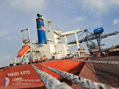
NAVIOS KOYO
Bulk Carrier
Current Trip
| Time Travelled | --- |
|---|---|
| Remaining Time | --- |
| Distance Travelled | 9907.48 nm |
| Remaining Distance | --- |
| AVG Speed | 12 Knots |
| MAX Speed | 16.8 Knots |
| AVG Wind | 11.9 knots |
| MAX Wind | 33.8 knots |
| MIN Temp | 18°C / 64.4°F |
| MAX Temp | 29.7°C / 85.46°F |
| Dybgang | 11.2 m |
| Position Modtaget | 1 h, 49 m siden |
Current Position
| Longitude | --- |
|---|---|
| Latitude | --- |
| Status | Under way using engine |
| Fart | 11.5 Knots |
| Kurs | 2.2° |
| Område | North Atlantic Ocean |
| Station | T-AIS |
| Position Modtaget | 1 h, 49 m siden |
Info
Information
The current position of NAVIOS KOYO is in North Atlantic Ocean with coordinates 19.39493° / -17.30704° as reported on 2025-12-11 02:06 by AIS to our vessel tracker app. The vessel's current speed is 11.5 Knots and is heading at the port of NOUADHIBOU.
The vessel NAVIOS KOYO (IMO: 9598127, MMSI: 373997000) is a Bulk Carrier that was built in 2011 ( 14 år gamle ). It's sailing under the flag of [PA] Panama.
In this page you can find informations about the vessels current position, last detected port calls, and current voyage information. If the vessels is not in coverage by AIS you will find the latest position.
The current position of NAVIOS KOYO is detected by our AIS receivers and we are not responsible for the reliability of the data. The last position was recorded while the vessel was in Coverage by the Ais receivers of our vessel tracking app.
The current draught of NAVIOS KOYO as reported by AIS is 11.2 meters
Weather
| Temperature | 21.4°C / 70.52°F |
|---|---|
| Wind Speed | 14 knots |
| Direction | 30° NNE |
| Pressure | 1017.1 hPa |
| Humidity | 58 % |
| Cloud Coverage | 66 % |
Featured Company
Last Port Calls
Last Trips
| Origin | Departure | Destination | Arrival | Distance |
|---|
Events
| Tid | Hændelsen | Detaljer | Position / Dest | Info |
|---|---|---|---|---|
| 2025-12-11 02:09 | Status er ændret | Default Under way using engine |
19.40649 / -17.30607
MR NDB
|
Fart: 11.5 kn Kurs: 2.2° |
| 2025-12-11 02:06 | Status er ændret | Under way using engine Default |
19.39493 / -17.30704
MR NDB
|
Fart: 11.5 kn Kurs: 4° |
| 2025-12-11 02:06 | Udenfor Dækning |
19.39493 / -17.30704
North Atlantic Ocean
|
Fart: 11.5 kn Kurs: 2.2° |
|
| 2025-12-11 01:53 | Status er ændret | Default Under way using engine |
19.35594 / -17.31209
MR NDB
|
Fart: 11.3 kn Kurs: 6.8° |
| 2025-12-11 01:43 | Status er ændret | Under way using engine Default |
19.32202 / -17.31568
MR NDB
|
Fart: 11.3 kn Kurs: 9° |
| 2025-12-11 01:25 | Status er ændret | Default Under way using engine |
19.26737 / -17.32073
MR NDB
|
Fart: 11.4 kn Kurs: 0° |
| 2025-12-11 00:48 | Status er ændret | Under way using engine Default |
19.14842 / -17.33217
MR NDB
|
Fart: 11.6 kn Kurs: 7° |
| 2025-12-11 00:19 | Status er ændret | Default Under way using engine |
19.05706 / -17.34252
MR NDB
|
Fart: 11.5 kn Kurs: 7.9° |
| 2025-12-11 00:15 | Status er ændret | Under way using engine Default |
19.04288 / -17.34421
MR NDB
|
Fart: 11.4 kn Kurs: 5° |
| 2025-12-10 23:59 | Status er ændret | Default Under way using engine |
18.99489 / -17.35105
MR NDB
|
Fart: 11.2 kn Kurs: 2° |